Related Research Articles

The City of Arvada is a home rule municipality located in Jefferson and Adams counties, Colorado, United States. The city population was 124,402 at the 2020 United States Census, with 121,510 residing in Jefferson County and 2,892 residing in Adams County. Arvada is the seventh most populous city in Colorado. The city is a part of the Denver–Aurora–Lakewood, CO Metropolitan Statistical Area and the Front Range Urban Corridor. The Olde Town Arvada historic district is 7 miles northwest of the Colorado State Capitol in Denver.

The Town of Erie is a Statutory Town located in Boulder and Weld counties, Colorado, United States. The town population was 30,038 at the 2020 United States Census, a +65.64% increase since the 2010 United States Census. Erie is a part of the Denver-Aurora, CO Combined Statistical Area and the Front Range Urban Corridor.
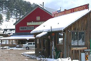
Rollinsville is an unincorporated town, a post office, and a census-designated place (CDP) located in and governed by Gilpin County, Colorado, United States. The CDP is a part of the Denver–Aurora–Lakewood, CO Metropolitan Statistical Area. The Rollinsville post office has the ZIP Code 80474. At the United States Census 2010, the population of the Rollinsville CDP was 181.

There are more than 1,500 properties and historic districts in Colorado listed on the National Register of Historic Places. They are distributed over 63 of Colorado's 64 counties; only the City and County of Broomfield has none.

Agate is an unincorporated community and U.S. Post Office in Elbert County, Colorado, United States. The ZIP Code of the Agate Post Office is 80101.
Carr is an unincorporated community and U.S. Post Office in Weld County, Colorado, United States. The ZIP Code of the Carr Post Office is 80612. Some consider Carr a ghost town. Today, just a few old houses remain plus the school house and a few old store fronts. Aside from that there are scattered old foundations throughout the town. There are a few year-round residents but for the most part the town is abandoned.

Greenland is an unincorporated community in Douglas County, Colorado, United States. Greenland is located off Exit 167 on Interstate 25. The largest nearby incorporated towns are Larkspur and Monument: Larkspur lies about 7 miles northeast and Monument about 13 miles south of the community. The U.S. Post Office at Larkspur now serves the Greenland postal addresses.
This timeline is a chronology of significant events in the history of the U.S. State of Colorado and the historical area now occupied by the state.

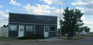
Leyner is an unincorporated community and a census-designated place (CDP) located in and governed by Boulder County, Colorado, United States. The CDP is a part of the Boulder, CO Metropolitan Statistical Area. The population of the Leyner CDP was 29 at the United States Census 2010. The Lafayette post office serves the area.
Canfield is an unincorporated community in Boulder County, in the U.S. state of Colorado.
Cornish is an unincorporated community in Weld County, in the U.S. state of Colorado.
Masters is an extinct town in Weld County, in the U.S. state of Colorado. The GNIS classifies it as a populated place.
Liggett is an unincorporated community in Boulder County, Colorado, United States. It is to the northwest of Lafayette.
Yoxall is a ghost town in Weld County, in the U.S. state of Colorado.
St Vrains is a ghost town in Weld County, in the U.S. state of Colorado.
Sligo is a ghost town in Weld County, in the U.S. state of Colorado.
Dick is a ghost town in Weld County, in the U.S. state of Colorado.
References
- ↑ "Tabor". Geographic Names Information System . United States Geological Survey . Retrieved September 29, 2021.
- ↑ United States Geological Survey (1951). Erie Quadrangle, Colorado (Map). United States Department of the Interior. Retrieved September 5, 2021.
- ↑ Fraser, Clayton, B. (August 31, 1997), The History and Evolution of Colorado's Railroads: 1858-1948 (PDF), Loveland: United States Department of the Interior, p. 101
- ↑ "North Metro Corridor - Final Environmental Impact Statement and Final Section 4(f) Evaluation - Executive Summary" (PDF). Retrieved September 5, 2021.
- ↑ "United States Zip Codes" . Retrieved September 5, 2021.
- ↑ "Postal History. Jim Forte Postal History" . Retrieved September 8, 2021.
Municipalities and communities of Boulder County, Colorado, United States | ||
|---|---|---|
| Cities |  | |
| Towns | ||
| CDPs | ||
| Unincorporated communities | ||
| Ghost town | ||
| Footnotes | ‡This populated place also has portions in an adjacent county or counties | |
Coordinates: 40°03′05″N105°04′27″W / 40.05139°N 105.07417°W
| | This Colorado state location article is a stub. You can help Wikipedia by expanding it. |