Tacoma Narrows Bridge

Last updated
Tacoma Narrows Bridge
Tacoma Narrows Bridge (117561801).jpeg
The bridges in 2015, as seen from the Tacoma side. 1950 bridge on the right, 2007 bridge on the left.
Coordinates 47°16′5″N122°33′2″W / 47.26806°N 122.55056°W / 47.26806; -122.55056
Carries8 lanes of WA-16.svg SR 16, cyclists and pedestrians
Crosses Tacoma Narrows
Locale Tacoma to the Kitsap Peninsula United States
Maintained by Washington State Department of Transportation
Characteristics
Design Twin suspension
Total length5,400 ft (1,645.92 m) [1]
Longest span2,800 ft (853.44 m) [1]
Clearance below 187.5 ft (57.15 m)
History
Construction startApril 12, 1948 (westbound)
October 4, 2002 (eastbound)
OpenedOctober 14, 1950 (westbound)
July 15, 2007 (eastbound)
Statistics
TollEastbound only (passenger car) [2] :
$5.50 (cash/credit price)
$4.50 (transponder price)
$6.50 (pay by mail)
Location
Tacoma Narrows Bridge

The Tacoma Narrows Bridge is a pair of twin suspension bridges that span the Tacoma Narrows strait of Puget Sound in Pierce County, Washington. The bridges connect the city of Tacoma with the Kitsap Peninsula and carry State Route 16 (known as Primary State Highway 14 until 1964) over the strait. Historically, the name "Tacoma Narrows Bridge" has applied to the original bridge nicknamed "Galloping Gertie", which opened in July 1940, but collapsed possibly because of aeroelastic flutter four months later, as well as the replacement of the original bridge which opened in 1950 and still stands today as the westbound lanes of the present-day two-bridge complex.

Contents

The original Tacoma Narrows Bridge opened on July 1, 1940. The original bridge received its nickname "Galloping Gertie" due to of the vertical movement of the deck observed by construction workers during windy conditions. While engineers and engineering professor, F. B. Farquharson were hired to seek ways to stop the odd movements, months of experiments were unsuccessful. [3] The bridge became known for its pitching deck, and collapsed into Puget Sound the morning of November 7, 1940, under high wind conditions. Engineering issues, as well as the United States' involvement in World War II, postponed plans to replace the bridge for several years; the replacement bridge was opened on October 14, 1950.

By 1990, population growth and development on the Kitsap Peninsula had caused traffic on the bridge to exceed its design capacity; as a result, in 1998 Washington voters approved a measure to support building a parallel bridge. After a series of protests and court battles, construction began in 2002 and the new bridge opened to carry eastbound traffic on July 16, 2007, while the 1950 bridge was reconfigured to carry westbound traffic. [4]

At the time of their construction, both the 1940 and 1950 bridges were the third-longest suspension bridges in the world in terms of main span length, behind the Golden Gate Bridge and George Washington Bridge. The 1950 and 2007 bridges are as of 2017 the fifth-longest suspension bridge spans in the United States and the 43rd-longest in the world.

Tolls were charged on the bridge for the entire four-month service life of the original span, as well as the first 15 years of the 1950 bridge. In 1965, the bridge's construction bonds plus interest were paid off, and the state ceased toll collection on the bridge. Over 40 years later, tolls were reinstated as part of the financing of the twin span, and are presently collected only from vehicles traveling eastbound.

Original bridge (1940)

Opening day of the Tacoma Narrows Bridge, Tacoma, Washington.jpg
Opening day, July 1, 1940

The desire for the construction of a bridge in this location dates back to 1889 with a Northern Pacific Railway proposal for a trestle, but concerted efforts began in the mid-1920s. In 1937, the Washington State legislature created the Washington State Toll Bridge Authority and appropriated $5,000 to study the request by Tacoma and Pierce County for a bridge over the Narrows. The bridge was designed by Leon Moisseiff and cost $6.4 million. [5]

The collapse of the original bridge.

The first Tacoma Narrows Bridge opened to traffic on July 1, 1940. Its main span collapsed into the Tacoma Narrows four months later on November 7, 1940, at 11:00 a.m. (Pacific time) possibly as a result of aeroelastic flutter caused by a 42 mph (68 km/h) wind. The bridge collapse had lasting effects on science and engineering. In many undergraduate physics texts, the event is presented as an example of elementary forced resonance, with the wind providing an external periodic frequency that matched the natural structural frequency, [6] the cause is still debated by engineers today. A contributing factor was its solid sides, not allowing wind to pass through the bridge's deck. Thus, its design allowed the bridge to catch the wind and sway, which ultimately took it down. [6] It was the first suspension bridge to utilize these solid I-beams as a form of support for the road deck, as other bridges would incorporate trusses in their designs in order to catch the wind. [7] Its failure also boosted research in the field of bridge aerodynamic and aeroelastic fields which have influenced the designs of all the world's great long-span bridges built since 1940.

There were no human deaths in the collapse of the bridge. The only fatality was a Cocker Spaniel named Tubby, who perished after he was abandoned in a car on the bridge by his owner, Leonard Coatsworth. Professor Frederick Burt Farquharson, an engineer from the University of Washington who had been involved in the design of the bridge, tried to rescue Tubby but was bitten by the terrified dog when he attempted to remove him. The collapse of the bridge was recorded on Kodachrome 16 mm film by Barney Elliott and Harbine Monroe, owners of The Camera Shop in Tacoma, and shows Farquharson leaving the bridge after trying to rescue Tubby and making observations in the middle of the bridge. The film was subsequently sold to Paramount Studios, who then duplicated the footage for newsreels in black-and-white and distributed the film worldwide to movie theaters. Castle Films also received distribution rights for 8 mm home video. [8] [9]

Elliott and Monroe's original films of the construction and collapse of the bridge were shot on 16 mm Kodachrome color film, but most copies in circulation are in black and white because newsreels of the day copied the film onto 35 mm black-and-white stock. There were also film speed discrepancies between Monroe and Elliot's footage, with Monroe filming his footage in 24 fps while Elliott had filmed his footage at 16 fps. [10] As a result, most copies in circulation also show the bridge oscillating approximately 50% faster than real time, due to an assumption during conversion that the film was shot at 24 frames per second rather than the actual 16 fps. In 1998, The Tacoma Narrows Bridge Collapse was selected for preservation in the United States National Film Registry by the Library of Congress as being "culturally, historically, or aesthetically significant". [11] This footage is commonly shown to engineering, architecture, and physics students as a means to teach about engineering disaster.

The dismantling of the towers and side spans — having survived the collapse of the main span, but being damaged beyond repair — began shortly after the collapse and continued into May 1943. The United States' participation in World War II, as well as engineering and finance issues, delayed plans to replace the bridge.

Westbound bridge (1950)

The westbound span in 1988. Tacoma Bridge Puget.jpg
The westbound span in 1988.

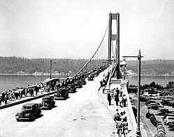
After the infamous fall of the original bridge, Professor Farquharson was commissioned again to test new designs for the bridge at the University of Washington, the home of these models. Tests ensured the new design would have a different outcome than the first and construction began on April 12, 1948, following the completion of a financing and insurance plan. [3] [12] A major earthquake struck the construction site on April 13, 1949, but the only damage was to a cable that fell into the water and was recovered; a fire two months later on the west tower damaged equipment and tools but did not cause permanent damage. The 502-foot (153 m) towers were complete in July 1949 and the cables for the new bridge were finished on January 16, 1950. [12] The current westbound bridge was designed and rebuilt with open trusses, stiffening struts and openings in the roadway to let wind through.[ citation needed ] It opened on October 14, 1950, and is 5,979 feet (1822 m) long—40 feet (12 m) longer than the first bridge. The new bridge cost $18 million to construct. [13] Local residents nicknamed the new bridge Sturdy Gertie, as the oscillations that plagued the previous design had been eliminated. [14] This bridge and its new parallel eastbound bridge are currently the fifth-longest suspension bridges in the United States.

When built, the westbound bridge was the third longest suspension bridge span in the world. [15] Like other modern suspension bridges, the westbound bridge was built with steel plates that feature sharp entry edges rather than the flat plate sides used in the original Tacoma Narrows Bridge (see the suspension bridge article for an example).

The bridge was designed to handle 60,000 vehicles a day. It carried both westbound and eastbound traffic until the eastbound bridge opened on July 15, 2007. [16] [17] During the Hanukkah Eve windstorm of 2006, the bridge was closed for the first time in its operating existence due to heavy winds but reopened approximately 6 hours later. [18]

Eastbound bridge (2007)

The eastbound span in 2013. Tacoma Narrows Bridge-2.jpg
The eastbound span in 2013.

In 1998, voters in several Washington counties approved an advisory measure to create a second Narrows span. Construction of the new span, which carries eastbound traffic parallel to the current bridge, began on October 4, 2002, and was completed in July 2007. The Washington State Department of Transportation (WSDOT) signed a design-and-construction agreement with Bechtel and Kiewit Pacific Co., who then engaged in a joint venture to construct eastbound. It was estimated by WSDOT that the project would cost $849 million to complete, but ultimately finished under budget at $786 million due to not using the funds allocated to emergency scenarios. [19] [20] [21]

The eastbound bridge has an overall length of 1,646 m, and a main span of 853 m, making it the fifth largest suspension bridge in the United States. In comparison, the Golden Gate bridge in San Francisco has a total length of 2,372 m or 1.7 miles.

The bridge was dedicated in honor of State Representative Ruth Fisher and State Senator Robert "Bob" Oke, a South Kitsap resident, one of the main proponents of building the second span across Puget Sound between the Kitsap Peninsula and Tacoma.

WSDOT collects a toll before entering the eastbound span. Tolls currently are $4.50 for "Good to Go" account holders with in-vehicle transponders, $5.50 for cash/credit card customers, and $6.50 for those who choose Pay-By-Mail. [2] The existing span had been free of tolls since 1965. The new bridge marks the first installation of the new Good To Go electronic toll collection system.

Opening Day

On July 15, 2007 the eastbound section opened to a ceremonial 5K run across the newly constructed bridge. About 10,000 people participated in the event. After the run finished, a ceremonial ribbon cutting event took place on eastbound. WSDOT estimated 40,000 people would be in attendance for the opening, but 60,000 ultimately attended. [22] A select few Washington State government officials partook in the ribbon cutting, such as Washington State Treasurer; Michael Murphy, State Representative Pat Lantz, Chief of the Washington State Patrol; John Batiste, and State Speaker of the House; Frank Chopp.

Tacoma Narrows Bridge Panorama.jpg
~300° panorama from the deck of the new Tacoma Narrows Bridge at sunset.

See also

Related Research Articles

<span class="mw-page-title-main">Suspension bridge</span> Type of bridge

A suspension bridge is a type of bridge in which the deck is hung below suspension cables on vertical suspenders. The first modern examples of this type of bridge were built in the early 1800s. Simple suspension bridges, which lack vertical suspenders, have a long history in many mountainous parts of the world.

<span class="mw-page-title-main">Othmar Ammann</span> Swiss-American structural engineer

Othmar Hermann Ammann was a Swiss-American civil engineer whose bridge designs include the George Washington Bridge, Verrazzano-Narrows Bridge, and Bayonne Bridge. He also directed the planning and construction of the Lincoln Tunnel.

<span class="mw-page-title-main">Tacoma Narrows Bridge (1940)</span> Suspension bridge in Washington, US, collapsed in 1940

The 1940 Tacoma Narrows Bridge, the first bridge at this location, was a suspension bridge in the U.S. state of Washington that spanned the Tacoma Narrows strait of Puget Sound between Tacoma and the Kitsap Peninsula. It opened to traffic on July 1, 1940, and dramatically collapsed into Puget Sound on November 7 of the same year. The bridge's collapse has been described as "spectacular" and in subsequent decades "has attracted the attention of engineers, physicists, and mathematicians". Throughout its short existence, it was the world's third-longest suspension bridge by main span, behind the Golden Gate Bridge and the George Washington Bridge.

<span class="mw-page-title-main">Evergreen Point Floating Bridge (1963)</span> Former highway floating bridge in Seattle, Washington, United States

The Evergreen Point Floating Bridge, officially the Governor Albert D. Rosellini Bridge, and commonly called the SR 520 Bridge or 520 Bridge, was a floating bridge in the U.S. state of Washington that carried State Route 520 across Lake Washington, connecting Medina with the Montlake/Union Bay district of Seattle.

<span class="mw-page-title-main">Lacey V. Murrow Memorial Bridge</span> Floating bridge in Seattle, Washington, U.S.

The Lacey V. Murrow Memorial Bridge is a floating bridge in the Seattle metropolitan area of the U.S. state of Washington. It is one of the Interstate 90 floating bridges that carries the eastbound lanes of Interstate 90 across Lake Washington from Seattle to Mercer Island. Westbound traffic is carried by the adjacent Homer M. Hadley Memorial Bridge.

<span class="mw-page-title-main">Delaware Memorial Bridge</span> Twin suspension bridge between New Castle, Delaware and Pennsville Township, New Jersey

The Delaware Memorial Bridge is a dual-span suspension bridge crossing the Delaware River. The toll bridges carry Interstate 295 and U.S. Route 40 and is also the link between Delaware and New Jersey. The bridge was designed by the firm of Howard, Needles, Tammen & Bergendoff with consulting help from engineer Othmar Ammann, whose other designs include the George Washington Bridge and the Verrazzano-Narrows Bridge.

<span class="mw-page-title-main">Hood Canal Bridge</span> Pontoon bridge in western Washington State, United States

The Hood Canal Bridge is a floating bridge in the northwest United States, located in western Washington. It carries State Route 104 across Hood Canal in Puget Sound and connects the Olympic and Kitsap Peninsulas. At 7,869 feet in length, it is the longest floating bridge in the world located in a saltwater tidal basin, and the third longest floating bridge overall. It opened in 1961 and was the second concrete floating bridge constructed in Washington. Since that time, it has become a vital link for local residents, freight haulers, commuters, and recreational travelers. The convenience it provides has had a major impact on economic development, especially in eastern Jefferson County.

<span class="mw-page-title-main">Fatih Sultan Mehmet Bridge</span> Suspension bridge in Istanbul, Turkey

The Fatih Sultan Mehmet Bridge, also known as the Second Bosphorus Bridge, is a bridge in Istanbul, Turkey spanning the Bosphorus strait. When completed in 1988, it was the 5th-longest suspension bridge span in the world.

<span class="mw-page-title-main">Chesapeake Bay Bridge</span> Major dual-span bridge in the U.S. state of Maryland, spanning the Chesapeake Bay

The Chesapeake Bay Bridge is a major dual-span bridge in the U.S. state of Maryland. Spanning the Chesapeake Bay, it connects the state's rural Eastern Shore region with the urban Western Shore, between Stevensville and the capital city of Annapolis. The original span, opened in 1952 and with a length of 4.3 miles (6.9 km), was the world's longest continuous over-water steel structure. The parallel span was added in 1973. The bridge is officially named the Gov. William Preston Lane Jr. Memorial Bridge after William Preston Lane Jr. who, as the 52nd Governor of Maryland, initiated its construction in the late 1940s finally after decades of political indecision and public controversy.

<span class="mw-page-title-main">Washington State Route 16</span> State highway in the U.S. state of Washington

State Route 16 (SR 16) is a 27.16-mile-long (43.71 km) state highway in the U.S. state of Washington, connecting Pierce and Kitsap counties. The highway, signed as east–west, begins at an interchange with Interstate 5 (I-5) in Tacoma and travels through the city as a freeway towards the Tacoma Narrows. SR 16 crosses the narrows onto the Kitsap Peninsula on the partially tolled Tacoma Narrows Bridge and continues through Gig Harbor and Port Orchard before the freeway ends in Gorst. The designation ends at an intersection with SR 3 southwest of the beginning of its freeway through Bremerton and Poulsbo. SR 16 is designated as a Strategic Highway Network (STRAHNET) corridor within the National Highway System as the main thoroughfare connecting Tacoma to Naval Base Kitsap and a part of the Highways of Statewide Significance program.

<span class="mw-page-title-main">Bear Mountain Bridge</span> Bridge in United States of America

The Bear Mountain Bridge, ceremonially named the Purple Heart Veterans Memorial Bridge, is a toll suspension bridge in New York State. It carries US 6 and US 202 across the Hudson River between Bear Mountain State Park in Orange County and Cortlandt in Westchester County. At completion in 1924 it was the longest suspension bridge in the world until this record was surpassed 19 months later by the Benjamin Franklin Bridge between Philadelphia and Camden, New Jersey. Like the Williamsburg Bridge in New York City, the approach spans of the Bear Mountain Bridge are unsuspended; only its main span is suspended by cables.

<span class="mw-page-title-main">David B. Steinman</span> American civil engineer

David Barnard Steinman was an American civil engineer. He was the designer of the Mackinac Bridge and many other notable bridges, and a published author. He grew up in New York City's lower Manhattan, and lived with the ambition of making his mark on the Brooklyn Bridge that he lived under. In 1906 he earned a bachelor's degree from City College and in 1909, a Master of Arts from Columbia University and a Doctorate in 1911. He also received an honorary Doctor of Science in Engineering on 15 April 1952 from degree mill Sequoia University, but would distance himself from it soon after a 1957 inquiry raised doubts over its legitimacy, and did not mention the qualifications in his biographies. He was awarded the Franklin Institute's Louis E. Levy Medal in 1957.

<span class="mw-page-title-main">Carquinez Bridge</span> Pair of bridges in the San Francisco Bay between Crockett and Vallejo, California, USA

The Carquinez Bridge is a pair of parallel bridges spanning the Carquinez Strait at the northeastern end of San Francisco Bay. They form the part of Interstate 80 between Crockett and Vallejo, California, United States.

<span class="mw-page-title-main">Vincent Thomas Bridge</span> Suspension bridge in Los Angeles, California, United States

The Vincent Thomas Bridge is a 1,500-foot-long (460 m) suspension bridge, crossing Los Angeles Harbor in Los Angeles, California, linking San Pedro with Terminal Island. It is the only suspension bridge in the Greater Los Angeles area. The bridge is part of State Route 47, which is also known as the Seaside Freeway. The bridge opened in 1963 and is named for California Assemblyman Vincent Thomas of San Pedro, who championed its construction. Its chief engineer was William (Jim) Jurkovich who was instrumental in bringing pre-stress concrete bridge design to California. It was the first welded suspension bridge in the United States and is now the fourth-longest suspension bridge in California and the 76th-longest span in the world. The clear height of the navigation channel is approximately 185 feet (56 m); it is the only suspension bridge in the world supported entirely on piles.

Leon Solomon Moisseiff was a leading suspension bridge engineer in the United States in the 1920s and 1930s. He was awarded The Franklin Institute's Louis E. Levy Medal in 1933.

The Washington State Department of Transportation is a governmental agency that constructs, maintains, and regulates the use of transportation infrastructure in the U.S. state of Washington. Established in 1905, it is led by a secretary and overseen by the governor. WSDOT is responsible for more than 20,000 lane-miles of roadway, nearly 3,000 vehicular bridges and 524 other structures. This infrastructure includes rail lines, state highways, state ferries and state airports.

<span class="mw-page-title-main">Mid-Hudson Bridge</span> Bridge in New York and Poughkeepsie, New York

The Franklin Delano Roosevelt Mid-Hudson Bridge is a toll suspension bridge which carries US 44 and NY 55 across the Hudson River between Poughkeepsie and Highland in the state of New York.

<span class="mw-page-title-main">Kingston–Rhinecliff Bridge</span> Bridge in New York, United States

The George Clinton Kingston–Rhinecliff Bridge is a continuous under-deck truss toll bridge that carries NY 199 across the Hudson River in New York State north of the City of Kingston and the hamlet of Rhinecliff. It was opened to traffic on February 2, 1957, as a two-lane bridge, although it was not actually complete. The formal opening was May 11, 1957. The original cost was $17.5 million.

<span class="mw-page-title-main">Good to Go (toll collection system)</span> Electronic toll collection system in Washington state

Good to Go, stylized as GoodToGo!, is the electronic toll collection program managed by the Washington State Department of Transportation on all current toll and future projects in the U.S. state of Washington. Regular Good to Go customers may set up an account from which tolls are automically deducted. Vehicles that are not linked to an account are photographed and a toll bill is sent to the registered owner by U.S. mail.

<span class="mw-page-title-main">Tacoma Narrows Bridge (1950)</span> Suspension bridge in Washington State

The 1950 Tacoma Narrows Bridge is a suspension bridge in the U.S. state of Washington that carries the westbound lanes of Washington State Route 16 across the Tacoma Narrows strait, between the city of Tacoma and the Kitsap Peninsula. Opened on October 14, 1950, it was built in the same location as the original Tacoma Narrows Bridge, which collapsed due to a windstorm on November 7, 1940. It is the older of the twin bridges that make up the Tacoma Narrows Bridge crossing of the Tacoma Narrows, and carried both directions of traffic across the strait until 2007. At the time of its construction, the bridge was, like its predecessor, the third-longest suspension bridge in the world in terms of main span length, behind the Golden Gate Bridge and George Washington Bridge; it is now the 46th longest suspension bridge in the world.

References

Notes
  1. 1 2 Tacoma Narrows Bridge at Structurae
  2. 1 2 "Tacoma Narrows Bridge tolling". Wsdot. Washington State Department of Transportation. Retrieved 26 October 2022.
  3. 1 2 "Introduction — UW Libraries". www.lib.washington.edu. Retrieved 2021-12-07.
  4. "More Than a Bridge". Wsdot. Washington State Department of Transportation.
  5. "PCAD - State of Washington, Highway Department, Tacoma Narrows Bridge #1, Tacoma, WA". pcad.lib.washington.edu. Retrieved 2021-12-07.
  6. 1 2 Billah, K.; R. Scanlan (1991). "Resonance, Tacoma Narrows Bridge Failure, and Undergraduate Physics Textbooks" (PDF). American Journal of Physics . 59 (2): 118–124. Bibcode:1991AmJPh..59..118B. doi:10.1119/1.16590.
  7. von Kármán, Theodore (August 2005). "Collapse of the tacoma narrows bridge". Resonance. 10 (8): 97–102. doi:10.1007/bf02866750. ISSN   0971-8044. S2CID   120498720.
  8. "Tacoma Narrows Bridge: Art of the Bridges Continues". www.wsdot.wa.gov. Archived from the original on 1 June 2019. Retrieved 7 December 2020.
  9. "::: Tacoma Narrows Bridge Film Collection :::". content.lib.washington.edu. Retrieved 7 December 2020.
  10. Pasternack, Alex (14 December 2015). "The Strangest, Most Spectacular Bridge Collapse (And How We Got It Wrong)". Vice Magazine . Retrieved 7 December 2020.
  11. "Complete National Film Registry Listing – National Film Preservation Board". The Library of Congress. Retrieved 2016-11-21.
  12. 1 2 "Narrows Bridge Was Designed Like Plane". The News Tribune. October 14, 1950. p. C2. Retrieved November 22, 2022 via Newspapers.com.
  13. "Governor Dedicates New Tacoma Narrows Bridge". The Bellingham Herald . Associated Press. October 15, 1950. p. 1. Retrieved November 22, 2022 via Newspapers.com.
  14. Vogel, Elmer C. (October 14, 1950). "Narrows Bridge Is Result of Research". The News Tribune. Associated Press. p. C3. Retrieved November 22, 2022.
  15. Holstine, Craig E. (2005). Spanning Washington : historic highway bridges of the Evergreen State. Washington State University Press. pp. 61–62. ISBN   0-87422-281-8.
  16. Carson, Rob (July 15, 2007). "First to cross? Nah, just go with the flow". The News Tribune. p. A14. Retrieved November 22, 2022 via Newspapers.com.
  17. Beekman, Dan and Santos, Melissa; "First traffic crosses new bridge" [ permanent dead link ]; The News Tribune ; July 16, 2007
  18. Sistek, Scott (December 14, 2016). "Dec. 14-15, 2006: Historic Hanukkah Eve windstorm pummeled Western Washington". KOMO 4 News (Seattle, Washington). Retrieved November 14, 2023. Article contains a copy of a live blog during the storm and an original Associated Press article from December 15, 2006
  19. Pilling, Nathan. "Eying traffic decline on Tacoma Narrows Bridge, state commission floats possible toll hikes". Kitsap Sun. Retrieved December 7, 2021.
  20. "Parsons/HNTB Joint Venture to Proceed on Tacoma Narrows Bridge Project Design". Business Wire. Pasadena, California. October 8, 2002. Retrieved June 1, 2022.
  21. Staff (January 1, 2008). "New Narrows Bridge comes in $114M less than state expected". The Seattle Times. Retrieved December 7, 2021.
  22. "Smooth opening day for drivers on new Tacoma Narrows Bridge". The Seattle Times. July 16, 2007. Retrieved December 8, 2021.

Further reading

Historical
Second span project