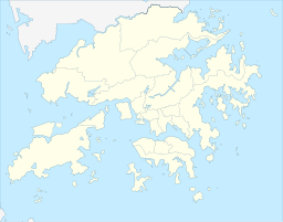
Tai Lam Country Park, established on 23 February 1979, is a country park located in Tai Lam, at the south of Yuen Long Town, Kam Tin and Shek Kong and east of Tuen Mun Town, in the western New Territories of Hong Kong. This country park has an area of 54 km².

Tai Tam Road in Hong Kong links the districts of Chai Wan and Stanley on Hong Kong Island. This road connects Chai Wan Road, the northern end of Shek O Road, Turtle Cove, Tai Tam and Stanley. The Tai Tam Tuk Reservoir's dam constitutes a section of the road that is particularly narrow.

Plover Cove Reservoir, located within Plover Cove Country Park, in the northeastern New Territories, is the largest reservoir in Hong Kong in terms of area, and the second-largest in terms of volume. It is the world's first freshwater coastal lake constructed from an arm of the ocean. Its main dam, which disconnected Plover Cove from the sea, was one of the largest in the world at the time of its construction.

Shing Mun Reservoir is a reservoir in Hong Kong. It is located in Shing Mun, the area between Tsuen Wan and Sha Tin, in the New Territories. Administratively, it is located within the boundaries of Tsuen Wan District.
Water supply and sanitation in Hong Kong is characterized by water import, reservoirs, and treatment infrastructure. Though multiple measures were made throughout its history, providing an adequate water supply for Hong Kong has met with numerous challenges because the region has few natural lakes and rivers, inadequate groundwater sources, a high population density, and extreme seasonable variations in rainfall. Thus nearly 80 percent of water demand is met by importing water from mainland China, based on a longstanding contract. In addition, freshwater demand is curtailed by the use of seawater for toilet flushing, using a separate distribution system. Hong Kong also uses reservoirs and water treatment plants to maintain its source of clean water.

Tai Tam or Tytam is an area in Southern District on Hong Kong Island, Hong Kong. Tai Tam means a big pool in the Chinese language which illustrates a triangular bay, namely Tai Tam Bay between Stanley Peninsula, D'Aguilar Peak and Tai Tam Tuk. The meaning of Tai Tam varies greatly between the early colonial days and the present day.

The Kowloon Group of Reservoirs is located in the Kam Shan Country Park, north of Kowloon, Hong Kong. They include:

Tai Tam Intermediate Reservoir, part of the Tai Tam Reservoirs, is a reservoir in Tai Tam Country Park, Tai Tam, Hong Kong Island, Hong Kong and has a water storage capacity of 19.6 million gallons. The reservoir was completed in 1907.

Tai Tam Byewash Reservoir, part of the Tai Tam Reservoirs, is a reservoir in Tai Tam Country Park, Tai Tam, Hong Kong Island, Hong Kong, and has a water storage capacity of 22.4 million gallons. The reservoir was completed in 1904.
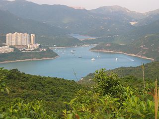
Tai Tam Harbour is a harbour in the innermost part of Tai Tam Bay in the southeastern part of Hong Kong Island, in the Southern District of Hong Kong. It is located at the estuary of Tai Tam Tuk.
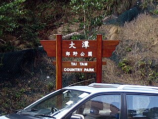
Tai Tam Country Park is a country park in the Tai Tam area in the south end of Hong Kong Island. At 1,315 hectares, the park consists of one fifth of Hong Kong Island's land mass. During World War II, the Japanese encountered strong resistance from British defence forces here. So that the park preserves bloody memories from that period.
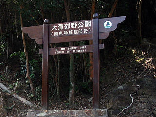
Tai Tam Country Park, also known simply as Quarry Bay Country Park (鰂魚涌郊野公園), on the eastern side of Hong Kong Island, is one of the twenty four statutory country parks in Hong Kong, and the twentieth to be so designated, in 1979.
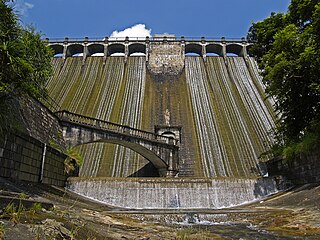
The Aberdeen Reservoirs are a group of two reservoirs, consisting of the Upper Aberdeen Reservoir (香港仔上水塘) and the Lower Aberdeen Reservoir (香港仔下水塘), in Aberdeen, Hong Kong.
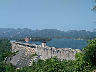
Tai Lam Chung Reservoir is a reservoir in Tai Lam Country Park, Tuen Mun District, New Territories, Hong Kong.

Wong Nai Chung Reservoir Park is a park and artificial lake in the Wong Nai Chung Gap, Wong Nai Chung, Hong Kong, located near Hong Kong Parkview. It was formerly Wong Nai Chung Reservoir (黃泥涌水塘), a closed reservoir in Hong Kong.

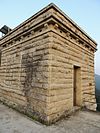
The Tai Tam Waterworks Heritage Trail is a heritage trail in Hong Kong that comprises 22 waterworks structures with historical value near the Tai Tam group of reservoirs. The Trail is about 5 km long and takes about two hours to complete. The Trail is located along the Tai Tam Reservoir Road with entrance at Wong Nai Chung Gap near Hong Kong Parkview or at the junction of Tai Tam Road and Tai Tam Reservoir Road. Ten information stations were established en route to introduce the functions and historic values of the structures. Guided tours will be organised for schools and non-profit making organisations.

The Engineer's Office of the Former Pumping Station, Water Supplies Department, sometimes called "The Red Brick House", is located at No. 344 Shanghai Street, in Yau Ma Tei, Hong Kong. It has been classified as a Grade I historical building since 2000 by the Antiquities Advisory Board in view of its historical and architectural merit. It is now owned by the HKSAR Government.

Tai Tam Bay is a bay in the Tai Tam area, in the southeastern part of Hong Kong Island, in the Southern District of Hong Kong.

