
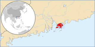
Hong Kong Island is an island in the southern part of Hong Kong. The island,known originally and on road signs simply as "Hong Kong",had a population of 1,289,500 and a population density of 16,390 per square kilometre (42,400/sq mi),as of 2023. It is the second largest island in Hong Kong,with the largest being Lantau Island. Hong Kong Island forms one of the three areas of Hong Kong,with the other two being Kowloon and the New Territories.

Chai Wan,formerly known as Sai Wan (西灣),lies at the east end of the urban area of Hong Kong Island next to Shau Kei Wan. The area is administratively part of the Eastern District,and is a mosaic of industrial and residential areas. The population was 186,505 in 2001.
Hong Kong has a long and jagged coastline with many bays and beaches. The shelter provided by adjacent mountains keeps wave sizes generally small,and most beaches are thus suitable for swimming and recreation,if they can be reached.
Hong Kong counts approximately 600 temples,shrines and monasteries. While Buddhism and Christianity are the most widely practiced religions,most religions are represented in the Special Administrative Region.

The Sai Kung Peninsula is a peninsula in the easternmost part of the New Territories in Hong Kong. Its name comes from Sai Kung Town in the central southern area of the peninsula. The southern part of the peninsula is administered by Sai Kung District,the north by Tai Po District and the northwest by Sha Tin District.

Quarry Bay is an area beneath Mount Parker in the Eastern District of Hong Kong Island,in Hong Kong. Quarry Bay is bordered by Sai Wan Ho to the east,Mount Parker to the south,North Point to the west,and Victoria Harbour to the north.

The Tai Tam Reservoirs,also known as Tai Tam Reservoir Group,is a group of reservoirs located in the Tai Tam Country Park in the eastern part of Hong Kong Island in Hong Kong. The four reservoirs have a total storage capacity of 6.2 million cubic metres. They are managed by the Water Supplies Department of the Hong Kong Government.

Route 9,Hong Kong is one of the strategic trunk roads,mostly in the form of a motorway,circumnavigating the New Territories. The route is also known as the New Territories Circular Road (新界環迴公路). Starting from the Shing Mun Tunnels,Route 9 links Sha Tin,Tai Po,Fanling,Sheung Shui,Yuen Long,Tuen Mun and Tsuen Wan. The section between Exit 10 in Kwu Tung and Exit 16 in Lam Tei is part of Asian Highway 1,although the Asian Highway Network is not signed in Hong Kong.
Telephone numbers in Hong Kong are mostly eight-digit. Fixed land line numbers start with 2 or 3,mobile (cellular) phone numbers with 4,5,6,7,8,or 9,pager numbers with 7 and forwarding service with 8. Since the end of 1989,there have been no area codes within Hong Kong.

The Wilson Trail is a 78-kilometre (48 mi) long-distance footpath in Hong Kong,63 km of which runs through Hong Kong country parks. It was named after David Wilson,Baron Wilson of Tillyorn,who was penultimate Governor of Hong Kong from 1987 to 1992. The Wilson Trail was developed by Friends of the Country Park and sponsored by various private organisations. The construction work of the trail began in 1994. The Wilson Trail was first opened on 21 January 1996.

Tai Tam or Tytam is an area in Southern District on Hong Kong Island,Hong Kong. Tai Tam means a big pool in the Chinese language which illustrates a triangular bay,namely Tai Tam Bay between Stanley Peninsula,D'Aguilar Peak and Tai Tam Tuk. The meaning of Tai Tam varies greatly between the early colonial days and the present day.

The MacLehose Trail is a 100-kilometre hiking trail that crosses much of the New Territories,Hong Kong,starting from Pak Tam Chung,Sai Kung District in the east to Tuen Mun Town,Tuen Mun District in the west. It is the longest trail in Hong Kong and the path is marked by distance posts at 500-metre intervals. The trail is named after Murray MacLehose,Baron MacLehose of Beoch,the longest-serving governor of Hong Kong,who established the Country Parks and was himself an enthusiastic hiker. The trail passes through a variety of natural scenery including beaches and mountains.
Articles related to Hong Kong include:
The Chinese Temples Committee is a statutory body in Hong Kong established in 1928 under the Chinese Temples Ordinance (華人廟宇條例). It is mainly responsible for the operation and management of twenty-four temples directly under its management. It also handles temple registration. There are 20 additional temples,of which management has been delegated to other organisations.

