This article needs additional citations for verification .(October 2009) |
Conduit Road | |||||||||||
---|---|---|---|---|---|---|---|---|---|---|---|
![]() Conduit Road as from the view of No.2 Conduit Rd. The view encompasses the "slope section" (The section leading up from Glenealy; the "spiral slope"; one of the steepest roads in Hong Kong. | |||||||||||
Chinese | 干德道 | ||||||||||
| |||||||||||
Former name | |||||||||||
Traditional Chinese | 干讀道 | ||||||||||
Simplified Chinese | 干读道 | ||||||||||
|
Conduit Road is a road in the Mid-Levels on Hong Kong Island in Hong Kong.
Conduit Road was constructed in 1910. It is located in Western Mid-Levels. It is named after the aqueduct passing underneath which carries water from the Pok Fu Lam Reservoir to the Central area. It is at the highest point on Victoria Peak reached by the Central–Mid-Levels escalators. It is also the second highest road;second to Po Shan Road;in Western Mid-Levels. The road was renamed as "Izumo-dori" (出雲通) during Japanese occupation of Hong Kong. After the surrender and evacuation of Japanese army,its name was changed back.
It is a luxury residential area. One of the road's earliest residents was Catchick Paul Chater,who built a magnificent residence at 1,Conduit Road named 'Marble Hall',whose gatehouse is the only reminder of this connection today. The road interchanges with Glenealy at the east-end with Hornsey Road intersecting next to the "slope section" near the east-end of the road.
Kotewall Road,Po Shan Road,and Hatton Road at the west-end. The east-end is often considered as the start of the road with the rest being sparsely populated with less traffic.
Because of its long history,the residence found along it are at times relatively older and lower-standard than the more recent properties,and those found on the relatively newly developed Central Mid-Levels area. An example of the larger "old" residential apartments is Realty Gardens (No. 41) (recently renovated). Other similarly old properties include Elegant Garden (No.11),Panorama (No.15),Cliffview Mansions (No. 17-19 &21–25);Conway Mansion (No.29) ;Woodland Gardens (No.62A ~ F) ;and Manly Mansion (No.44,44A).
Other than Realty Gardens,all the other relatively old assets are concentrated very shallow into the road itself as proven by the almost-consecutive numbers. These properties are also all built on the northern side of the road,as shown by all the even numbers. The main reason for this is that there were no flat tough ground for foundations on the waterfront side (northern side) of the road 30–40 years ago,but only slopes of greenery. Furthermore,building them on the mountainside is easier and allows a more laid-back position with a better view of the Victoria Harbour. Thus the buildings standing along the eastern part and on the waterfront side of the road (northern side) were mostly built in recent times. They were built by removing sections of the mountain (so to add foundations) and/or extending the foundations from Robinson Road- the road one street-level lower. This is mostly the case for the near-eastern-end part of Conduit Road.
In the past,until the early 1990s;the views of the harbour were mostly uninterrupted for the any mid-rise mountainside properties lining the mountainside near the eastern end of the road. (they have had to be of lesser height as they are elevated by the slope;the height limit was also very low 30–40 years ago). However,in the early 1990s,new properties began to be constructed by extending foundations from Robinson Road. And since the building height requirements became much more loose with the buildings being 30–40 storeys high,the harbour views were no more.
Number 41A Conduit Road is a deeply secluded pre-war house blocked-from-view by Realty Gardens (No. 41) and is located on the hillside. Number 41,next door,had a wide history; [1] not only did it feature as the original location of The Foreign Correspondents' Club [2] but it was also the hospital in the 1955 film Love Is a Many-Splendored Thing . Number 2 also has proven history and citywide recognition:it is renowned for housing influential Hong Kong socialites.
Numbers are odd on the mountainside of the road and even on the side closer to waterfront;which makes sense since the first properties were built along the mountainside (southern side) of the road.
The odd numbers starts at the busier eastern end of the road from the government estate Chater Hall Flats (No.1 Conduit Road) and ends at Skyline Mansion (No. 51 Conduit Road) near the western end of the road;while even numbers starts right across No.1,Yukon Court (No.2 Conduit Road) is its name,ran all the way through Kiu Sen Court (No.70 Conduit Road). Although there is currently a new residential building numbered 55 on the road which will technically forever be the last property on the road in terms of location (as the site is located on the last stretch of land on Conduit Road).
Thus,the main reason for the particular direction of property-numbering was chiefly attributed by the fact that the first properties to have graced Conduit Road were all concentrated at the eastern end;which is understandable as that end is closer to the Central District than the western end giving it much higher accessibility and convenience,and as of 15 October 1993 serviced by The Central–Mid-Levels escalator and walkway system.
On 7 December 1911,a major landslip,caused by heavy rainfall,killed four people at a building site. This occurred during excavation and heavy rain.
On 18 June 1972,an even more devastating landslide occurred. It started from a redevelopment site on Conduit Road above Po Shan Road and slid down 270 meters to Kotewall Road crossing Conduit Road near number 53. Casualties were high with 67 people killed,20 injured and 2 buildings totally destroyed. An estimated 40,000 cubic meters of earth and debris moved in this slip. [3] 22°16′44″N114°09′03″E / 22.27882°N 114.15077°E
Hong Kong Island is an island in the southern part of Hong Kong. Known colloquially and on road signs simply as Hong Kong, the island had a population of 1,289,500 and a population density of 16,390 per square kilometre (42,400/sq mi), as of 2008. The island had a population of about 3,000 inhabitants scattered in a dozen fishing villages when it was occupied by the United Kingdom in the First Opium War (1839–1842). In 1842, the island was formally ceded in perpetuity to the UK under the Treaty of Nanking and the City of Victoria was then established on the island by the British Force in honour of Queen Victoria. The Central area on the island is the historical, political and economic centre of Hong Kong. The northern coast of the island forms the southern shore of the Victoria Harbour, which is largely responsible for the development of Hong Kong due to its deep waters favoured by large trade ships.
Kowloon is an urban area in Hong Kong comprising the Kowloon Peninsula and New Kowloon. With a population of 2,019,533 and a population density of 43,033/km2 (111,450/sq mi) in 2006, it is the most populous area in Hong Kong, compared with Hong Kong Island and the rest of the New Territories. The peninsula's area is about 47 km2 (18 sq mi).
Mid-Levels is an affluent residential area on Hong Kong Island in Hong Kong. It is located between Victoria Peak and Central. Residents are predominantly more affluent Hong Kong locals and expatriate professionals.
Lung Fu Shan Country Park, established 18 December 1998, is a country park in the Central and Western District of Hong Kong. It covers the densely vegetated slopes of Lung Fu Shan, and includes the disused Pinewood Battery as well as the Pinewood Garden picnic area, providing a scenic backdrop to the residential and commercial districts of Hong Kong Island.
Robinson Road is a thoroughfare located in Mid-Levels, Hong Kong Island, Hong Kong. To the east, it intersects with Magazine Gap Road and Garden Road, while to the west, it connects with Babington Path and Park Road.
Taikoo Shing or Tai Koo Shing, is a private residential development in Quarry Bay, in the eastern part of Hong Kong Island, Hong Kong. It is a part of Swire's property business, along with Taikoo Place, the adjacent Cityplaza retail and office complex and EAST, a lifestyle business hotel.
The Central Elevated Walkway is an extensive footbridge network spanning Admiralty, Central and parts of Sheung Wan, near Victoria Harbour in Hong Kong.
Braemar Hill is a hill with a height of 200 metres (660 ft) south of Braemar Point on Hong Kong Island, Hong Kong. The hill was likely named after the Scottish village of Braemar by British officials.
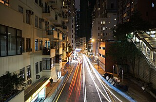
First Street is a street in Sai Ying Pun, an early suburb of Hong Kong.
Articles related to Hong Kong include:
Kotewall Road is a street in Mid-Levels, Hong Kong Island, Hong Kong, located between Po Shan Road and Robinson Road. It is a 400-metre-long two-way road located on hill slopes south of Sai Ying Pun.
Pound Lane is a lane in Sheung Wan on Hong Kong Island, Hong Kong.
The Central and Western District located on northwestern part of Hong Kong Island is one of the 18 administrative districts of Hong Kong. It had a population of 243,266 in 2016. The district has the most educated residents with the second highest income and the third lowest population due to its relatively small size.
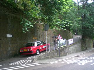
Hatton Road, also known as "The Morning Trail", is a paved, steep, motor vehicle-free road in western Hong Kong Island, Hong Kong, on Lung Fu Shan. It is largely used as a fitness trail for walking, running, and cycling.
A series of major landslides occurred in Hong Kong in June 1972. Several apartment complexes and houses were wiped out, and at least 156 people lost their lives. The landslides had been caused by waterlogged soils in the area, a result of Typhoon Rose bringing unusually heavy rainfall in August 1971 as well as heavy rainstorms hitting Hong Kong on the days preceding the landslides.