Hong Kong counts approximately 600 temples,shrines and monasteries. While Buddhism and Christianity are the most widely practiced religions,most religions are represented in the Special Administrative Region.

Tam Kung or Tam Tai Sin (譚大仙) is a sea deity worshiped in Hong Kong and Macau.

Tung Ping Chau is an island in Hong Kong,part of Hong Kong UNESCO Global Geopark. It is also known as Ping Chau (平洲). Tung is prepended to the name at times so as to avoid possible confusion with Peng Chau,another island in Hong Kong with an identically pronounced name in the Cantonese language. Administratively,the island is part of the Tai Po District in the New Territories.

Happy Valley is an upper-income residential area in Hong Kong,located on Hong Kong Island. The area is bordered by Caroline Hill to the east,Jardine's Lookout to the south,Morrison Hill to the west,and Causeway Bay to the north. Administratively,it is part of Wan Chai District.

The Sai Kung Peninsula is a peninsula in the easternmost part of the New Territories in Hong Kong. Its name comes from Sai Kung Town in the central southern area of the peninsula. The southern part of the peninsula is administrated by Sai Kung District,the north by Tai Po District and the northwest by Sha Tin District.

Tai Wai is an area in the New Territories,Hong Kong,located between Sha Tin and the Lion Rock,within the Sha Tin District.

Che Kung Miu,also called Che Kung Temple,are temples dedicated to Che Kung,who was a general during the Southern Song dynasty (1127–1279) in imperial China. He is believed by some worshipers to have been involved in the attempt to keep the Song state alive by bringing Prince Ping and his brother to the South. There are two temples dedicated to Che Kung in Hong Kong:one in Sha Tin and one in Ho Chung. Other temples in Hong Kong are partly dedicated to Che Kung.

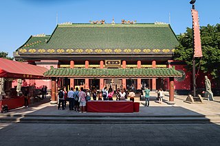
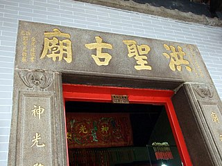
Hung Shing Temples or Tai Wong Temples are temples dedicated to Hung Shing Tai Wong (洪聖大王). Hung Shing temples have been widely built in southern China,especially Guangdong province and in Hong Kong.

Queen's Road East is a street in Wan Chai,in the north of Hong Kong Island,Hong Kong,connecting Admiralty in the west to Happy Valley in the east. Queen's Road East is one of the four sections of Queen's Road,and historically included Queensway.

Bowen Road is a road from the Mid-Levels to Wong Nai Chung Gap of Hong Kong Island,on the slope above Central,Wan Chai and Happy Valley in Hong Kong. Bowen Road starts from Magazine Gap Road near the rail of Peak Tram and ends at the junction with Stubbs Road,Tai Hang Road and Wong Nai Chung Gap Road.

Shek Pik is an area located along the southwestern coast of Lantau Island,Hong Kong. When the Shek Pik Reservoir was built,villages at Shek Pik were demolished and the villagers were relocated to other parts of Lantau Island and to Tsuen Wan. Below the dam of the reservoir is Shek Pik Prison.
Articles related to Hong Kong include:

Hau Wong or Hou Wang is a title that can be translated as "Prince Marquis" or "Holy Marquis". It is not any one person's name. Hau Wong refers usually to Yeung Leung-jit,a loyal and courageous general. Despite his failing health,he remained in the army to protect the last emperor of Southern Song Dynasty when he took refuge southwards in Kowloon.

Tin Hau temples in Hong Kong are dedicated to Tin Hau (Mazu). Over 100 temples are dedicated to Tin Hau in Hong Kong. A list of these temples can be found below.
The Chinese Temples Committee is a statutory body in Hong Kong established in 1928 under the Chinese Temples Ordinance (華人廟宇條例). It is mainly responsible for the operation and management of twenty-four temples directly under its management. It also handles temple registration. There are 20 additional temples,of which management has been delegated to other organisations.

Tsam Chuk Wan is a bay of the Sai Kung Peninsula in Hong Kong. By extension,it is also the name of the area around the bay. Tsam Chuk Wan Village (斬竹灣村) is one of the villages located within this area.
The Nine Alliances of Lek Yuen or Kau Yeuk was a regional organization of various groups in Sha Tin Valley,Hong Kong.


