
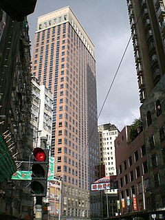
Central is the central business district of Hong Kong. It is located in Central and Western District, on the north shore of Hong Kong Island, across Victoria Harbour from Tsim Sha Tsui, the southernmost point of Kowloon Peninsula. The area was the heart of Victoria City, although that name is rarely used today.

Sheung Wan is an area in Hong Kong, located in the north-west of Hong Kong Island, between Central and Sai Ying Pun. Administratively, it is part of the Central and Western District. The name can be variously interpreted as Upper District, or Gateway District.
Shek Tong Tsui or Belcher Point is an area in Sai Wan on Hong Kong Island in Hong Kong. Administratively, it belongs to the Central and Western District.

Sai Ying Pun is a station on the Hong Kong MTR Island line. It serves the neighbourhood of Sai Ying Pun and the western part of Mid-Levels in northwestern Hong Kong Island, Hong Kong. Sai Ying Pun station was opened on 29 March 2015, completing the West Island line extension of the Island line.

Sheung Wan is a station of the Hong Kong MTR Island line, and was formerly the westbound terminus of the Island line. It was originally planned in 1970 as Western Market but its construction was discontinued after further planning for the new lines. Upon the construction of the Island line, the station was finally constructed and opened on 23 May 1986. The livery colour of this station is khaki.

Sai Ying Pun is an area in Western District, on Hong Kong Island, in Hong Kong. It is administratively part of the Central and Western District.
Des Voeux Road Central and Des Voeux Road West are two roads on the north shore of Hong Kong Island, Hong Kong. They were named after the 10th Governor of Hong Kong, Sir William Des Vœux. The name was sometimes spelt with the ligature œ in pre-war documents but is nowadays spelt officially as Des Voeux Road.

Bonham Road is a main road in West Mid-Levels, Hong Kong Island in Hong Kong, running mainly East-West. The road connects Pok Fu Lam Road in the west, near the University of Hong Kong, and Caine Road in the east, at the junction with Hospital Road and Seymour Road. It was named after Sir George Bonham, the third Governor of Hong Kong. It was renamed Nishi-Taisho Dori (西大正通) during Japanese occupation of Hong Kong.
High Street is a one-way street in Sai Ying Pun, Hong Kong, available only to minibuses and private vehicles. It connects Bonham Road in the east and Pok Fu Lam Road in the west. It runs from east to west from Western Street to Pok Fu Lam Road, and from west to east from Western Street to Bonham Road. It was originally named Fourth Street, but because the number four is commonly avoided in Chinese culture, the government changed the name to High Street.

Eastern Street is an early street of Hong Kong, located in the Sai Ying Pun area of Hong Kong Island. Eastern Street North (東邊街北) is an extension of the street leading to the seafront following progressive harbour reclamations.

Western Street is an uphill one-way street in Sai Ying Pun, Hong Kong. It connects Bonham Road in the south and Connaught Road West in the north. There are 337 units in 17 buildings in the street. Addresses are odd on the west side of the street, and mostly even on the east side. However, on the newer part of the street, on the reclamation north of Queen's Road West, the east side has both odd and even numbered addresses.
First Street is a street in Sai Ying Pun, an early suburb of Hong Kong.

Third Street, is a street in Sai Ying Pun neighbourhood of Hong Kong. It runs one way from Pok Fu Lam Road, then crosses Water Street, then Pok Fu Lam Road again, then Western Street, Centre Street and terminates at Eastern Street.

Second Street is a street in the Sai Ying Pun area of the Central and Western District on Hong Kong Island, in Hong Kong.

Water Street is a street in Sai Ying Pun, Hong Kong. It runs from Connaught Road, crossing Des Voeux Road West and Queen's Road West then climbing steeply up the hill crossing Second Street, Third Street and then end in steps to High Street and Pok Fu Lam Road conjunction. Originally, there was a nullah in the middle of the street carrying water from the hills down to the harbour. With the development of the area, the nullah was covered and used for hot food hawkers market for many years and this was a favourable night meeting spot for professional drivers such as taxis and trucks to have their dinner and late night gathering until the foodstalls were removed to give way for more traffic lanes.
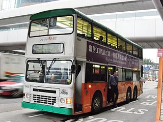
Urban Route No.4 is a bus route on Hong Kong Island operated by New World First Bus. It runs between Wong Chuk Hang and Central Bus Terminus, via Aberdeen, Wah Fu Estate, Pok Fu Lam Road and Sai Ying Pun.
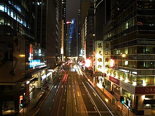
The Central and Western District located on northwestern part of Hong Kong Island is one of the 18 administrative districts of Hong Kong. It had a population of 243,266 in 2016. The district has the most educated residents with the second highest income and the third lowest population due to its relatively small size.

Douglas Street is a pedestrianised street in Central, Hong Kong. It runs north-south from Connaught Road Central to Des Voeux Road Central, and ends at its intersection with Des Voeux Road Central, though the street name is continued in Douglas Lane which continues almost all the way to Queen's Road Central before curving and converging with Li Yuen Street East.

Douglas Lane is a lane converted for pedestrian use in the core of Hong Kong's Central District. It runs north-south from Des Voeux Road Central to Queen's Road Central. though the street name is continued in Douglas Street which continues to its north across Des Voeux Road Central all the way to Connaught Road Central. The lane is named for Hong Kong Tai-pan Douglas Lapraik.


