Tanjung Manis Airport Lapangan Terbang Tanjung Manis | |||||||||||
|---|---|---|---|---|---|---|---|---|---|---|---|
 | |||||||||||
| Summary | |||||||||||
| Airport type | Public | ||||||||||
| Operator | Sarawak Timber Industry Development Corporation | ||||||||||
| Serves | Tanjung Manis,Mukah and Sarikei,Sarawak | ||||||||||
| Location | Tanjung Manis, Mukah, Sarawak, Malaysia | ||||||||||
| Time zone | MST (UTC+08:00) | ||||||||||
| Elevation AMSL | 15 ft / 5 m | ||||||||||
| Coordinates | 02°10′40″N111°12′07″E / 2.17778°N 111.20194°E | ||||||||||
| Map | |||||||||||
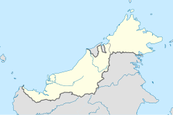 WBTM Location in East Malaysia | |||||||||||
| Runways | |||||||||||
| |||||||||||
| Source: AIP Malaysia [1] | |||||||||||
Tanjung Manis Airport (Malay: Lapangan Terbang Tanjung Manis ) ( IATA : TGC, ICAO : WBTM) is an airport located in Mukah Division, Sarawak, Malaysia. Although Tanjung Manis is now under the jurisdiction of Mukah Division, due to its close proximity to Sarikei, the airport also serves the Sarikei Division as well.