Sowerby is a village, electoral ward and civil parish in the Hambleton District of North Yorkshire, England immediately south of the neighbouring market town of Thirsk. Although the boundary between the two parishes runs very close to Thirsk town centre, the village retains its own identity and has a separate Parish Council. The author James Herriot lived in the village.

Norton is a village and civil parish in the Metropolitan Borough of Doncaster, on the border with North Yorkshire.
Hampole is a small village and civil parish in the Metropolitan Borough of Doncaster, on the border with West Yorkshire. Historically part of the West Riding of Yorkshire, the eastern boundary of the parish is marked by the Great North Road, and the parish lies in what was once the Barnsdale Forest. It had a population of 187 in 2001, increasing to 203 at the 2011 Census.

Brierley is a town and former civil parish in the Metropolitan Borough of Barnsley in South Yorkshire, England. The civil parish was abolished in 2016. The settlement is tightly clustered and green buffered on a modest escarpment close to the border with West Yorkshire, it is almost wholly in population south of the A628 road, and is less than 2 miles (3 km) to the south west of Hemsworth.

Birdwell is a village in the Metropolitan Borough of Barnsley in South Yorkshire, England and is located approximately 4.5 miles (7 km) south of Barnsley, 12.1 miles (19 km) north-east of Sheffield, and 20.0 miles (32 km) west of Doncaster. The village falls within the Rockingham Ward of the Barnsley Metropolitan Council. Neighbouring villages include Worsbrough, Tankersley and Hoyland Common.

Bramhope is a village and civil parish in the City of Leeds metropolitan borough, West Yorkshire, England, north of Holt Park and north east of Cookridge.
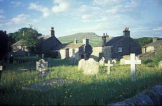
Horton in Ribblesdale is a small village and civil parish in the Craven district of North Yorkshire, England. It is situated in Ribblesdale on the Settle–Carlisle Railway to the west of Pen-y-ghent.

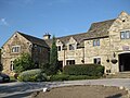
Thornby is a village and civil parish in West Northamptonshire in England. It has a Manor house. At the time of the 2001 census, the parish's population was 162 people, increasing to 189 at the 2011 Census. The village is bisected by the A5199 road between Northampton and Leicester and about 11 miles (17.7 km) north-west of Northampton town centre. It is about 1½ miles south of a junction with the A14 road which joins the M1 Motorway and M6 junction at Catthorpe with Felixstowe, Suffolk.

Aysgarth is a village and civil parish in Wensleydale, in the Richmondshire district of North Yorkshire, England. The village is in the Yorkshire Dales National Park, about 16 miles (26 km) south-west of Richmond and 22.6 miles (36.4 km) west of the county town of Northallerton.

Baldersby is a village and civil parish in the Harrogate district of North Yorkshire, England, about 6 miles (10 km) west of Thirsk and 5 miles (8 km) north-east of Ripon on the A61. The parish includes the village of Baldersby St James, 1 mile (2 km) south east of the village of Baldersby, but not Baldersby Park, which is in the parish of Rainton with Newby. According to the 2001 census the parish had a population of 253, increasing to 285 at the 2011 census.

Bilbrough is a village and civil parish in the Selby District of North Yorkshire, England, 6 miles (10 km) south-west of York, and just outside the York city boundary. According to the 2001 Census it had a population of 319 increasing to 348 at the 2011 census.

Leckhampton is a district in south Cheltenham, Gloucestershire, England. The area is in the civil parish of Leckhampton with Warden Hill and is part of the district of Cheltenham. The population of the civil parish taken at the 2011 census was 4,409.

Wigginton is a village and civil parish in the unitary authority of the City of York in North Yorkshire, England. It is situated 4 miles (6.4 km) north of York. According to the 2001 census the parish had a population of 3,714, reducing to 3,610 at the 2011 Census.

Topcliffe is a village and civil parish in the Hambleton district of North Yorkshire, England. The village is situated on the River Swale, on the A167 road and close to the A168. It is about 5 miles (8 km) south-west of Thirsk and 11 miles (18 km) south of the county town of Northallerton. It has a population of 1,489. An army barracks, with a Royal Air Force airfield enclosed within, is located to the north of the village.
Willerby is a village and civil parish located on the western outskirts of the city of Kingston upon Hull in the East Riding of Yorkshire, England.
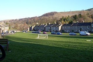
West Burton is a village in Bishopdale, a side valley of Wensleydale, in the Yorkshire Dales, North Yorkshire, England. It lies 6.2 miles (10 km) south-west of Leyburn and 22.3 miles (35.9 km) west of the County Town of Northallerton. It is the largest settlement in the civil parish of Burton-cum-Walden.

Monk Fryston is a small village and civil parish in the Selby district of North Yorkshire, England.
Pilley is a village in the metropolitan borough of Barnsley in South Yorkshire, England.

Sitlington, historically Shitlington, was a township in the ancient ecclesiastical parish of Thornhill in the wapentake of Agbrigg and Morley in the West Riding of Yorkshire comprising the villages and hamlets of Middlestown, Netherton, Overton and Midgley. The h was dropped from Shitlington and Sitlington was adopted in 1929 with the approval of the county council. The population of the civil parish at the 2011 census was 5,963.
Tankersley is a civil parish in the metropolitan borough of Barnsley, South Yorkshire, England. The parish contains twelve listed buildings that are recorded in the National Heritage List for England. Of these, one is listed at Grade II*, the middle of the three grades, and the others are at Grade II, the lowest grade. The parish contains the villages of Tankersley and Pilley, and the surrounding area. The listed buildings consist of a church, a [[sundial] and a mounting block in the churchyard, houses, farmhouses and farm buildings, a milepost, and a former coal mines rescue station.