Tanyard is an unincorporated community in Caroline County, Maryland, United States. [1]
Contents

Tanyard is an unincorporated community in Caroline County, Maryland, United States. [1]

As far back as 1900, Tanyard was an established post village. [2]
Tanyard is located one mile south of Dover Bridge, which crosses the Choptank River and crossroad with Frazier Neck Road.

Caroline County is a rural county located in the U.S. state of Maryland on its Eastern Shore. As of the 2020 census, the population was 33,293. Its county seat is Denton.

Bridgeville is a town in Sussex County, Delaware, United States. According to the 2010 census, the population is 2,048, an increase of 42.6% from the previous decade. It is part of the Salisbury, Maryland-Delaware Metropolitan Statistical Area.

Tulebras is a town and municipality located in the province and autonomous community of Navarre, northern Spain.

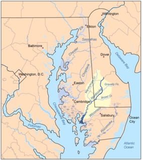
Marshyhope Creek is a 37.0-mile-long (59.5 km) tributary of the Nanticoke River on the Delmarva Peninsula. It rises in Kent County, Delaware, and runs through Caroline County, Maryland, and Dorchester County, Maryland.
KYYW is a news/talk radio station that serves the Abilene, Texas, area. The station is under ownership of Townsquare Media.
Clearwater Air Park is a city-owned public-use airport located three miles (4.8 km) northeast of the central business district of Clearwater, a city in Pinellas County, Florida, United States.

Guthrie is an unincorporated community in Marshall Township, Lawrence County, Indiana.
The Sturgis One Room School is a historic U.S. school located at 209 Willow Street, Pocomoke City, Maryland. The community used this one room school from 1900 to 1937. It was originally known as Sturgis School and was located on Brantley Road. It was moved to its current location in 1996. The school currently serves as The Sturgis One Room School Museum.

The Ocean City Police Department (OCPD) is a full-time-service law enforcement agency providing police services to a population of 7,031 people within 36.4 square miles (94 km2) of the municipality of Ocean City, MD.
The St. Martin River is a tributary of Isle of Wight Bay in Worcester County, Maryland. Approximately 4.4 miles (7.1 km) long, it drains the northernmost part of Worcester County.

Tuckahoe Creek is a 21.5-mile-long (34.6 km) tributary of the Choptank River on Maryland's Eastern Shore. It is sometimes (erroneously) referred to as the Tuckahoe River. Upstream of Hillsboro, it forms the boundary between Caroline County and Queen Anne's County, passing through Tuckahoe State Park and dividing the small towns of Queen Anne and Hillsboro. Downstream of Hillsboro, it forms the boundary between Caroline County and Talbot County, before flowing into the Choptank.
Johnson Wildlife Management Area is a Wildlife Management Area in Wicomico County, Maryland.
Linkwood Wildlife Management Area is a 313-acre (1.27 km2) Wildlife Management Area in the state of Maryland. It is located in Dorchester County, near the town of Linkwood.
Nanticoke River Wildlife Management Area is a Wildlife Management Area in Wicomico County, Maryland near Quantico, Maryland.
Le Compte Wildlife Management Area is a Wildlife Management Area in Dorchester County, Maryland.
Clay Hill, also spelled Clayhill, is an unincorporated community in Marengo County, Alabama, United States. Clay Hill was established prior to the American Civil War. It had a post office at one time, but it no longer exists.
Pickerel is an unincorporated community in Pittsylvania County, in the U.S. state of Virginia.
Brookwood is a neighborhood at the southernmost tip of the Buckhead Community of Atlanta. It should not be confused with Brookwood Hills, a neighborhood and historic district east of Brookwood across Peachtree Road.
Schumaker Pond is a 35-acre pond created by damming Beaverdam Creek, in Wicomico County, Maryland. The pond is owned by the City of Salisbury and is on the eastern end of the Salisbury City Park. The maximum water depth is 5 feet near the dam, in the old creek channel. In the 1950s-60s Schumaker Pond was popular for swimming, but swimming has since been banned due to the large quantities of E-Coli bacteria in the water. Today, the pond is often used for fishing.
Beaverdam Creek is a tributary of the Wicomico River on the Eastern Shore of Maryland. Parker Pond and Schumaker Pond were created by damming Beaverdam Creek.
Coordinates: 38°45′02″N75°58′36″W / 38.75056°N 75.97667°W