Tyukalinsk is a town in Omsk Oblast, Russia, located 60 kilometers (37 mi) northeast of the Nazyvayevsk railway station on the Trans-Siberian Railway and 120 kilometers (75 mi) northwest of Omsk, the administrative center of the oblast. Population: 11,275 (2010 Census); 12,007 (2002 Census); 12,191 (1989 Census).

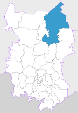
Gorkovsky District is an administrative and municipal district (raion), one of the thirty-two in Omsk Oblast, Russia. It is located in the eastern central part of the oblast. The area of the district is 3,000 square kilometers (1,200 sq mi). Its administrative center is the urban locality of Gorkovskoye. Population: 20,807 ; 24,718 (2002 Census); 28,038 (1989 Census). The population of Gorkovskoye accounts for 25.8% of the district's total population.

Isilkulsky District is an administrative and municipal district (raion), one of the thirty-two in Omsk Oblast, Russia. It is located in the southwest of the oblast. The area of the district is 2,800 square kilometers (1,100 sq mi). Its administrative center is the town of Isilkul. Population: 18,942 ; 22,216 (2002 Census); 22,691 (1989 Census).
Kalachinsky District is an administrative and municipal district (raion), one of the thirty-two in Omsk Oblast, Russia. It is located in the southeast of the oblast. The area of the district is 2,800 square kilometers (1,100 sq mi). Its administrative center is the town of Kalachinsk. Population: 18,197 ; 21,810 (2002 Census); 22,812 (1989 Census).

Kolosovsky District is an administrative and municipal district (raion), one of the thirty-two in Omsk Oblast, Russia. It is located in the center of the oblast. The area of the district is 4,700 square kilometers (1,800 sq mi). Its administrative center is the rural locality of Kolosovka. Population: 12,803 ; 15,763 (2002 Census); 17,861 (1989 Census). The population of Kolosovka accounts for 41.5% of the district's total population.

Kormilovsky District is an administrative and municipal district (raion), one of the thirty-two in Omsk Oblast, Russia. It is located in the southern central part of the oblast. The area of the district is 1,908.23 square kilometers (736.77 sq mi). Its administrative center is the urban locality of Kormilovka. Population: 24,726 ; 25,989 (2002 Census); 26,319 (1989 Census). The population of Kormilovka accounts for 38.9% of the district's total population.
Krutinsky District is an administrative and municipal district (raion), one of the thirty-two in Omsk Oblast, Russia. It is located in the west of the oblast. The area of the district is 5,700 square kilometers (2,200 sq mi). Its administrative center is the urban locality of Krutinka. Population: 17,408 ; 21,287 (2002 Census); 23,411 (1989 Census). The population of Krutinka accounts for 42.1% of the district's total population.

Maryanovsky District is an administrative and municipal district (raion), one of the thirty-two in Omsk Oblast, Russia. It is located in the southwest of the oblast. The area of the district is 1,700 square kilometers (660 sq mi). Its administrative center is the urban locality of Maryanovka. Population: 27,595 ; 27,802 (2002 Census); 30,173 (1989 Census). The population of Maryanovka accounts for 31.3% of the district's total population.

Moskalensky District is an administrative and municipal district (raion), one of the thirty-two in Omsk Oblast, Russia. It is located in the southwest of the oblast. The area of the district is 2,500 square kilometers (970 sq mi). Its administrative center is the urban locality of Moskalenki. Population: 28,968 ; 32,053 (2002 Census); 33,611 (1989 Census). The population of Moskalenki accounts for 32.1% of the district's total population.
Muromtsevsky District is an administrative and municipal district (raion), one of the thirty-two in Omsk Oblast, Russia. It is located in the east of the oblast. The area of the district is 6,700 square kilometers (2,600 sq mi). Its administrative center is the urban locality of Muromtsevo. Population: 23,795 ; 28,380 (2002 Census); 31,935 (1989 Census). The population of Muromtsevo accounts for 45.3% of the district's total population.

Nazyvayevsky District is an administrative and municipal district (raion), one of the thirty-two in Omsk Oblast, Russia. It is located in the west of the oblast. The area of the district is 5,900 square kilometers (2,300 sq mi). Its administrative center is the town of Nazyvayevsk. Population: 12,372 ; 17,654 (2002 Census); 21,626 (1989 Census).
Nizhneomsky District is an administrative and municipal district (raion), one of the thirty-two in Omsk Oblast, Russia. It is located in the east of the oblast. The area of the district is 3,400 square kilometers (1,300 sq mi). Its administrative center is the rural locality of Nizhnyaya Omka. Population: 15,826 ; 19,766 (2002 Census); 21,779 (1989 Census). The population of the administrative center accounts for 30.5% of the district's total population.

Okoneshnikovsky District is an administrative and municipal district (raion), one of the thirty-two in Omsk Oblast, Russia. It is located in the southeast of the oblast. The area of the district is 3,100 square kilometers (1,200 sq mi). Its administrative center is the urban locality of Okoneshnikovo. Population: 14,791 ; 17,280 (2002 Census); 19,744 (1989 Census). The population of Okoneshnikovo accounts for 35.2% of the district's total population.

Omsky District is an administrative and municipal district (raion), one of the thirty-two in Omsk Oblast, Russia. It is located in the southern central part of the oblast. The area of the district is 3,600 square kilometers (1,400 sq mi). Its administrative center is the rural locality of Rostovka. Population: 94,086 ; 94,251 (2002 Census); 90,461 (1989 Census). The population of Rostovka accounts for 5.8% of the district's total population.
Russko-Polyansky District is an administrative and municipal district (raion), one of the thirty-two in Omsk Oblast, Russia. It is located in the south of the oblast. The area of the district is 3,300 square kilometers (1,300 sq mi). Its administrative center is the urban locality of Russkaya Polyana. Population: 19,333 ; 24,481 (2002 Census); 26,959 (1989 Census). The population of the administrative center accounts for 30.6% of the district's total population.

Sargatsky District is an administrative and municipal district (raion), one of the thirty-two in Omsk Oblast, Russia. It is located in the center of the oblast. The area of the district is 3,800 square kilometers (1,500 sq mi). Its administrative center is the urban locality of Sargatskoye. Population: 20,014 ; 22,320 (2002 Census); 23,923 (1989 Census). The population of Sargatskoye accounts for 40.8% of the district's total population.

Ust-Ishimsky District is an administrative and municipal district (raion), one of the thirty-two in Omsk Oblast, Russia. It is located in the northwest of the oblast. The area of the district is 7,846 square kilometers (3,029 sq mi).} Its administrative center is the rural locality of Ust-Ishim, which, as its name indicates, is located at the confluence of the Ishim River with the Irtysh.

Znamensky District is an administrative and municipal district (raion), one of the thirty-two in Omsk Oblast, Russia. It is located in the north of the oblast. The area of the district is 3,700 square kilometers (1,400 sq mi). Its administrative center is the rural locality of Znamenskoye. Population: 12,427 ; 13,876 (2002 Census); 15,046 (1989 Census). The population of Znamenskoye accounts for 42.6% of the district's total population.

Azovo is a rural locality and the administrative center of Azovsky Nemetsky National District of Omsk Oblast, Russia. Population: 5,997 (2010 Census); 5,376 (2002 Census);