Tchabal Nganha

Last updated
Tchabal Nganha
Cameroon physical map.svg
Red triangle with thick white border.svg
Tchabal Nganha
Location in Cameroon
Highest point
Elevation 1,927 m (6,322 ft)
Prominence 1,000 metres (3,300 ft)
Coordinates 7°21′13″N14°00′53″E / 7.353687°N 14.014683°E / 7.353687; 14.014683 Coordinates: 7°21′13″N14°00′53″E / 7.353687°N 14.014683°E / 7.353687; 14.014683
Geology
Mountain type Stratovolcano
Volcanic arc Cameroon line

Tchabal Nganha is a stratovolcano on the Ngaoundere Plateau, a highland area in the Adamawa Region of Cameroon.

Contents

Location

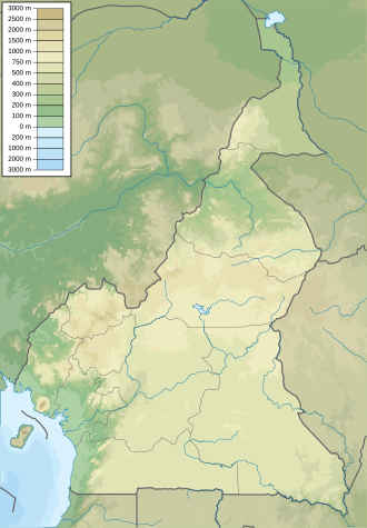
Tchabal Nganha is a large composite volcano located within the Ngaoundere volcanic field in the east of the Adamawa Plateau. [1] It is the only stratovolcano in the field. [2] Nganha rises about 1,000 metres (3,300 ft) above the surrounding plateau to a height of 1,927 metres (6,322 ft) at Doïtaïa Mounts. [3]

The Adamawa plateau is an asymmetrical horst bounded by N70°E faults and tilted to the south. [4] The plateau has a Precambrian metamorphic basement that is intruded by granite and syenite plutons from the Paleozoic. It is partly covered by volcanic formations from the Cenozoic to Recent ages. The crust is 33 kilometres (21 mi) thick below the plateau. [3] Although considered by many geologists to be part of the Cameroon line, the silicic volcanism of the Ngaoundere Plateau is younger (11 to 9 million years old) than silicic volcanism in the Western Highlands, with much more alkaline basalts than in the western part of the line. [5]

Formation

Basalt and trachyte rock samples from Nganha have K–Ar ages of 7.2, 7.9 and 9.8 Ma (million years). The volcano was formed in four overlapping phases. First, many basaltic lava flows erupted throughout the region, creating the generally smooth relief. Next, voluminous breccias were deposited. Most of these have been deeply eroded except where covered by later lava flows. Thick, radially distributed trachyte and phonolite flows then erupted. They have steep margins and are separated by deep and narrow valleys. Later there was basaltic activity at the summit. [3]

Notes

    1. Woolley 2001, p. 33.
    2. Duyck 2012.
    3. 1 2 3 Nono et al. 1994, p. 149.
    4. Nono et al. 1994, pp. 148–149.
    5. Marzoli et al. 1999, p. 133ff.

    Sources

    Related Research Articles

    Rhyolite Igneous, volcanic rock, of felsic (silica-rich) composition

    Rhyolite is the most silica-rich of volcanic rocks. It is generally glassy or fine-grained (aphanitic) in texture, but may be porphyritic, containing larger mineral crystals (phenocrysts) in an otherwise fine-grained groundmass. The mineral assemblage is predominantly quartz, sanidine, and plagioclase. It is the extrusive equivalent to granite.

    Shield volcano Low profile volcano usually formed almost entirely of fluid lava flows

    A shield volcano is a type of volcano named for its low profile, resembling a warrior's shield lying on the ground. It is formed by the eruption of highly fluid lava, which travels farther and forms thinner flows than the more viscous lava erupted from a stratovolcano. Repeated eruptions result in the steady accumulation of broad sheets of lava, building up the shield volcano's distinctive form.

    Anahim Volcanic Belt

    The Anahim Volcanic Belt (AVB) is a west–east trending chain of volcanoes and related magmatic features in British Columbia, Canada. It extends from Athlone Island on the Central Coast, running eastward through the strongly uplifted and deeply dissected Coast Mountains to near the community of Nazko on the Interior Plateau. The AVB is delineated as three west-to-east segments that differ in age and structure. A wide variety of igneous rocks with differing compositions occur throughout these segments, comprising landforms such as volcanic cones, volcanic plugs, lava domes, shield volcanoes and intrusions.

    Flood basalt The result of a very large volume eruption of basalt lava

    A flood basalt is the result of a giant volcanic eruption or series of eruptions that covers large stretches of land or the ocean floor with basalt lava. Many flood basalts have been attributed to the onset of a hotspot reaching the surface of the earth via a mantle plume. Flood basalt provinces such as the Deccan Traps of India are often called traps, after the Swedish word trappa, due to the characteristic stairstep geomorphology of many associated landscapes.

    Mount Taylor (New Mexico) Stratovolcano in the San Mateo Mountains, North America

    Mount Taylor is a dormant stratovolcano in northwest New Mexico, northeast of the town of Grants. It is the high point of the San Mateo Mountains and the highest point in the Cibola National Forest.

    Cameroon line Chain of volcanoes in western Africa

    The Cameroon line is a 1,600 km (990 mi) chain of volcanoes. It includes islands in the Gulf of Guinea and mountains that extend along the border region of eastern Nigeria and the West Region of Cameroon, from Mount Cameroon on the Gulf of Guinea north and east towards Lake Chad. The islands, which span the equator, have tropical climates and are home to many unique plant and bird species. The mainland mountain regions are much cooler than the surrounding lowlands, and also contain unique and ecologically important environments.

    Itcha Range Mountain range in British Columbia, Canada

    The Itcha Range, also known as the Itchas, is a small isolated mountain range in the West-Central Interior of British Columbia, Canada. It is located 40 km (25 mi) northeast of the community of Anahim Lake. With a maximum elevation of 2,375 m (7,792 ft), it is the lowest of three mountain ranges on the Chilcotin Plateau extending east from the Coast Mountains. Two mountains are named in the Itcha Range; Mount Downton and Itcha Mountain. A large provincial park surrounds the Itcha Range and other features in its vicinity. More than 15 animal species are known to exist in the Itcha Range area, as well as a grassland community that is limited only to this location of British Columbia. The Itcha Range is within territory which has been occupied by aboriginal peoples for millennia. This area has a relatively dry environment compared to the Coast Mountains in the west.

    Namarunu

    Namarunu is a shield volcano located in the Great Rift Valley, Kenya.

    Ollagüe Stratovolcano in Bolivia and Chile

    Ollagüe or Ullawi is a massive andesite stratovolcano in the Andes on the border between Bolivia and Chile, within the Antofagasta Region of Chile and the Potosi Department of Bolivia. Part of the Central Volcanic Zone of the Andes, its highest summit is 5,868 metres (19,252 ft) above sea level and features a summit crater that opens to the south. The western rim of the summit crater is formed by a compound of lava domes, the youngest of which features a vigorous fumarole that is visible from afar.

    Level Mountain Volcanic complex in British Columbia, Canada

    Level Mountain is a large volcanic complex in the Northern Interior of British Columbia, Canada. It is located 50 kilometres north-northwest of Telegraph Creek and 60 kilometres west of Dease Lake on the Nahlin Plateau. With a maximum elevation of 2,164 metres , it is the second-highest of four large complexes in an extensive north–south trending volcanic region. Much of the mountain is gently-sloping; when measured from its base, Level Mountain is about 1,100 metres tall, slightly taller than its neighbour to the northwest, Heart Peaks. The lower, broader half of Level Mountain consists of a shield-like structure while its upper half has a more steep, jagged profile. Its broad summit is dominated by the Level Mountain Range, a small mountain range with prominent peaks cut by deep valleys. These valleys serve as a radial drainage for several small streams that flow from the mountain. Meszah Peak is the only named peak in the Level Mountain Range.

    Volcanism of New Zealand

    The volcanism of New Zealand has been responsible for many of the country's geographical features, especially in the North Island and the country's outlying islands.

    The Barrier is an active shield volcano located in the north of Kenya. It is last known to have erupted in 1921.

    Mount Edziza volcanic complex Mountain in British Columbia, Canada

    The Mount Edziza volcanic complex is a large and potentially active north-south trending complex volcano in Stikine Country, northwestern British Columbia, Canada, located 38 kilometres (24 mi) southeast of the small community of Telegraph Creek. It occupies the southeastern portion of the Tahltan Highland, an upland area of plateau and lower mountain ranges, lying east of the Boundary Ranges and south of the Inklin River, which is the east fork of the Taku River. As a volcanic complex, it consists of many types of volcanoes, including shield volcanoes, calderas, lava domes, stratovolcanoes, and cinder cones.

    Lava Molten rock expelled by a volcano during an eruption

    Lava is magma once it has been expelled from the interior of a terrestrial planet or a moon onto its surface. Lava may be erupted at a volcano or through a fracture in the crust, on land or undersea, usually at temperatures from 800 to 1,200 °C. The volcanic rock resulting from subsequent cooling is also often called lava.

    Nganha is a commune in Cameroon. It has a population between 3,000 and 5,000. It is about 10 kilometres (6.2 mi) northwest of the summit of Tchabal Nganha, a large stratovolcano on the Ngaoundere Plateau, a highland area in the Adamawa Region of Cameroon.

    Volcanic history of the Northern Cordilleran Volcanic Province

    The volcanic history of the Northern Cordilleran Volcanic Province presents a record of volcanic activity in northwestern British Columbia, central Yukon and the U.S. state of easternmost Alaska. The volcanic activity lies in the northern part of the Western Cordillera of the Pacific Northwest region of North America. Extensional cracking of the North American Plate in this part of North America has existed for millions of years. Continuation of this continental rifting has fed scores of volcanoes throughout the Northern Cordilleran Volcanic Province over at least the past 20 million years and occasionally continued into geologically recent times.

    Canadian Cascade Arc Canadian segment of the North American Cascade Volcanic Arc

    The Canadian Cascade Arc, also called the Canadian Cascades, is the Canadian segment of the North American Cascade Volcanic Arc. Located entirely within the Canadian province of British Columbia, it extends from the Cascade Mountains in the south to the Coast Mountains in the north. Specifically, the southern end of the Canadian Cascades begin at the Canada–United States border. However, the specific boundaries of the northern end are not precisely known and the geology in this part of the volcanic arc is poorly understood. It is widely accepted by geologists that the Canadian Cascade Arc extends through the Pacific Ranges of the Coast Mountains. However, others have expressed concern that the volcanic arc possibly extends further north into the Kitimat Ranges, another subdivision of the Coast Mountains, and even as far north as Haida Gwaii.

    Ngaoundere Plateau

    The Ngaoundéré Plateau is a highland area in the Adamawa Region of Cameroon. It contains Tchabal Nganha, a large volcano, and many other recent volcanic structures.

    Tengchong volcanic field Volcanic field in Yunnan, China

    The Tengchong Volcanic Field (TVF) is a Cenozoic volcanic field located in the Southeastern margin of the Tibetan Plateau around 40 km from the Chinese border with Myanmar. The TVF is uniquely the only region affected by Quaternary volcanism that is part of the Himalayan Geothermal Belt caused by the Indo-Asian continent-continent collision. The TVF is characterized by hydrothermal activity and large-scale eruptions last recorded in 1609CE. Although the volcanoes themselves are considered extinct, several geothermal fields geographically linked to the TVF are still highly active. Evidence for geothermal activity can be linked to several prevalent active hot-springs located predominantly within the vicinity of the volcanoes in the TVF. Holocene eruptions occurred predominantly in the three largest volcanoes in the TVF named the Dayingshan, Maa'nshan and Heikongshan, the highest of which (Dayingshan) reaches 2865 meters above sea level. The volcanoes are distributed in a string-like pattern clustered from North to South in the middle on the Tengchong basin and are characterized by post-collisional high-Potassium (K) calc-alkaline series eruptions. The TVF provides unique geographical and geological knowledge as understanding the geological processes of creation provides insight into aspects such as the history of volcanism during the Quaternary Era in the region and as well as compositional information of its source and crustal assimilants. The TVF can be visited in the Tengchong Volcanic Geothermal National Geological Park.`

    Udokan Plateau

    The Udokan Plateau is a volcanic field in Transbaikalia, Russia. It covers a surface area of 3,000 square kilometres (1,200 sq mi) northeast of Lake Baikal in North Asia. Volcanism in the Udokan Plateau included both basaltic lava flows and later individual volcanic cones. Volcanism commenced in the Miocene and continued on into the Holocene.