This article relies largely or entirely on a single source .(October 2022) |
Teer | |
|---|---|
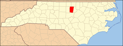
 Teer Location within the state | |
| Coordinates: 35°57′38″N79°13′49″W / 35.96056°N 79.23028°W | |
| Country | United States |
| State | North Carolina |
| County | Orange |
| Elevation | 486 ft (148 m) |
| Time zone | UTC-5 (Eastern (EST)) |
| • Summer (DST) | UTC-4 (EDT) |
| GNIS feature ID | 1022899 |
Teer is an unincorporated community in southwestern Orange County, North Carolina, United States, northeast of Oaks. Its elevation is 486 feet or 148 meters. [1]