Tennessee State Route 92

Last updated

Tennessee 92.svg

State Route 92

Tennessee State Route 92
SR 92 highlighted in red
Route information
Maintained by TDOT
Length34.88 mi (56.13 km)
Major junctions
South endUS 411.svg US 411 in Chestnut Hill
Major intersectionsUS 25W.svgUS 70.svgSecondary Tennessee 66.svg US 25W  / US 70  / SR 66 in Dandridge
I-40.svg I-40 in Dandridge
US 11E.svg US 11E in Jefferson City
North endUS 11W.svg US 11W in Rutledge
Location
Country United States
State Tennessee
Counties Jefferson, Grainger
Highway system
Secondary Tennessee 91.svg SR 91 Tennessee 93.svg SR 93

State Route 92 (SR 92) is a state highway in East Tennessee with both four lane and two lane sections.

Contents

Route description

SR 92 begins at US 411/SR 35 in Chestnut Hill. It heads north toward Dandridge and crosses over the French Broad River/Douglas Lake just inside Dandridge city limits, just after crossing the river/lake it junctions with SR 139 in downtown. It the junctions with US 25W, US 70 and SR 66 in downtown Dandridge. SR 92 begins a 0.6-mile (0.97 km) concurrency with US 25W, US 70 and SR 66, the four routes head west then northwest to where US 25W, US 70 and SR 66 head west and SR 92 heads northward and becomes a four-lane divided highway. Next it junctions with I-40 at exit 417. SR 92 then leaves Dandridge city limits 2.1 miles (3.4 km) north of I-40, and the route enters Jefferson City city limits and heads north to US 11E where it begins a 1.3-mile-long (2.1 km) concurrency with US 11E. The two routes head west to where US 11E heads west and SR 92 turns northeast on the edge of Jefferson City. SR 92 then leaves Jefferson City and turns northwest. It then crosses the Holston River just west of Cherokee Dam on the JeffersonGrainger county line heads north to end at US 11W in downtown Rutledge. [1] [2] [3]

Since 1971, plans were proposed for SR 92 to be extended north of Rutledge to cross the Clinch Mountain ridgeline connecting to the unincorporated town of Washburn, but no action has been taken to move forward with these plans. [4]

Junction list

CountyLocationmikmDestinationsNotes
Jefferson Chestnut Hill 0.00.0US 411.svg US 411 (Newport Highway/SR 35) Sevierville, Newport Southern terminus
East plate.svg
Secondary Tennessee 363.svg
SR 363 east (Indian Creek Road)
Western terminus of SR 363
Dandridge West plate.svg
Secondary Tennessee 139.svg
SR 139 west (West Main Street) Kodak
Eastern terminus of SR 139
South plate.svg
US 25W.svg
East plate.svg
US 70.svg
North plate.svg
Secondary Tennessee 66.svg
US 25W south / US 70 east / SR 66 north (East Meeting Street/SR 9) Newport
begin US 25W/US 70/SR 66/SR 9 overlap
North plate.svg
US 25W.svg
West plate.svg
US 70.svg
South plate.svg
Secondary Tennessee 66.svg
US 25W north / US 70 west / SR 66 south (SR 9) Knoxville
end US 25/US 70/SR 66/SR 9 overlap
I-40.svg I-40  Knoxville, Asheville I-40 exit 417
Jefferson City North plate.svg
US 11E.svg
US 11E north (West Broadway Boulevard/SR 34) Morristown
begin US 11E/SR 34 overlap
South plate.svg
US 11E.svg
US 11E south (Andrew Johnson Highway/SR 34) New Market, Strawberry Plains, Knoxville
end US 11E/SR 34 overlap
West Old Andrew Johnson Highway – Downtown Jefferson City, Carson-Newman University
Grainger Cherokee North plate.svg
Secondary Tennessee 375.svg
SR 375 north (Lakeshore Drive) Bean Station
Southern terminus of SR 375
Rutledge 34.8856.13US 11W.svg US 11W (Rutledge Pike/SR 1) Bean Station, Blaine Northern terminus
1.000 mi = 1.609 km; 1.000 km = 0.621 mi

Related Research Articles

<span class="mw-page-title-main">Tennessee State Route 1</span> State highway in Tennessee, United States

State Route 1, known as the Memphis to Bristol Highway, is a 538.8-mile-long (867.1 km) mostly-unsigned state highway in the U.S. state of Tennessee. It stretches all the way from the Arkansas state line at Memphis in the southwest corner of the state to Bristol in the northeast part. Most of the route travels concurrently with U.S. Route 70 and US 11W. It is the longest highway of any kind in the state of Tennessee. The route is signed as both in the state of Tennessee, a Primary and Secondary Highway

<span class="mw-page-title-main">U.S. Route 11W</span> Suffixed section of U.S. Highway in Tennessee and Virginia in the United States

U.S. Route 11W (US 11W) is the western branch of US 11 from the twin cities of Bristol, Tennessee/Bristol, Virginia, where US 11 splits into US 11E and US 11W, to Knoxville, Tennessee, where the two highways rejoin. The highway serves the Appalachia region's Ridge-and-Valley section of East Tennessee, bounded by the Clinch Mountain ridge to the north and the Holston River to the south. US 11W from Bristol to Bean Station and Blaine to Knoxville are designated as part of the National Highway System.

<span class="mw-page-title-main">U.S. Route 11E</span> Suffixed U.S. Highway in Tennessee and Virginia in the United States

U.S. Route 11E (US 11E) is a divided highway of US 11 in the U.S. states of Tennessee and Virginia. The United States Numbered Highway, which is complemented by US 11W to the north and west, runs 120.94 miles (194.63 km) from US 11, US 11W, and US 70 in Knoxville, Tennessee, north and east to US 11, US 11W, US 19, and US 421 in Bristol, Virginia. US 11E connects Knoxville and the twin cities of Bristol, Virginia, and Bristol, Tennessee, with the East Tennessee communities of Morristown, Greeneville, and Johnson City. The U.S. Highway runs concurrently with US 70 and US 25W east of Knoxville, US 321 from Greeneville and Johnson City, and both US 19W and US 19 between Johnson City and Bristol. US 11E also has an unsigned concurrency with State Route 34 (SR 34) for almost all of its course in Tennessee.

<span class="mw-page-title-main">Tennessee State Route 8</span> Highway in Tennessee

State Route 8 is a 75.43-mile-long (121.39 km) north–south state highway in East and Middle Tennessee. It connects the cities of Chattanooga and McMinnville via Signal Mountain and Dunlap.

<span class="mw-page-title-main">U.S. Route 412 in Tennessee</span> U.S. Highway in Tennessee

In Tennessee, U.S. Route 412 stretches for 181.93 miles (292.79 km) through the farmland of West Tennessee and the hills of Middle Tennessee, starting at the Missouri state line near Dyersburg and running to an interchange between I-65 and SR 99 in Columbia.

<span class="mw-page-title-main">Tennessee State Route 21</span> State highway in Tennessee, United States

State Route 21 is a two lane highway that runs from the Mississippi River west of Tiptonville, Tennessee to the Kentucky state line north of Union City. This road provides access to Reelfoot Lake State Park.

<span class="mw-page-title-main">U.S. Route 31A</span> U.S. Highway in Tennessee

U.S. Route 31A is a 76.94-mile-long (123.82 km) alternate route of U.S. Route 31 that exists between Nashville and Pulaski, Tennessee. It is located entirely in Middle Tennessee and except for the Lewisburg bypass, where it is concurrent with SR 106, it is entirely concurrent with unsigned State Route 11.

<span class="mw-page-title-main">Tennessee State Route 63</span> Highway in Tennessee

State Route 63 is an east–west state highway in the northern portion of eastern Tennessee. It goes from U.S. Route 27 in Huntsville to SR 33 in Sneedville, running 102 miles (164 km).

<span class="mw-page-title-main">Tennessee State Route 381</span> State highway in Tennessee, United States

State Route 381 is a state highway in Johnson City, Washington County, Tennessee. It serves as a bypass of Downtown on the north, west and south sides of the city. The route is also a retail corridor, lined with stores, restaurants and hotels.

<span class="mw-page-title-main">Tennessee State Route 139</span> State highway in Tennessee, United States

State Route 139 is a 25-mile-long (40 km) state highway in Jefferson and Sevier counties in the eastern portion of the U.S. state of Tennessee. It connects Strawberry Plains to Dandridge.

<span class="mw-page-title-main">Tennessee State Route 130</span> State highway in Tennessee, United States

State Route 130 is a 51.3-mile-long (82.6 km) east–west state highway in Middle Tennessee.

<span class="mw-page-title-main">Tennessee State Route 142</span> Highway in Tennessee

State Route 142 is a 24.59 mile long east-west state highway in West Tennessee.

<span class="mw-page-title-main">Tennessee State Route 187</span> State highway in Gibson County, Tennessee

State Route 187 is a 7.8 mile long east-west state highway in Gibson County, Tennessee

<span class="mw-page-title-main">Tennessee State Route 189</span> State highway in Tennessee, United States

State Route 189 is a short 5.5-mile-long (8.9 km) north–south state highway in Crockett County, Tennessee, connecting the towns of Maury City and Friendship.

<span class="mw-page-title-main">Tennessee State Route 201</span> State highway

State Route 201 is a 23.0 mile long north-south state highway in West Tennessee.

<span class="mw-page-title-main">Tennessee State Route 216</span> State highway in Tennessee, United States

State Route 216 is a 17.7-mile-long (28.5 km) east–west state highway in West Tennessee, connecting Rives with Martin.

<span class="mw-page-title-main">Tennessee State Route 224</span> State highway in Tennessee, United States

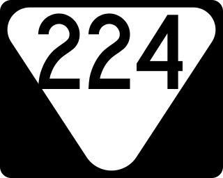
State Route 224 is a 26.6 miles (42.8 km) north-south state highway that is located almost entirely in McNairy County, Tennessee, connecting Michie with Enville via Stantonville and Adamsville.

<span class="mw-page-title-main">Tennessee State Route 269</span> State highway in Tennessee, United States

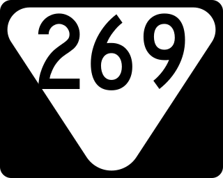
State Route 269 is a 49.2-mile-long (79.2 km) east–west state highway in central Middle Tennessee.

<span class="mw-page-title-main">Tennessee State Route 273</span> State highway in Tennessee, United States

State Route 273 is a 36.9-mile-long (59.4 km) east–west state highway traversing the hills of southern Middle Tennessee.

References

  1. "TN-92 · Tennessee".
  2. https://www.tn.gov/content/dam/tn/tdot/maps/county-maps-(us-shields)/h-m/Jefferson%20County.pdf [ bare URL PDF ]
  3. https://www.tn.gov/content/dam/tn/tdot/maps/county-maps-(us-shields)/a-g/Grainger%20County.pdf [ bare URL PDF ]
  4. Major Road Plan. Knoxville, Tennessee: East Tennessee Development District. 1971. Retrieved April 16, 2022.