Darlington is a market and industrial town in County Durham, England. It is the main administrative centre of the unitary authority Borough of Darlington. The borough is a constituent member of the devolved Tees Valley area.

Ferryhill is a town in County Durham, England, with an estimated population in 2018 of 9,362. The town grew in the 1900s around the coal mining industry. The last mine officially closed in 1968. It is located between the towns of Bishop Auckland, Newton Aycliffe, Sedgefield, Shildon, Spennymoor and the cathedral city of Durham.

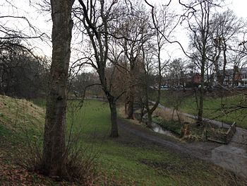
Durham Wildlife Trust is a registered charity that was established in 1971, originally as the Durham County Conservation Trust, becoming Durham Wildlife Trust in 1988. The Trust operates across the area of the old County Durham, which includes Darlington, Gateshead, South Tyneside and Sunderland.

South Moor is a village in County Durham, in England. It is located to the south-west of Stanley on the northern slope of the Craghead valley. It is a well-developed village, yet still semi-rural, containing a main street of around twelve shops which survive despite their proximity to the front street of Stanley and its Asda supermarket.

Saltburn-by-the-Sea, commonly referred to as Saltburn, is a seaside town in North Yorkshire, England, 12 miles (19 km) south-east of Hartlepool and 5 miles (8 km) south-east of Redcar. It lies within the historic boundaries of the North Riding of Yorkshire. It had a population of 5,958 in 2011.

Carlbury is a hamlet in the civil parish of High Coniscliffe in County Durham, in England. It is situated a few miles to the west of Darlington, on the north bank of the River Tees between Piercebridge to the west, and High Coniscliffe to the east. High and Low Carlbury once constituted a slightly larger settlement, but most of the hamlet at Low Carlbury became derelict and was demolished by the late 1940s. A few buildings remain.
Corporation Park is a traditional Victorian park in Blackburn, Lancashire, England. It was landscaped by William Henderson and opened in 1857. Corporation Park is regarded as the main formal park in Blackburn and is used mainly by local people for general recreation, walking and dog walking, as well as for its tennis, bowling and football facilities.
Croesyceiliog is a suburb of Cwmbran, Wales.

East Bowling is an area of Bradford, West Yorkshire, England located to the south of Bradford city centre. It forms the eastern half of the historic township and manor of Bowling. Bowling became a ward of the newly created Borough of Bradford in 1847. In 1882 the ward was split into the wards of East and West Bowling. In the north the boundary was along the Lancashire and Yorkshire Railway. To the south it was along Hall Lane and Bolling Hall Lane.
Dene is an electoral ward of Newcastle upon Tyne in North East England. The ward takes its name from the nearby gorge at Jesmond Dene. Contained within the ward are government offices of the Department for Work and Pensions and the Freeman Hospital. The population of the ward is 9,554, increasing to 9,667 at the 2011 Census, 3.7% of the total population of Newcastle upon Tyne. Car ownership in the area is 74.8% much higher than the city average of 54.7%.
Holywells Park is a 67-acre (270,000 m2) public park in Ipswich, England situated between Nacton Road and Cliff Lane, near to the Ipswich Waterfront.

Pennsylvania Route 168 is a highway in Western Pennsylvania that runs for 55 miles (89 km) from PA 18 in Frankfort Springs to PA 208 in Volant. PA 168 intersects or runs concurrently with PA 18 at several points, including in New Castle.
Barking Park is a public park covering 30 hectares to the northeast of Barking town centre in east London. It was opened as the Recreation Ground in 1898 by the Barking Town Urban District Council and is now the oldest public park in the London Borough of Barking and Dagenham. It lies north of Longbridge Road and south of the neighbourhood of Loxford, with the northern boundary of the park along Loxford Water also the borough boundary with Redbridge.

Bispham Rock Gardens, also known as Devonshire Road Rock Gardens or the Rock Gardens, is a municipal park located in Bispham, Blackpool on the Fylde coast in Lancashire, England. The gardens are an important wildlife resource and contains a number of rare species.
Philips Park is an area of parkland situated within the Metropolitan Borough of Bury on the boundary of Whitefield and Prestwich, in Greater Manchester. The park consists of rich woodland and grassland habitat and is home to an assortment of wildlife. Two thirds of the site was once the Philips family estate, and the remainder, known as Waterdale, is Irwell Valley land reclaimed following the demolition of two bleach and dye works. The park is a local nature reserve.

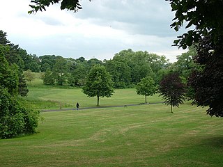
Highfields Park is Grade II listed park providing 121 acres (49 ha) of public space, in the west of Nottingham, England. It is owned and maintained by Nottingham City Council. It located alongside University Boulevard, adjoining the University of Nottingham's University Park campus. Due to its proximity to the university campus to the north, Highfields Park appears to be a part of the campus itself and therefore many refer to the whole area as University Park. There are historical ties between the park and the campus. The park contains a boating lake, complete with boats to hire throughout the summer months. The cascade and the stepping stones at the western end are Grade II listed. To the south of the lake the Tottle Brook, a tributary of the River Trent, flows on the surface, this brook is culverted for much of its length. At the eastern end there are children's play facilities and a pavilion with a cafe.

Thornaby Town Hall is a municipal building in the Mandale Road in Thornaby-on-Tees, North Yorkshire, England. The building, which is owned by Thornaby Town Council, is a Grade II listed building.

Northbrook Park is a public park located on Baring Road south of Lee Green and north of Grove Park in the London Borough of Lewisham, southeast London, England. It is roughly 9 acres (3.6 ha) in size, and contains a large central field bounded by trees, a children's playground, with a sandpit and splash pool, a multipurpose game court, two football pitches, and outdoor gym equipment. The park was previously a field named Ten-Acre Field, despite actually being 7 acres (2.8 ha), and part of the Baring Estate of Lee. In 1898, Thomas Baring, 1st Earl of Northbrook gifted part of his family's estate to public use in commemoration of the Diamond Jubilee of Queen Victoria. The Park was designed by Lt Col J J Sexby, Chief Officer of the London County Council's Parks Department, then was officially opened on 14 March 1903. In the past the park contained a larger playground, a paddling pool, a "legal" graffiti wall, a pond, a bowling green and a tennis court.
The Tarn is a 9 acres (3.6 ha) site on Court Road between Mottingham and Eltham, in the Royal Borough of Greenwich, southeast London, United Kingdom, consisting of a public garden, a bird sanctuary nature reserve and a lake amongst woodland. The woodland and lake, which was historically known as Starbuck's Pond, were previously the southern part of the Great Park, one of three parks belonging to the estate of Eltham Palace and used as a royal deer hunting park for several centuries up until the English Civil War. As a garden The Tarn opened in 1935, after the Metropolitan Borough of Woolwich acquired the site from the adjacent Royal Blackheath Golf Course. The Tarn remains largely unchanged since the 1930s and contains several shelters, benches, a public toilets building and a circular path which crosses a wooden footbridge spanning the lake. There is also an 18th-century ice house in the garden, which is a listed structure.