
Attingal is a municipality in Thiruvananthapuram metropolitan area in Thiruvananthapuram district of Kerala state, India. It was the location of the Attingal kingdom, under Travancore. It is the headquarters of Chirayinkeezhu Taluk, and the important government institutions of the taluk such as the Taluk office, court complex, office of the deputy superintendent of Police, civil station, and treasuries are situated in Attingal. It is one of the oldest municipalities of Kerala which was constituted prior to its independence in 1924. In 1914 itself Attingal Town Improvement Authority (TIA) was formed which was the term used before the municipality regulation act of 1922. Attingal Town is located 25 kilometres (16 mi) north of Thiruvananthapuram. Attingal is the 3rd densely populated municipality in the district.

Nedumangad is a municipal town in the Thiruvananthapuram district in the Indian state of Kerala. It is the headquarters of Nedumangad Tehsil and Nedumangad Revenue Division. It is a suburb of the extended metropolitan region of Thiruvananthapuram. It is located around 16 km (9.9 mi) to the north-east of Thiruvananthapuram on the State Highway 2. It is an important commercial center in the district. It is a growing commercial and educational hub and all important government institutions are situated in the town. The Nedumangadu market has significance in southern Kerala.

Thiruvananthapuram District is the southernmost district in the Indian state of Kerala. The district was created in 1949, with its headquarters in the city of Thiruvananthapuram, which is also Kerala's administrative centre. The present district was created in 1956 by separating the four southernmost Taluks of the erstwhile district to form Kanyakumari district. The city of Thiruvananthapuram is also known as the Information technology capital of the State, since it is home to the first and largest IT park in India, Technopark, established in 1990. The district is home to more than 9% of total population of the state.
Manavalakurichi is a panchayat town in Kanniyakumari district in the Indian state of Tamil Nadu. It is hardly 60 km from Thiruvananthapuram, the capital city of Kerala. Tamil and Malayalam are the common languages of people living here.

Peralasseri is a census town and Panchayat headquarters in Kannur district in the Indian state of Kerala, situated on the Kannur-Kuthuparamba State Highway 38 (Kerala), 12 km from Kannur city, on the bank of Anjarakandy river.
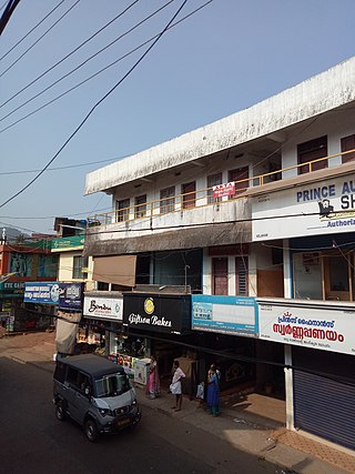
Navaikulam is a panchayat in Varkala Taluk of Thiruvananthapuram district in the state of Kerala, India. It is situated 11km east of Varkala town and 37km north of Trivandrum City along NH66.
Kelakam is a small town and Grama Panchayat located in the south eastern part of Kannur district in Kerala state, India.

Pulingome is a village in Kannur District of Kerala state, India.
Kadannapalli is a census town in Kannur district of Kerala state, India.

Kanichar is a village and Grama Panchayat in Kannur district in the Indian state of Kerala.

Karivellur is a census town and Gram Panchayat in Kannur district of Kerala state, India.

Manathana is a village in Peravoor Grama Panchayat of Kannur district, Kerala, India.
Bayar is a village in Kasaragod district in the state of Kerala, India. Bayar is 12 km (7.5 mi) far from the Uppala town.
Karakulam is a panchayat in Nedumangad Taluk in Tiruvananthapuram District in the state of Kerala, India. It is the most populated panchayat in the district according to 2011 census.
Maranalloor is a village in Thiruvananthapuram district in the state of Kerala, India.

Ottasekharamangalam is a village in Thiruvananthapuram district in the state of Kerala, India.
Vamanapuram is a village in Thiruvananthapuram district in the state of Kerala, India. It is the location of Shri 'Vamana', one of the ten incarnations of Maha Vishnu. The Lord Vamana temple is located here, and hence the name Vamanapuram, meaning 'the city of the lord Vamana'.
Vattappara is a village in Thiruvananthapuram district in the state of Kerala, India. , well known for its geographical peculiarities with quarries that are generally used for extracting building materials (rock).This town is by the side of MC Road connecting Trivandrum and Kottayam and 14 km away from Trivandrum City. The nearest township is Nedumangad.There is no recorded history on the origin of this place. The major occupation in Vattappara is farming(Rubber, Coconut).
Thirunattalam, also called Nattalam, is a Panchayat town in Kanyakumari district in the Indian State of Tamil Nadu. It is located 4 km (2.5 mi) from Marthandam, 6 km (3.7 mi) from Karungal and 10 km (6.2 mi) from Thuckalay.
Muttom road Eraniel is a place near Eraniel in Kanyakumari district in the state of Tamil Nadu, India.


