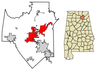
Thompson's Station, Tennessee | |
---|---|
Coordinates: 35°47′55″N86°54′26″W / 35.79861°N 86.90722°W | |
Country | United States |
State | Tennessee |
County | Williamson |
Settled | 1780 [1] |
Incorporated | 1990 [2] |
Named for | Dr. Elijah Thompson, early settler [1] |
Government | |
• Mayor | Brian Stover |
Area | |
• Total | 22.81 sq mi (59.06 km2) |
• Land | 22.79 sq mi (59.03 km2) |
• Water | 0.01 sq mi (0.03 km2) |
Elevation | 801 ft (244 m) |
Population | |
• Total | 7,485 |
• Density | 328.40/sq mi (126.80/km2) |
Time zone | UTC-6 (Central (CST)) |
• Summer (DST) | UTC-5 (CDT) |
ZIP code | 37179 |
Area code | 615 |
FIPS code | 47-73900 [5] |
GNIS feature ID | 1652469 [6] |
Website | thompsons-station.com |
Thompson's Station is a town in Williamson County, Tennessee. The population has grown from 2,194 at the 2010 Census to 7,485 in the 2020 Census. [7] Locations in Thompson's Station listed on the U.S. National Register of Historic Places include the Jacob Critz House and the Thomas L. Critz House, Thompson's Station Bank, John Neely House, James P. Johnson House, Homestead Manor and James Giddens House.
The first settlers arrived in what is now Thompson's Station in the late 18th century. The community was originally known as "White House," but changed its name to "Littlebury" in 1836. [1] After the arrival of the railroad in 1855, Dr. Elijah Thompson donated land for a town and train station, and the community was renamed for him. [1]
On March 5, 1863, during the Civil War, the Battle of Thompson's Station was fought, with Confederate forces led by General Earl Van Dorn defeating Union forces under Colonel John Coburn. [1]
Thompson's Station is located at 35°47′55″N86°54′26″W / 35.79861°N 86.90722°W (35.798670, -86.907341). [8] It is approximately 25 miles (40 km) south of Nashville, just south of Franklin, and just north of Spring Hill.
The Town includes several parks that encompass over 200 acres (81 ha): [9]
According to the United States Census Bureau, the town has a total area of 21.6 square miles (56 km2).
The community voted to incorporate in August 1990 with resident David Lee Coleman chosen as the first mayor. The community elects four at-large aldermen and a mayor who meet monthly at Board of Mayor and Aldermen meetings. Two aldermen are elected every two years with the mayoral election every four years. [10]
In early 2015, the Town embarked on a city planning process to update the zoning regulations. After gathering public input, the Town worked with planning consultants to create the Land Development Ordinance that went on to receive the Driehaus Award's Honorable Mention for form-based code in 2016. [11]
Census | Pop. | Note | %± |
---|---|---|---|
1880 | 135 | — | |
2000 | 1,283 | — | |
2010 | 2,194 | 71.0% | |
2020 | 7,485 | 241.2% | |
Sources: [12] [13] 2020 [7] [4] |
Race | Number | Percentage |
---|---|---|
White (non-Hispanic) | 6,438 | 86.01% |
Black or African American (non-Hispanic) | 191 | 2.55% |
Native American | 15 | 0.2% |
Asian | 126 | 1.68% |
Pacific Islander | 5 | 0.07% |
Other/Mixed | 313 | 4.18% |
Hispanic or Latino | 397 | 5.3% |
As of the 2020 United States census, there were 7,485 people, 1,911 households, and 1,468 families residing in the town.
As of the census [5] of 2000, there were 1,283 people, 447 households, and 375 families residing in the town. The population density was 87.2 inhabitants per square mile (33.7/km2). There were 473 housing units at an average density of 32.2 per square mile (12.4/km2). The racial makeup of the town was 91.19% White, 7.01% African American, 0.16% Native American, 0.55% Asian, 0.62% from other races, and 0.47% from two or more races. Hispanic or Latino of any race were 2.57% of the population.
There were 447 households, out of which 40.0% had children under the age of 18 living with them, 75.2% were married couples living together, 6.9% had a female householder with no husband present, and 15.9% were non-families. 14.1% of all households were made up of individuals, and 4.7% had someone living alone who was 65 years of age or older. The average household size was 2.87 and the average family size was 3.17.
In the town, the population was spread out, with 26.8% under the age of 18, 6.3% from 18 to 24, 31.0% from 25 to 44, 26.8% from 45 to 64, and 9.0% who were 65 years of age or older. The median age was 38 years. For every 100 females, there were 102.4 males. For every 100 females age 18 and over, there were 96.4 males.
The median income for a household in the town was $66,875, and the median income for a family was $70,568. Males had a median income of $50,337 versus $31,528 for females. The per capita income for the town was $24,143. About 4.1% of families and 4.4% of the population were below the poverty line, including 5.3% of those under age 18 and 12.6% of those age 65 or over.
A special census was taken by the Town in November 2013, and the new census of 2,681 residents was certified by the State of Tennessee on June 30, 2014. No demographic data was obtained in this census. Due to quick growth, another special census was taken in October 2016 with a newly certified population of 4,726. [15]
The 2020 Federal Census population results for Thompson's Station show the Town has grown to 7,485 residents.
Thompson's Station has historically been a residential community, but growth in recent years has made the area more attractive to larger businesses. The Mars Regional Innovation Center was built off Columbia Pk and State Route 840 in late 2014. Several properties have been purchased as local event centers (Graystone Quarry/Homestead Manor). The FirstBank Amphitheater, a 7,500-seat outdoor concert venue, opened in August 2021. The Heritage Commons shopping center is also located in Thompson's Station, including a Kroger, Tractor Supply, Advance Auto Parts and Liberty Bank. Thompson CAT Machinery opened off Hwy 31 south of 840 in late 2020.
Spurring the growth are 3 large residential subdivisions: Bridgemore Village, Fields of Canterbury and Tollgate Village. There are several "pocket" subdivisions in Town as well: Littlebury, Allenwood, Station South, Arbor Lakes, etc.
Thompson's Station Public Schools are part of Williamson County Schools.
Schools located in Thompson's Station include:
Ashland is a town in Benton County, Mississippi, United States and the county seat. The population was 551 at the 2020 census, down from 569 at the 2010 census. Ashland was incorporated on March 8, 1871, and has a Mayor-Aldermen form of government. Mitch Carroll is the 28th mayor of Ashland.
Pearl is a city located in Rankin County, Mississippi, United States, on the east side of the Pearl River across from the state capital Jackson. The population was 27,115 as of the 2020 census. It is part of the Jackson Metropolitan Statistical Area.
Crestwood is a city in south St. Louis County, Missouri, United States, part of the Metropolitan Statistical Area known as Greater St. Louis. The population was 11,912 at the 2010 census.
Vinita Park is a city in St. Louis County, Missouri, United States, located just east of I-170 and south of St. Charles Rock Road. The population was 1,970 at the 2020 census.
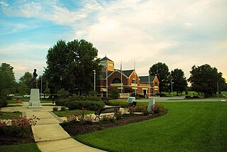
Marshfield is a city in Missouri and the county seat of Webster County, Missouri. As of the 2010 census, the city population was 6,633. As of the 2020 census, Marshfield had a population of 7,458. It is part of the Springfield, Missouri, metropolitan area.
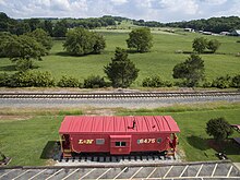
Park City is a census-designated place (CDP) in Stillwater County, Montana, United States. The population was 870 at the 2000 census.
Eureka is a town in Lincoln County, Montana, United States, 9 miles (14 km) south of the Canada–US border. The population was 1,380 at the 2020 census.
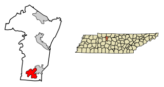
Pleasant View is a city on the northern border of Cheatham County. Located in Middle Tennessee, it is part of the Nashville-Davidson–Murfreesboro–Franklin, TN Metropolitan Statistical Area. As of the 2020 census, the city's population was 4,807.
New Tazewell is a city in Claiborne County, Tennessee, United States. The population was 3,037 at the 2010 census.The population was 2,769 at the 2020 census.
Huntland is a town in Franklin County, Tennessee, United States. The population was 872 at the 2010 census and 886 at the 2020 census. It is part of the Tullahoma, Tennessee Micropolitan Statistical Area.
Centerville is a town in Hickman County, Tennessee, United States. The population was 3,489 as of the 2020 Census. It is the county seat and the only incorporated town in Hickman County. It is best known for being the hometown of American comedian Minnie Pearl.
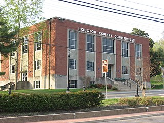
Springfield is the county seat of Robertson County, Tennessee, United States. It is located in Middle Tennessee near the northern border of the state. As of the 2020 census, the city's population was 18,782.
Germantown is a city in Shelby County, Tennessee, United States. The population was 41,333 at the 2020 census.
Gordonsville is a town in Smith County, Tennessee, United States. The population was 1,213 at the 2010 census.
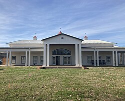
Nolensville is a town in Williamson County, Tennessee. Its population was 13,829 at the 2020 census. It was established in 1797 by William Nolen, a veteran of the American Revolutionary War. Located in Middle Tennessee, it is about 22 miles southeast of Nashville. The town was reincorporated in 1996.
Honey Grove is a city in Fannin County, Texas, United States. Honey Grove bills itself as "The Sweetest Town in Texas". The population was 1,668 at the 2010 census.
Iron Gate is a town in eastern Alleghany County, Virginia, United States. The population was 324 at the 2020 census. The town is located along U.S. Route 220, near Clifton Forge.
Adamsville is a town in Hardin and McNairy counties, Tennessee, United States. The population was 2,207 at the 2010 census. Adamsville is named after George D. Adams, who operated an inn and stagecoach stop in the 1840s. Adamsville's nickname is the "Biggest Little Town in Tennessee" and was the home of Sheriff Buford Pusser.
Farragut is a suburban town located in Knox and Loudon counties in the State of Tennessee, United States. The town's population was 23,506 at the 2020 census. It is included in the Knoxville Metropolitan Area. The town is named in honor of Union Admiral David Farragut, who was born just east of Farragut at Campbell's Station in 1801, and fought in the American Civil War.
Spring Hill is a city in Maury and Williamson counties in the U.S. state of Tennessee, located approximately 30 miles (48 km) south of Nashville. Its population as of 2022 is 55,800. Spring Hill is recognized as the 4th fastest growing city in Tennessee by the U.S. Census Bureau and is included in the Nashville metropolitan area.