
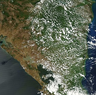
Central America is a subregion of the Americas. Its political boundaries are defined as bordering Mexico to the north, Colombia to the south, the Caribbean Sea to the east, and the Pacific Ocean to the west. Central America is usually defined as consisting of seven countries: Belize, Costa Rica, El Salvador, Guatemala, Honduras, Nicaragua, and Panama. Within Central America is the Mesoamerican biodiversity hotspot, which extends from northern Guatemala to central Panama. Due to the presence of several active geologic faults and the Central America Volcanic Arc, there is a high amount of seismic activity in the region, such as volcanic eruptions and earthquakes, which has resulted in death, injury, and property damage.

El Salvador is a country in Central America. Situated at the meeting point of three tectonic plates, it is highly seismologically active and the location of numerous earthquakes and volcanic eruptions. The country has a tropical climate.

Honduras is a country in Central America. Honduras borders the Caribbean Sea and the North Pacific Ocean. Guatemala lies to the west, Nicaragua south east and El Salvador to the south west. Honduras is the second largest Central American republic, with a total area of 112,890 square kilometres (43,590 sq mi).
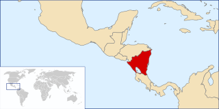
Nicaragua is a country in Central America, bordering both the Caribbean Sea and the North Pacific Ocean, between Costa Rica and Honduras. Nicaragua is the largest country in Central America in square kilometers.
The Football War, also known as the Soccer War or the Hundred Hours' War, was a brief military conflict fought between El Salvador and Honduras in 1969. Existing tensions between the two countries coincided with rioting during a 1970 FIFA World Cup qualifier. The war began on 14 July 1969 when the Salvadoran military launched an attack against Honduras. The Organization of American States (OAS) negotiated a cease-fire on the night of 18 July, which took full effect on 20 July. Salvadoran troops were withdrawn in early August. The war had major consequences for both countries and was a major factor in starting the Salvadoran Civil War a decade later.

Serranilla Bank is a partially submerged reef, with small uninhabited islets, in the western Caribbean Sea. It is situated about 350 kilometres (220 mi) northeast of Punta Gorda, Nicaragua, and roughly 280 kilometres (170 mi) southwest of Jamaica. The closest neighbouring land feature is Bajo Nuevo Bank, located 110 kilometres (68 mi) to the east.
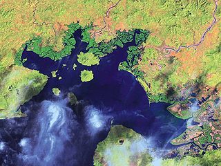
The Gulf of Fonseca, a part of the Pacific Ocean, is a gulf in Central America, bordering El Salvador, Honduras, and Nicaragua.

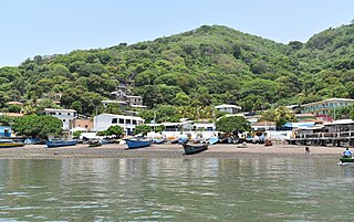
Amapala is a municipality in the Honduran department of Valle.
Meanguera del Golfo is a municipality in the La Unión department of El Salvador. It is located 30 kilometres (19 mi) from department of La Unión and 213 km (132 mi) from San Salvador on the island of Meanguera in the Gulf of Fonseca. It has an area of 23.6 km2 (9.1 sq mi) with a population of 2,398 inhabitants (2007).
Conejo Island, in Spanish Isla Conejo, meaning "rabbit island", is a Honduran Island alongside many other islands in the region. El Salvador has disputed the Honduran island located in the Gulf of Fonseca.
Territorial disputes of Nicaragua include the territorial dispute with Colombia over the Archipelago of San Andrés, Providencia and Santa Catalina and Quita Sueño Bank. Nicaragua also has a maritime boundary dispute with Honduras in the Caribbean Sea and a boundary dispute over the Rio San Juan with Costa Rica.
The following is an alphabetical list of topics related to Nicaragua.
The Central America bioregion is a biogeographic region comprising southern Mexico and Central America.

The following outline is provided as an overview of and topical guide to Honduras:
This is an index of Central America-related articles. This index defines Central America as the seven nations of Belize, Costa Rica, El Salvador, Guatemala, Honduras, Nicaragua, and Panama.

The following is an alphabetical list of topics related to the Republic of Honduras.

El Salvador became independent from Spain in 1821. It has produced its own stamps since 1867.

The El Salvador–Honduras border is a continuous line of 256 km long, separating the east and the north of El Salvador from the territory of Honduras. There are two excerpts:
