Kolpashevo is a town and the administrative center of Kolpashevsky District in Tomsk Oblast, Russia, located on the Ob River. Population: 24,124 (2010 Census); 28,441 (2002 Census); 31,319 (1989 Census).
Asino is a town and the administrative center of Asinovsky District in Tomsk Oblast, Russia. Population: 25,618 (2010 Census); 28,068 (2002 Census); 33,471 (1989 Census). It was previously known as Kseniyevsky.

Kedrovy is a town in Tomsk Oblast, Russia, situated in the valley of the Chusik River. Population: 2,451 (2010 Census); 3,052 ; 1,998 (1989 Census).
Strezhevoy is a town in Tomsk Oblast, Russia, located on the shores of the Ob River's canal. Population: 42,219 (2010 Census); 43,815 (2002 Census); 43,348 (1989 Census).

Alexandrovsky District is an administrative and municipal district (raion), one of the sixteen in Tomsk Oblast, Russia. It is located in the northwest of the oblast and borders with the territory of Strezhevoy Town Under Oblast Jurisdiction, with Kargasoksky District, and with Khanty–Mansi Autonomous Okrug. The area of the district is 30,160 square kilometers (11,640 sq mi).} Its administrative center is the rural locality of Alexandrovskoye. Population: 8,686 ; 10,136 (2002 Census); 11,356 (1989 Census)—the second least populated in Tomsk Oblast. The population of Alexandrovskoye accounts for 83.0% of the district's total population.

Kargasoksky District is an administrative and municipal district (raion), one of the sixteen in Tomsk Oblast, Russia. It is located in the northern, western, and southwestern parts of the oblast. The area of the district is 86,900 square kilometers (33,600 sq mi). Its administrative center is the rural locality of Kargasok. Population: 21,814 ; 24,756 (2002 Census); 28,651 (1989 Census). The population of Kargasok accounts for 37.3% of the district's total population.

Asinovsky District is an administrative and municipal district (raion), one of the sixteen in Tomsk Oblast, Russia. It is located in the southeast of the oblast. The area of the district is 5,943.3 square kilometers (2,294.7 sq mi). Its administrative center is the town of Asino. Population: 36,459 ; 12,911 (2002 Census); 16,222 (1989 Census). The population of Asino accounts for 70.3% of the district's total population.

Bakcharsky District is an administrative and municipal district (raion), one of the sixteen in Tomsk Oblast, Russia. It is located in the south of the oblast. The area of the district is 24,700 square kilometers (9,500 sq mi). Its administrative center is the rural locality of Bakchar. Population: 13,419 ; 15,963 (2002 Census); 17,879 (1989 Census). The population of Bakchar accounts for 45.7% of the district's total population.

Chainsky District is an administrative and municipal district (raion), one of the sixteen in Tomsk Oblast, Russia. It is located in the center of the oblast. The area of the district is 7,242 square kilometers (2,796 sq mi). Its administrative center is the rural locality of Podgornoye. Population: 12,920 ; 13,888 (2002 Census); 17,325 (1989 Census). The population of Podgornoye accounts for 38.6% of the district's total population.
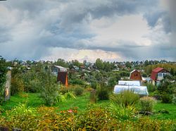
Kolpashevsky District is an administrative and municipal district (raion), one of the sixteen in Tomsk Oblast, Russia. It is located in the center of the oblast. The area of the district is 17,112 square kilometers (6,607 sq mi). Its administrative center is the town of Kolpashevo. Population: 41,183 ; 19,723 (2002 Census); 22,689 (1989 Census). The population of Kolpashevo accounts for 58.6% of the district's total population.

Kozhevnikovsky District is an administrative and municipal district (raion), one of the sixteen in Tomsk Oblast, Russia. It is located in the southeast of the oblast. The area of the district is 3,907.5 square kilometers (1,508.7 sq mi). Its administrative center is the rural locality of Kozhevnikovo. Population: 20,967 ; 22,582 (2002 Census); 24,535 (1989 Census). The population of Kozhevnikovo accounts for 39.0% of the district's total population.

Krivosheinsky District is an administrative and municipal district (raion), one of the sixteen in Tomsk Oblast, Russia. It is located in the southeastern central part of the oblast. The area of the district is 4,380 square kilometers (1,690 sq mi). Its administrative center is the rural locality of Krivosheino. Population: 13,285 ; 15,848 (2002 Census); 19,332 (1989 Census). The population of Krivosheino accounts for 41.2% of the district's total population.

Molchanovsky District is an administrative and municipal district (raion), one of the sixteen in Tomsk Oblast, Russia. It is located in the eastern central part of the oblast. The area of the district is 6,351.2 square kilometers (2,452.2 sq mi). Its administrative center is the rural locality of Molchanovo. Population: 13,446 ; 15,591 (2002 Census); 19,217 (1989 Census). The population of Molchanovo accounts for 42.7% of the district's total population.

Parabelsky District is an administrative and municipal district (raion), one of the sixteen in Tomsk Oblast, Russia. It is located in the northern, central, and southwestern parts of the oblast. The area of the district is 35,846.69 square kilometers (13,840.48 sq mi). Its administrative center is the rural locality of Parabel. Population: 12,595 ; 13,533 (2002 Census); 16,033 (1989 Census). The population of Parabel accounts for 48.4% of the district's total population.

Pervomaysky District is an administrative and municipal district (raion), one of the sixteen in Tomsk Oblast, Russia. It is located in the east of the oblast. The area of the district is 15,554.18 square kilometers (6,005.50 sq mi). Its administrative center is the rural locality of Pervomayskoye. Population: 18,947 ; 21,260 (2002 Census); 23,350 (1989 Census). The population of Pervomayskoye accounts for 29.8% of the district's total population.

Shegarsky District is an administrative and municipal district (raion), one of the sixteen in Tomsk Oblast, Russia. It is located in the southeast of the oblast. The area of the district is 5,029.54 square kilometers (1,941.92 sq mi). Its administrative center is the rural locality of Melnikovo. Population: 20,306 ; 22,551 (2002 Census); 24,129 (1989 Census). The population of Melnikovo accounts for 41.3% of the district's total population.
Teguldetsky District is an administrative and municipal district (raion), one of the sixteen in Tomsk Oblast, Russia. It is located in the east of the oblast and borders Verkhneketsky District in the north, Krasnoyarsk Krai in the east, Kemerovo Oblast in the south, and Zyryansky and Pervomaysky Districts in the west. The area of the district is 12,271.1 square kilometers (4,737.9 sq mi). Its administrative center is the rural locality of Teguldet. As of the 2010 Census, the total population of the district was 6,937, with the population of Teguldet accounting for 63.2% of that number.
Verkhneketsky District is an administrative and municipal district (raion), one of the sixteen in Tomsk Oblast, Russia. It is located in the northeast of the oblast. The area of the district is 43,348.9 square kilometers (16,737.1 sq mi). Its administrative center is the urban locality of Bely Yar. Population: 17,052 ; 18,300 (2002 Census); 25,127 (1989 Census). The population of Bely Yar accounts for 46.9% of the district's total population.
Zyryansky District is an administrative and municipal district (raion), one of the sixteen in Tomsk Oblast, Russia. It is located in the east of the oblast. The area of the district is 3,966 square kilometers (1,531 sq mi). Its administrative center is the rural locality of Zyryanskoye. Population: 13,179 ; 16,052 (2002 Census); 18,549 (1989 Census). The population of Zyryanskoye accounts for 42.7% of the district's total population.
Novaya Usman is a rural locality and the administrative center of Novousmansky District of Voronezh Oblast, Russia. Population: 29,270 (2010 Census); 22,476 (2002 Census); 18,223 (1989 Census).