
The Arctic Archipelago, also known as the Canadian Arctic Archipelago, is an archipelago lying to the north of the Canadian continental mainland, excluding Greenland and Iceland.

Brabus GmbH is a German high-performance automotive aftermarket tuning company founded in 1977 in Bottrop. Brabus specialises mainly in Mercedes-Benz, Maybach and Smart vehicles. They have also modified other vehicles too, including Porsche.

The Rolls-Royce Eagle was the first aircraft engine to be developed by Rolls-Royce Limited. Introduced in 1915 to meet British military requirements during World War I, it was used to power the Handley Page Type O bombers and a number of other military aircraft.
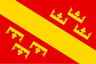
Oberelsaß was the southern part of the historical region Alsace or Elsass, inhabited originally by locals speaking Alemannic German. From 1871 to 1918, Bezirk Oberelsaß was a region (Bezirk) in the southern part of the province of Elsaß-Lothringen in the German Empire. The region corresponds exactly to the current French department of Haut-Rhin. Its capital was Colmar. It was divided into the districts (Kreise) of:
German submarine U-1235 was a Type IXC/40 U-boat of Nazi Germany's Kriegsmarine during World War II. The submarine was laid down on 25 May 1943 at the Deutsche Werft yard at Hamburg, launched on 25 January 1944, and commissioned on 17 May 1944. She served with 31st U-boat Flotilla, a training unit, and with 33rd U-boat Flotilla from 1 December 1944 until 15 April 1945.
Drummond is a former provincial electoral riding in the Centre-du-Québec region of Quebec, Canada, which elected members to the National Assembly of Quebec. As of its final election, it consisted of most of the city of Drummondville and all of Saint-Edmond-de-Grantham, Saint-Eugène, Saint-Germain-de-Grantham and Saint-Majorique-de-Grantham.

Cilleruelo de Arriba is a municipality located in the province of Burgos, Castile and León, Spain. According to the 2004 census (INE), the municipality has a population of 72 inhabitants.

Tyholland, also known as Tehallan, is a small parish in County Monaghan, Ireland. It is the smallest parish in County Monaghan and borders County Armagh, Northern Ireland. For a period it was united with Donagh parish and later still with Monaghan parish. Since 1826 it has been once again a parish in its own right.
The Mariner Glacier is a major glacier over 60 nautical miles long, descending southeast from the plateau of Victoria Land, Antarctica, between Mountaineer Range and Malta Plateau, and terminating at Lady Newnes Bay, Ross Sea, where it forms the floating Mariner Glacier Tongue.
This is a list of the extreme points and extreme elevations in Scotland.
Maununneva (Finnish), Magnuskärr (Swedish) is a neighborhood of Helsinki, Finland. It is a subdivision of the Kaarela district in Helsinki.
Yankovtsi is a village in Gabrovo Municipality, in Gabrovo Province, in northern central Bulgaria.
Đerekari is a village in the municipality of Brus, Serbia. According to the 2002 census, the village has a population of 23 people.
Pozderčići is a village in the municipality of Višegrad, Bosnia and Herzegovina.
Planet Heights is a series of summits running along an ice-free ridge, extending 24 nautical miles (44 km) in a north-south direction between the southernmost extremity of the LeMay Range and George VI Sound in the east part of Alexander Island, Antarctica. Many landforms and nearby features are named in association with this mountain range; some of these include landforms named after astronomers, satellites, planets and other things related to astrology and astrophysics. The mountain range was first mapped from air photos taken by the Ronne Antarctic Research Expedition (RARE), 1947–48, by Searle of the Falkland Islands Dependencies Survey (FIDS) in 1960. Named by the United Kingdom Antarctic Place-Names Committee (UK-APC) from association with the nearby glaciers named for planets of the Solar System. The only planet that is not featured in any of these glaciers is the planet Earth, as there are no glaciers named "Earth Glacier" and this glacier does not exist.
Arensky Glacier is an Antarctic glacier, lying 3 miles (5 km) east of Alyabiev Glacier and flows south from Beethoven Peninsula, Alexander Island, into the north end of Boccherini Inlet. The glacier was named by the USSR Academy of Sciences in 1987, after Anton Arensky, the Russian composer.

The north magnetic pole, also known as the magnetic north pole, is a point on the surface of Earth's Northern Hemisphere at which the planet's magnetic field points vertically downward. There is only one location where this occurs, near the geographic north pole. The geomagnetic north pole is the northern antipodal pole of an ideal dipole model of the Earth's magnetic field, which is the most closely fitting model of Earth's actual magnetic field.
This page is based on this
Wikipedia article Text is available under the
CC BY-SA 4.0 license; additional terms may apply.
Images, videos and audio are available under their respective licenses.


