The Arctic Archipelago, also known as the Canadian Arctic Archipelago, is an archipelago lying to the north of the Canadian continental mainland, excluding Greenland and Iceland.

Sabana Grande is a town and municipality of Puerto Rico located north of Lajas and Guánica; south of Maricao; east of San Germán; and west of Yauco. Sabana Grande is spread over seven barrios and Sabana Grande Pueblo. It is part of the San Germán-Cabo Rojo Metropolitan Statistical Area.

Comendador is the capital of the Elías Piña province of the Dominican Republic. It has a border crossing to the Haitian town Belladère.

Río Piedras is a populous district of San Juan, and former town and municipality of Puerto Rico, which was merged with the municipality of San Juan in 1951. The district today is composed of various barrios such as Pueblo and Universidad. The historic town was founded in 1714 as El Roble, it was given municipality rights in 1823, and since 1903 it has been the home of the University of Puerto Rico's main campus, earning the popular name of Ciudad Universitaria today. The downtown and historic center of Río Piedras is officially known as the Pueblo barrio of the municipality of San Juan.
Sabana Grande de Palenque is a municipality (municipio) of the San Cristóbal province in the Dominican Republic.

Río de Oro is a town and municipality in the Colombian Department of Cesar.

Sabanas de San Ángel, Spanish for Savannas of Saint Angel, is a town and municipality of the Colombian Department of Magdalena. Founded around 1607 with the name San Antoñito by the Spanish Colonizers as a pathway town in the route between La Guajira Department and the Magdalena River. On June 24, 1999 the municipality is created with the name of Sabanas de San Angel that segregated from the municipalities of Ariguaní, Pivijay, Chibolo and Plato.

Soracá is a town and municipality in the Colombian Department of Boyacá, part of the subregion of the Central Boyacá Province. Soracá borders the municipalities of Chivatá in the north, Siachoque, Viracacha and Ramiriquí in the east, Boyacá in the south and the department capital Tunja in the west.

Turmequé is a town and municipality in the Colombian Department of Boyacá, part of the subregion of the Márquez Province. Turmequé is located at 105 kilometres (65 mi) northeast from the capital Bogotá. The municipality borders Ventaquemada in the west, in the east Úmbita, in the north Nuevo Colón and in the south the municipality Villapinzón of the department of Cundinamarca.

Nemocón is a municipality and town of Colombia in the Central Savanna Province, part of the department of Cundinamarca. Nemocón, famous for its salt mine, was an important village in the Muisca Confederation, the country in the central Colombian Andes before the arrival of the Spanish. The municipality is situated in the northern part of the Bogotá savanna, part of the Altiplano Cundiboyacense with its urban centre at an altitude of 2,585 metres (8,481 ft) and 65 kilometres (40 mi) from the capital Bogotá. Nemocón is the northeasternmost municipality of the Metropolitan Area of Bogotá and the Bogotá River originates close to Nemocón. The median temperature of Nemocón is 12.8 °C. The municipality borders Tausa in the north, Suesca and Gachancipá in the east, Tocancipá and Zipaquirá in the south and in the west the rivers Checua and Neusa and the municipality of Cogua.

Cevico de la Torre is a Spanish municipality belonging to the province of Palencia, in the northern part of the autonomous community of Castile and León.

Valencia de las Torres is a municipality located in the province of Badajoz, Extremadura, Spain. According to the 2005 census (INE), the municipality has a population of 724 inhabitants.

Caldearenas is a municipality located in the province of Huesca, Aragon, Spain. According to the 2004 census (INE), the municipality has a population of 270 inhabitants.
Villa Riva is a municipality (municipio) of the Duarte Province in the Dominican Republic.

Cova-Paul-Ribeira da Torre Natural Park, in the east of the island of Santo Antão, is one of ten "natural parks" in the country of Cape Verde. Its area is 20.92 km2 (8.08 sq mi), of which 8.91 km2 (3.44 sq mi) in the municipality of Ribeira Grande, 8.85 km2 (3.42 sq mi) in the municipality of Paul and 3.16 km2 (1.22 sq mi) in the municipality of Porto Novo. Since 2016, the natural park is on the tentative list of World Heritage Sites.
The Soacha River is a river on the Bogotá savanna and a left tributary of the Bogotá River.
The Río Frío is a river on the Bogotá savanna and a right tributary of the Bogotá River. The river, in a basin of 6,008.69 hectares (23.1997 sq mi), originates on the Páramo de Guerrero in Zipaquirá at an altitude of 3,700 metres (12,100 ft). It flows through the municipalities Tabio and Cajicá and into the Bogotá River in the south of Chía, at 2,650 metres (8,690 ft) above sea level.
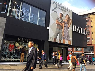
The Boulevard of Sabana Grande is an important leisure and shopping area located in eastern Caracas in the geographic center of the Metropolitan District of Caracas. It is a pedestrian-only, tree-shaded public space. In 2011, the boulevard of Sabana Grande went through a rehabilitation process founded by PDVSA La Estancia. A commercial and financial district, Sabana Grande is the commercial corridor, and a tourist district of Caracas. The boulevard of Sabana Grande is home to the most important ornithological collection in Latin America, the William Phelps Ornithological Collection. Until the beginning of the 20th century, it was called Calle Real because it was the town's main road.

La Torre-La Janera megalithic site is located in the municipalities of Ayamonte and Villablanca in the province of Huelva, Andalusia. It was discovered when in 2018 a farmer intended to prepare the land to cultivate avocados and in view of the archaeological potential of the site the local council demanded a survey to be made. It is considered to be one of the largest megalithic site in Europe with over 500 standing stones.