
The Arctic Archipelago, also known as the Canadian Arctic Archipelago, is an archipelago lying to the north of the Canadian continental mainland, excluding Greenland.
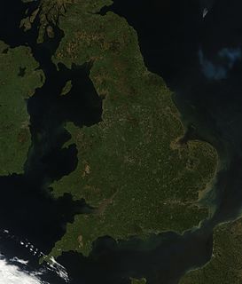
England comprises most of the central and southern two-thirds of the island of Great Britain, in addition to a number of small islands of which the largest is the Isle of Wight. England is bordered to the north by Scotland and to the west by Wales. It is closer to continental Europe than any other part of mainland Britain, divided from France only by a 33 km (21 mi) sea gap, the English Channel. The 50 km (31 mi) Channel Tunnel, near Folkestone, directly links England to mainland Europe. The English/French border is halfway along the tunnel.

Banha is the capital of the Qalyubiyya Governorate in north-eastern Egypt. Between the capital of Cairo and the city of Tanta, Banha is an important transport hub, as rail lines from Cairo to various cities in the Nile Delta pass through it. Banha was founded as a city in 1850.

La Jagua de Ibirico is a town and municipality in the Department of Cesar, Colombia. This region of La Jagua is rich in coal which is exploited extensively and is second only to El Cerrejon in La Guajira. The area is also known for being a hot spot in the Colombian conflict.
Aguada is a town and municipality in the Vélez Province of the Santander Department in northeastern Colombia. Aguada is located in the vicinity of the Opón River at an altitude of 1,700 metres (5,600 ft). It borders El Guacamayo in the north, San Benito in the south, Suaita in the east and La Paz in the west.
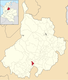
Ocamonte is a town and municipality in the Santander Department in northeastern Colombia.

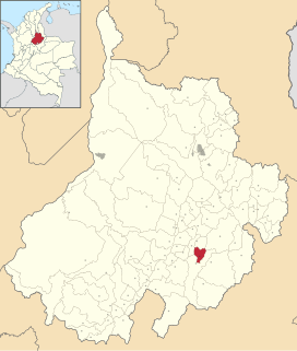
Simacota is a town and municipality in the Santander Department in northeastern Colombia. In 1965, the city had briefly been invaded by more than 100 members of the anti-government Ejército de Liberación Nacional (ELN), the "National Liberation Army") and "captured the public imagination" in its first act as a new guerrilla organization. The invaders murdered three of Simacota's four policemen, robbed the local bank, harassed the townspeople and looted the local pharmacy of its medicines, before being driven out by the Colombian Army. Only three of the 100 ELN men were captured.

El Cantón de San Pablo is a municipality and town in the Chocó Department, Colombia.

El Calvario is a town and municipality in the Meta Department, Colombia. It was the epicenter of the 2008 Colombia earthquake.

Fuentes de Andalucía is a city located in the province of Seville, Spain. According to the 2012 census (INE), the city has a population of 7315 inhabitants.

Castropodame is a village and municipality located in the region of El Bierzo. According to the 2010 census (INE), the municipality has a population of 1,812 inhabitants.

El Pego is a municipality located in the province of Zamora, Castile and León, Spain. According to the 2004 census (INE), the municipality has a population of 413 inhabitants.

Hato is a town and municipality in the Santander Department in northeastern Colombia.
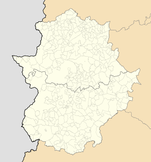
Atalaya is a Spanish municipality in the province of Badajoz, Extremadura. It has a population of 339 (2007) and an area of 22.7 km².
Zapotitlán Municipality is a municipality in Puebla in south-eastern Mexico.
Matlapa is a town and municipality in San Luis Potosí in central Mexico.
Giesecke Glacier is a glacier in the Qaasuitsup municipality in northwestern Greenland. Its outflow is split in the center by a nunatak. Through two tongues it drains the Greenland ice sheet westwards into Kangerlussuaq Icefjord. The northern tongue reaches the fjord at 73°35′N55°36′W. The southern tongue reaches the fjord at 73°30′N55°28′W.

German submarine U-1271 was a Type VIIC/41 U-boat of Nazi Germany's Kriegsmarine during World War II.

