Town and Country, Washington

Last updated

Town and Country, Washington
CDP
5MileEastView.png
Town and Country from Five Mile Prairie looking southeast
Spokane County Washington Incorporated and Unincorporated areas Town and Country Highlighted.svg
Location of Town and Country, Washington
Coordinates: 47°43′17″N117°25′17″W / 47.72139°N 117.42139°W / 47.72139; -117.42139 Coordinates: 47°43′17″N117°25′17″W / 47.72139°N 117.42139°W / 47.72139; -117.42139
CountryUnited States
State Washington
County Spokane
Area
  Total1.2 sq mi (3 km2)
  Land1.2 sq mi (3 km2)
  Water0.0 sq mi (0 km2)
Elevation
2,060 ft (628 m)
Population
 (2020)
  Total5,068
  Density4,223.3/sq mi (1,630.6/km2)
Time zone UTC-8 (Pacific (PST))
  Summer (DST) UTC-7 (PDT)
FIPS code 53-72170 [1]
GNIS feature ID1867638 [2]

Town and Country (often referred to locally as 'Lynwood') is a census-designated place (CDP) in Spokane County, Washington, United States. The population was 5,068 at the 2020 census.

Contents

Geography

Linwood Park showing the Five Mile Prairie bluff in the background. Linwood Park Spokane.png
Linwood Park showing the Five Mile Prairie bluff in the background.

Town and Country is located at 47°43′17″N117°25′17″W / 47.72139°N 117.42139°W / 47.72139; -117.42139 (47.721441, -117.421383). [3] According to the United States Census Bureau, the CDP has a total area of 1.2 square miles (3.6 km2), all of it land. [4]

The city of Spokane surrounds the CDP on three sides: the east, south and west. [5] The city's street grid continues into Town and Country uninterrupted in the east, though it breaks down in the west along the bluff leading up to Five Mile Prairie. The bulk of the CDP lies on flat ground like the surrounding north side of Spokane. Along the west, however, the terrain rises rapidly from Town and Country's elevation of roughly 2,000 feet to over 2,300 at the crest over less than 1,000 feet of distance in places. [6]

As is the case with the city of Spokane to the east and south, Town and Country blends into its neighbor to the north, the CDP of Country Homes, Washington, seamlessly. [6]

Francis Avenue, carrying Washington State Route 291, serves as Town and Country's southern border, beyond which lies the North Hill neighborhood. Cedar Road is the western border, beginning on the flatland and then climbing the bluff towards the crest and into Five Mile Prairie. Most of the northern border with Country Homes runs along Country Homes Boulevard. Division Street, carrying U.S. Route 2 was the eastern border until 2008, when the city of Spokane annexed some of Town and Country. Division is still the eastern border from Country Homes Boulevard south to Lincoln Road. South of Lincoln the border works its way around the Holy Cross Cemetery, which used to be part of Country Homes, before following Atlantic Street, which runs parallel to and one block to the west of Division, for the four southernmost blocks of the CDP. [5]

Most of Town and Country is zoned as low density residential, but there are commercial zones along Francis Avenue in the south and Division Street on the east. [7]

Demographics

As of the census [4] of 2020, there were 5,068 people and 2,109 households residing in the CDP, with an average of 2.56 persons per household. The population density was 4,223.3 people per square mile. The racial makeup of the CDP was 89.2% White, 1.3% African American, 0.1% Native American, 1.3% Asian, 0.0% Pacific Islander, and 7.4% from two or more races. Hispanic or Latino of any race were 6.9% of the population. [4]

In the CDP, the age distribution of the population showed 25.2% under the age of 18 and 16.1% who were 65 years of age or older. Females made up 51.4% of the population. Of those age 16 and above, 66.7% were in the workforce, with 57.3% of females age 16+ in the workforce. [4]

The median income for a household in the CDP was $66,911. The per capita income for the CDP was $28,608. 9.2% of the population were below the poverty line. Median value of owner-occupied homes was $212,300, with 75.0% of homes being owner-occupied. Median rent in the CDP was $1,143. [4]

Education

Town and Country is split between two school districts, with Spokane Public Schools serving the southern half of the CDP and the Mead School District serving the north. Linwood Elementary, part of Spokane Public Schools, is located in Town and Country. [8] [9] It feeds into Salk Middle School and then into Shadle Park High School. Evergreen Elementary, part of the Mead School District, is also located in Town and Country. It feeds into Highland Middle School and then into Mead High School. [10] [11]

Transportation

Highway

Country Homes Boulevard in Town and Country, showing the swale running through the road. Country Homes Boulevard.png
Country Homes Boulevard in Town and Country, showing the swale running through the road.

U.S. 2 passes north–south along the eastern boundary of Town and Country on Division Street. [6]

U.S. 395 passes north–south along the eastern boundary of Town and Country along Division Street. [6]

State Route 291 passes along the southern boundary of Town and Country on Francis Avenue. [6]

Surface streets

The three highways serving Town and Country all travel along surface streets and none are classified as limited-access in the area. Francis Avenue and Division Street are classified by the city of Spokane as major arterials, the city's highest classification for a surface street. While the city does not classify streets that lie entirely within Town and Country, it does consider the streets which connect to and serve as extensions of Country Homes Boulevard once it passes into the city limits to be major arterials as well. [12] Country Homes Boulevard links the Maple/Ash couplet in the southwest with Division Street at a major intersection known as "the Y" in the northeast, making it a major thoroughfare in the neighborhood. It carried 26,400 vehicles per day in 2018, making Country Homes Boulevard one of unincorporated Spokane County's busiest roadways. [13]

Dedicated bike lanes run on Wall Street, Country Homes Boulevard and Lincoln Road, and Cedar Road is classified as a shared roadway bike route. [14]

Public transit

Town and Country is served by the Spokane area's public transit provider, the Spokane Transit Authority, which runs four fixed-route bus lines through the CDP. The Country Homes Park & Ride is located across the street to the north of the CDP and the Five Mile Park & Ride is one block to the south of the CDP. [15]

RouteTerminiService operation and notesStreets traveled
4
Monroe
Downtown Spokane
STA Plaza
Balboa/South Indian Trail
Five Mile Park and Ride
High-frequency routeFrancis Avenue west of Monroe
25
Division
Downtown Spokane
STA Plaza
Fairwood
Hastings Park and Ride
High-frequency routeDivision Street
27
Hillyard
Downtown Spokane
STA Plaza
Balboa/South Indian Trail
Five Mile Park and Ride
Basic-frequency route; Downtown Spokane via Hillyard Francis Avenue
124
North Express
Downtown Spokane
STA Plaza
Fairwood
Hastings Park and Ride
Express route during peak weekday hoursMonroe Street

Related Research Articles

Country Homes, Washington CDP in Washington, United States

Country Homes is a census-designated place (CDP) in Spokane County, Washington, United States. The population was 5,841 at the 2010 census. The campus of Whitworth University is located in Country Homes.

Hillyard, Spokane Neighborhood of Spokane in Spokane County, Washington, United States

Hillyard is a neighborhood in Spokane, Washington which existed as a separate town between 1892 and 1924.

Neighborhoods in Spokane, Washington

Neighborhoods in Spokane, Washington are officially grouped by the Spokane City Council into three main city council districts: 1, 2, and 3. Each city council district contains multiple, official neighborhoods that are recognized with a neighborhood council. Informally, neighborhoods are colloquially grouped by local geographical, geological, cultural, or historical features The list of neighborhoods below is organized based on the official designations by the City of Spokane. Unofficial neighborhoods and districts are listed within the official neighborhood in which they are located.

Boulevard Park is a census-designated place (CDP) in King County, Washington, United States. The population was 5,287 at the 2010 census. Boulevard Park was part of the Riverton-Boulevard Park CDP in 2000 but was split for the 2010 census into its own CDP.

Sprague Avenue (Spokane, Washington)

Sprague Avenue is a major east–west street serving Spokane, Spokane Valley, and Liberty Lake, Washington, United States. It travels approximately 17 miles (27 km), extending from Downtown Spokane eastward through Spokane Valley as an arterial road, and continues on as a collector road to its eastern terminus in Liberty Lake.

Logan, Spokane Spokane Neighborhood in Washington, United States

Logan is a neighborhood in Spokane, Washington. It is located immediately northeast of Downtown Spokane and is home to Gonzaga University. The Spokane River runs along its eastern and southern edge. Due to its proximity to the city center, Logan is home to some of the oldest and densest areas in the city. It is known for its tree-lined streets, historic buildings and population of college students. In addition to numerous individual properties, there are two historic districts listed on the National Register of Historic Places located within Logan: the Desmet Avenue Warehouse Historic District and the Mission Avenue Historic District.

East Central, Spokane Spokane Neighborhood in Washington, United States

East Central is a neighborhood in Spokane, Washington. As the name suggests, it is on the east side of Spokane and centrally located. The official neighborhood is expansive and covers multiple areas considered by locals to be independent neighborhoods, such as the Sprague Union District on East Sprague Avenue, the South Perry District, the Underhill Park area and the University District on the eastern fringe of Downtown Spokane.

Rockwood, Spokane Spokane Neighborhood in Washington, United States

Rockwood is a neighborhood in Spokane, Washington. It is located on the south side of the city to the southeast of Downtown Spokane and expanding southeasterly from close to the city center. Its proximity to downtown makes it one of Spokane's older neighborhoods, with mature trees lining most of its streets. Due to its location on the hill leading up from the Spokane River Valley, the street grid breaks down in many places around Rockwood. The most notable of these is along the winding Rockwood Boulevard, which bends its way from the northwesternmost corner of the neighborhood through the center and across to the eastern border.

Manito/Cannon Hill, Spokane Neighborhood in Spokane, Washington, United States

Manito/Cannon Hill is a neighborhood on the South Hill of Spokane, Washington. It is named after the two public parks that dominate its setting: Manito Park and Cannon Hill Park. Manito/Cannon Hill is a predominantly residential neighborhood made up mostly by single-family homes and city park land.

Latah/Hangman, Spokane Spokane Neighborhood in Washington, United States

Latah/Hangman is a neighborhood in Spokane, Washington.

Emerson/Garfield, Spokane Spokane Neighborhood in Washington, United States

Emerson/Garfield is a neighborhood in Spokane, Washington. It is located immediately north of Downtown Spokane's North Bank and extends out into the inner northwestern portion of the city. Emerson/Garfield is a diverse neighborhood with residential, commercial and civic zones all bordering one another, with density ranging from single-family homes to multi-use buildings. Due to its location in the central area of Spokane, Emerson/Garfield is criss-crossed by numerous arterials and thoroughfares. Along those main roads are numerous commercial and retail districts of importance to both the neighborhood and city as a whole.

Lincoln Heights, Spokane Spokane Neighborhood in Washington, United States

Lincoln Heights is a neighborhood in Spokane, Washington. It is located in the southeastern portion of the city in a broader area commonly known as the South Hill. As the name suggests, Lincoln Heights lies on the slopes and atop the crest of the South Hill area. Lincoln Heights is home to a mix of single-family residential, multi-family residential, and commercial areas and a significant amount of park land. The Lincoln Heights Shopping Center and surrounding area is one of the largest and most important commercial and retail districts on the entire south side of Spokane.

Comstock, Spokane Spokane Neighborhood in Washington, United States

Comstock is a neighborhood in Spokane, Washington. It is located on the south side of the city in a broader area commonly known as the South Hill. The neighborhood is primarily single-family residential, and a mix of homes built during the streetcar era and then built during the post-World War II housing boom. The neighborhood is also home to a few commercial districts, including the regionally important Manito Shopping Center, two schools, the eponymous Comstock Park, sports fields and a golf course.

North Hill, Spokane Spokane Neighborhood in Washington, United States

North Hill is a neighborhood in Spokane, Washington. As the name suggests, it is atop a hill on the north side of Spokane, within which it is centrally located and crossed by numerous major thoroughfares. It is home to parks, commercial districts and single family residential areas. The historic Garland Theater is located in North Hill, and the city's main north–south arterial, Division Street, is home to a major commercial district along the eastern edge of the neighborhood.
West Hills, Spokane Spokane Neighborhood in Washington, United States

West Hills is a neighborhood in Spokane, Washington. As the name suggests, the neighborhood is located on hillsides to the west of downtown Spokane. The neighborhood also extends far to the west along the West Plains to incorporate the Spokane International Airport and surrounding land. As the city has grown over the decades, the West Hills neighborhood has expanded uphill and onto the plains to the west. That history of incremental growth, combined with the hilly topography of the area cut by numerous watercourses, has broken up the neighborhood into multiple, distinct areas with swaths of undeveloped land mixed in between.

Five Mile Prairie, Spokane Spokane Neighborhood in Washington, United States

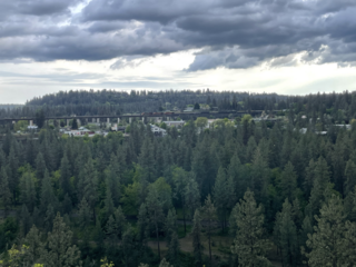
Five Mile Prairie is a neighborhood on the far north side of Spokane, Washington. It is located on a prairie of the same name that is atop a bluff on the northern edge of the city of Spokane. It contains the highest elevations on the north side of the city proper. Despite its elevation, however, most of the neighborhood is relatively flat prairie land. Housing development has been replacing the rural land in the neighborhood since the start of the 21st century.

Audubon/Downriver, Spokane Spokane Neighborhood in Washington, United States

Audubon/Downriver is a neighborhood in Spokane, Washington, located on the northwest side of the city. There is a diversity of land use in the neighborhood, with single-family residential areas dating from the early 20th century through the Post–World War II economic expansion era, regionally important commercial districts, smaller neighborhood retail areas, numerous schools, large parks, a golf course, conservation areas and part of Riverside State Park along the Spokane River. The neighborhood is the site of the corporate offices for Rosauers Supermarkets, a regional grocery store chain with stores located across the Northwestern United States.

Nevada Heights, Spokane Spokane Neighborhood in Washington, United States

Nevada Heights is a neighborhood in Spokane, Washington, located on the north side of the city. Its southern border is atop a bluff that runs east–west across the north side of the city, which gives the neighborhood its name. Nevada Street, a major north–south arterial, runs through the neighborhood. The neighborhood is largely residential, but also home to large retail districts, medical facilities, schools and parks. Being surrounded by the city of Spokane on all sides, the neighborhood is well integrated into urban area.

Shiloh Hills, Spokane Spokane Neighborhood in Washington, United States

Shiloh Hills is a neighborhood in Spokane, Washington, located on the far northeastern side of the city. It is one of the newer areas of the city, initially annexed in the late 1960s with growth continuing into the 21st century. The neighborhood is home to residential, commercial and industrial districts as well as multiple regionally important transportation corridors such as the Division Street "Y".

Northwest, Spokane Spokane Neighborhood in Washington, United States

Northwest is a neighborhood in Spokane, Washington, located in the northwestern portion of the city. Largely single-family residential, Northwest is also home to Spokane's VA Medical Center, the Dwight Merkel Sports complex, a large public sports facility, and portions of Riverside State Park along the Spokane River. The neighborhood contains developments that span from the post-World War II housing boom in the east to more contemporary, suburban-style developments in the west. It was also home to Joe Albi Stadium from 1950 until 2022, which served as the Spokane region's main high school sports stadium over its seven decades of use.

References

  1. "U.S. Census website". United States Census Bureau . Retrieved January 31, 2008.
  2. "US Board on Geographic Names". United States Geological Survey. October 25, 2007. Retrieved January 31, 2008.
  3. "US Gazetteer files: 2010, 2000, and 1990". United States Census Bureau. February 12, 2011. Retrieved April 23, 2011.
  4. 1 2 3 4 5 "QuickFacts Town and Country CDP, Washington". census.gov. U.S. Census Bureau. Retrieved August 21, 2022.
  5. 1 2 "City of Spokane Official City Map" (PDF). spokanecity.org. City of Spokane. Retrieved June 13, 2022.
  6. 1 2 3 4 5 "Spokane NW Quadrangle". usgs.gov. U.S. Geological Survey. Retrieved June 13, 2022.
  7. "Spokane County Generalized Zoning Map". spokanecounty.org. Spokane County. Retrieved June 13, 2022.
  8. "High School Boundary Map" (PDF). spokanepublicschools.org. Spokane Public Schools. Retrieved June 13, 2022.
  9. "Elementary School Boundary Map" (PDF). spokanepublicschools.org. Spokane Public Schools. Retrieved June 13, 2022.
  10. "Mead #354 School District Map -- Attendance Boundary Detail" (PDF). mead354.org. Mead School District. Retrieved June 13, 2022.
  11. "Mead #354 School District Map -- High School Attendance Boundaries" (PDF). Mead354.org. Mead School District. Retrieved June 13, 2022.
  12. "City of Spokane Arterial Street Map SMC 12.08.040" (PDF). City of Spokane. Retrieved June 13, 2022.
  13. Deshais, Nicholas (July 29, 2019). "Getting There: Country Homes was a 'route through empty fields,' now it's major thoroughfare being repaired". The Spokesman-Review. Retrieved June 13, 2022.
  14. "Spokane Regional Bike Map". srtc.maps.arcgis.com. Spokane Regional Transportation Council. Retrieved June 13, 2022.
  15. "STA System Map" (PDF). spokanetransit.com. Spokane Transit Authority. Retrieved June 12, 2022.