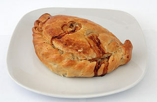
A pasty is a baked pastry, a traditional variety of which is particularly associated with Cornwall and Devon, United Kingdom. It is made by placing an uncooked filling, typically meat and vegetables, on one half of a flat shortcrust pastry circle, folding the pastry in half to wrap the filling in a semicircle and crimping the curved edge to form a seal before baking.
Restormel was a borough of Cornwall, England, United Kingdom, one of the six administrative divisions that made up the county. Its council was based in St Austell. Other towns included Newquay.

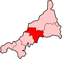
North Cornwall is an area of Cornwall, England, United Kingdom. It is also the name of a former local government district, which was administered from Bodmin and Wadebridge 50.516°N 4.835°W. Other towns in the area are Launceston, Bude, Padstow, and Camelford.

Camembert is a moist, soft, creamy, surface-ripened cow's milk cheese. It was first made in the late 18th century at Camembert, Normandy, in northern France. It is similar to Brie, which is native to the Brie region of France.

North Cornwall is a constituency represented in the House of Commons of the UK Parliament by Scott Mann, a Conservative.

Davidstow is a civil parish and village in north Cornwall, England, United Kingdom. The village is north of Bodmin Moor straddling the A395 road about 3 miles north of Camelford. The hamlets of Hallworthy, Hendraburnick, Tremail and Trewassa are in the parish.

Upton Cross and Upton are hamlets a quarter of a mile apart in east Cornwall, England, United Kingdom. Upton is situated at grid reference SX 279 724 north of Upton Cross 5 miles northwest of Callington. They are on the northeast side of Caradon Hill on the B3254 Liskeard to Launceston road. St Paul's Church at Upton Cross is a mission church built in this corner of the parish of Linkinhorne in 1887 to serve the needs of the local mining community.

Saint Endelienta was a Cornish saint of the 5th and 6th century. She is believed to be a daughter of the Welsh King Brychan, and a native of South Wales who travelled to North Cornwall to join her siblings in converting the locals to Christianity. Legend says that she was a goddaughter of King Arthur, and that she lived as a hermit at Trentinney where she subsisted on the milk of a cow. The saint is commemorated in the church and village of St Endellion which bear her name; Endellion being an Anglicised version of her name. Her feast day is 29 April.

The River Menalhyl is a river in Cornwall, England, that flows through the civil parishes of St Columb Major and Mawgan-in-Pydar. Its length is about 12 miles and it flows in a generally north-west direction. The name comes from the Cornish words melyn meaning mill and heyl meaning estuary - estuary mills. The name was recorded as Mellynheyl in the 19th century, but it had been known as Glyvion.

The River Allen in north Cornwall is one of two rivers of the same name in Cornwall which share this name. In this case the name is the result of a mistake made in 1888 by Ordnance Survey, replacing the name Layne with Allen which is the old name for the lower reaches of the Camel. The other River Allen runs through Truro.

Scorrier is a village in Cornwall, England, United Kingdom. It is in the civil parish of St Day, about 2 miles (3 km) northeast of the centre of Redruth and 3 miles (5 km) southeast of the coast at Porthtowan, on the A30 road at the junction of the A3047 road that leads west to Camborne and the B3298 road south to Carharrack. The Plymouth to Penzance railway line passes through the village and between 1852 and 1964 it had its own station. A. E. Rodda & Son, the principal maker of clotted cream is based here.

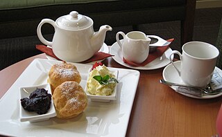
Cornish cuisine encompasses the cooking styles, traditions and recipes associated with Cornwall and the Cornish people. It has been heavily influenced by the geography of the county as well as its social history.
The cuisine of Devon in England has influenced, and been influenced, by other British cuisine.

The St Austell River properly known as the River Vinnick, but historically called The White River, is a 12 kilometres (7.5 mi) long river located in south Cornwall, England, United Kingdom. 50.337°N 4.793°W. The river has also been known as the "red river" due to tin streaming and mining activity upstream.
Cornish Blue is a type of blue cheese from Cornwall, England, United Kingdom. It is made by the Cornish Cheese Company at Upton Cross.
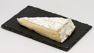
Cornish Brie is a type of brie-style, soft, white-rinded British cheese from Cornwall, England. Cornish brie is made by several dairies and has won a number of awards.
Presented below is an alphabetical index of articles related to Cornwall: