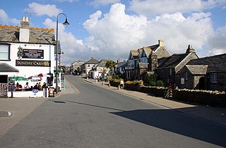
Tintagel or Trevena is a civil parish and village situated on the Atlantic coast of Cornwall, England, United Kingdom. The village and nearby Tintagel Castle are associated with the legends surrounding King Arthur and in recent times have become a tourist attraction. It was claimed by Geoffrey of Monmouth that the castle was the place of Arthur's conception.

Tintagel Castle is a medieval fortification located on the peninsula of Tintagel Island adjacent to the village of Tintagel (Trevena), North Cornwall in the United Kingdom. The site was possibly occupied in the Romano-British period, as an array of artefacts dating from this period have been found on the peninsula, but as yet no Roman-era structure has been proven to have existed there. It was settled during the early medieval period, when it was probably one of the seasonal residences of the regional king of Dumnonia. A castle was built on the site by Richard, 1st Earl of Cornwall in the 13th century, during the High Middle Ages. It later fell into disrepair and ruin.
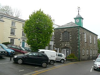
Camelford is a town and civil parish in north Cornwall, England, United Kingdom, situated in the River Camel valley northwest of Bodmin Moor. The town is approximately ten miles (16 km) north of Bodmin and is governed by Camelford Town Council. The ward population at the 2011 Census was 4,001. The town population at the same census was 865. Lanteglos-by-Camelford is the ecclesiastical parish in which the town is situated.

North Cornwall is an area of Cornwall, England, United Kingdom. It is also the name of a former local government district, which was administered from Bodmin and Wadebridge 50.516°N 4.835°W. Other towns in the area are Launceston, Bude, Padstow, and Camelford.

Boscastle is a village and fishing port on the north coast of Cornwall, England, in the civil parish of Forrabury and Minster. It is 14 miles (23 km) south of Bude and 5 miles (8 km) northeast of Tintagel. The harbour is a natural inlet protected by two stone harbour walls built in 1584 by Sir Richard Grenville and is the only significant harbour for 20 miles (32 km) along the coast. The village extends up the valleys of the River Valency and River Jordan. Heavy rainfall on 16 August 2004 caused extensive damage to the village.

Bossiney is a village in north Cornwall, England, United Kingdom. It is north-east of the larger village of Tintagel which it adjoins: further north-east are the Rocky Valley and Trethevy. Until 1832 the village, with its neighbour Tintagel, returned two MPs as a Rotten Borough, for the Bossiney constituency. The beach of Bossiney Haven is located nearby.

Treknow is a small village in Tintagel civil parish, Cornwall, England, United Kingdom: it is the second largest settlement, and is located between Trevena and Trebarwith. It is situated 19 miles (31 km) north of Bodmin, 4 miles (6.4 km) north-west of Camelford, and 1 mile (1.6 km) west of Tintagel, grid reference SX056869
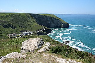
Trebarwith Strand is a section of coastline located near the coastal settlement of Trebarwith on the north coast of Cornwall, England, UK, 2+1⁄2 miles (4.0 km) south of Tintagel. It has 800m of sandy beach contained by cliffs in which natural caves are found. The beach can only be accessed at low tide. The strand was once used to land ships to export slate from the nearby quarries while sand from the beach was used for agricultural purposes. The view from the beach is dominated by rocks 300m offshore known as Gull Rock or Otterham Rocks.
Trethevy is a hamlet in north Cornwall, England, United Kingdom.
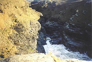
Rocky Valley is a small valley in the parish of Tintagel, north Cornwall, England, United Kingdom.

Saint Nectan's Glen is an area of woodland in Trethevy near Tintagel, north Cornwall stretching for around one mile along both banks of the Trevillet River. The glen's most prominent feature is St Nectan's Kieve, a spectacular sixty foot waterfall through a hole in the rocks. The site attracts tourists who believe it to be "one of the UK's most spiritual sites," and tie or place ribbons, crystals, photographs, small piles of flat stones and other materials near the waterfall.

The Parish Church of Saint Materiana at Tintagel is a Church of England parish church in the Church of England Diocese of Truro in Cornwall, England, UK. It stands on the cliffs between Trevena and Tintagel Castle and is listed Grade I.
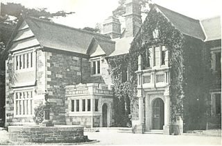
Lewtrenchard is a village and civil parish in the West Devon district, in the county of Devon, England. Most of the larger village of Lewdown is in the parish. In the Domesday Book of 1086, a manor of Lew is recorded in this area and two rivers have the same name: see River Lew. Trenchard comes from the lords of the manor in the 13th century.

The civil parishes to which the Forrabury and Minster parish churches belong were united in 1919 to form Forrabury and Minster parish, within Cornwall, England, UK. The main settlement in the parish is Boscastle. The two rectories had been united in 1800.
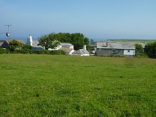
Halgabron is a hamlet in the parish of Tintagel, Cornwall, England. Halgabron is east of Bossiney. The family of Robartes once held land at Halgabron. Halgabron mill was built on the Trevillet River in the 19th century. It is in the civil parish of Michaelstow
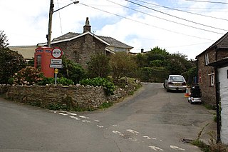
Trenale is a hamlet in north Cornwall, England, United Kingdom. It is located within the civil parish of Tintagel, to the south-east of Tintagel village.

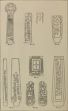
Wayside crosses and Celtic inscribed stones are found in Cornwall in large numbers; the inscribed stones are thought to be earlier in date than the crosses and are a product of Celtic Christian society. It is likely that the crosses represent a development from the inscribed stones but nothing is certain about the dating of them. In the late Middle Ages it is likely that their erection was very common and they occur in locations of various types, e.g. by the wayside, in churchyards, and in moorlands. Those by roadsides and on moorlands were doubtless intended as route markings. A few may have served as boundary stones, and others like the wayside shrines found in Catholic European countries. Crosses to which inscriptions have been added must have been memorial stones. According to W. G. V. Balchin "The crosses are either plain or ornamented, invariably carved in granite, and the great majority are of the wheel-headed Celtic type." Their distribution shows a greater concentration in west Cornwall and a gradual diminution further east and further north. In the extreme northeast none are found because it had been settled by West Saxons. The cross in Perran Sands has been dated by Charles Henderson as before 960 AD; that in Morrab Gardens, Penzance, has been dated by R. A. S. Macalister as before 924 AD; and the Doniert Stone is thought to be a memorial to King Dumgarth.
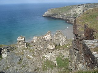
Tintagel Slate Quarries fall into two categories: the series of quarries lying between Tintagel Castle and Trebarwith Strand on the north coast of Cornwall, South West England and the open cast quarries further inland. There are around eight cliff-edge quarries as well as two wharfs, all of which are now disused as well as four inland sites, two of which are still in operation. The first quarry to be worked appears to have been Lanterdan at some point in the fifteenth century, while the last of the coastal quarries, Long Grass ceased operations in 1937. The remains of the coastal quarries occupy coastal land owned by the National Trust and most are easily accessible from the South West Coast Path. The Prince of Wales Quarry has been turned into a country park by North Cornwall District Council.

Lanterdan Quarry is a disused open cast slate quarry between Tintagel and Trebarwith on the north coast of Cornwall, South West England. The quarry is the oldest, largest and most spectacular of Tintagel’s coastal quarries and was worked from the fifteenth until the early twentieth century. A distinguishing feature of the quarry is a 25m high pinnacle of inferior slate.

West Quarry is a disused open cast slate quarry between Tintagel and Trebarwith on the north coast of Cornwall, South West England. The quarry ceased operations towards the end of the nineteenth century.
