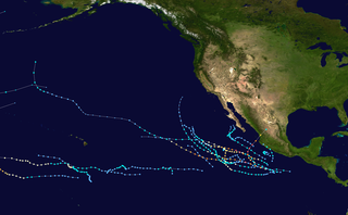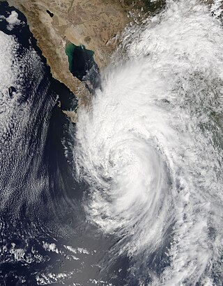
The 2002 Pacific hurricane season was an above-average season which produced fifteen named storms. Eight hurricanes formed, including three Category 5 hurricanes, which tied for the most in a season with 1994 and 2018. Moreover, the season was a near-average season in terms of accumulated cyclone energy (ACE), with a total index of 125 units. The season officially began on May 15 in the East Pacific Ocean, and on June 1 in the Central Pacific and they both ended on November 30. These dates conventionally delimit the period of each year when most tropical cyclones form in the Pacific basin. However, the formation of tropical cyclones is possible at any time of the year.

The 1998 Pacific hurricane season was a fairly average Pacific hurricane season. Despite this, it had nine hurricanes and six major hurricanes, which was well above average. The season officially started on May 15 in the eastern Pacific and on June 1 in the central Pacific, and ended on November 30; these dates conventionally delimit the period during which most tropical cyclones form in that region. The first tropical cyclone developed on June 11, about ten days later than the normal start of the season. The final storm of the year, Hurricane Madeline, dissipated on October 20. Storm activity in the Central Pacific Hurricane Center's warning zone was low, with just one tropical depression observed in the region. Two tropical cyclones from the eastern Pacific also entered the central Pacific; the former did so as a hurricane.

The 1996 Pacific hurricane season is tied with 2021 for the most Pacific hurricanes to make landfall on Mexico in one year, with four striking the country. It was a below average season that produced 9 tropical storms, 5 hurricanes and 2 major hurricanes. With 9 tropical storms, 1996 ranks as the second-least active Pacific hurricane season on record. It officially began May 15, 1996, in the eastern north Pacific and on June 1, 1996, in the central north Pacific. It ended on November 30, 1996. These dates conventionally delimit the period of each year when most tropical cyclones form in the northeastern Pacific Ocean. The season slightly exceeded these bounds when tropical storm One-E formed on May 13.

The 1995 Pacific hurricane season was the least active Pacific hurricane season since 1979, and marked the beginning of a multi-decade period of low activity in the basin. Of the eleven tropical cyclones that formed during the season, four affected land, with the most notable storm of the season being Hurricane Ismael, which killed at least 116 people in Mexico. The strongest hurricane in the season was Hurricane Juliette, which reached peak winds of 150 mph (240 km/h), but did not significantly affect land. Hurricane Adolph was an early-season Category 4 hurricane. Hurricane Henriette brushed the Baja California Peninsula in early September.

The 1990 Pacific hurricane season was a very active season which observed 21 named storms within the basin. The season also produced the fourth highest ACE index value on record. The season was officially started on May 15 in the eastern Pacific, and on June 1 in the central Pacific, and lasted until November 30. These dates conventionally delimit the period of each year when most tropical cyclones form in the northeastern Pacific Ocean. However, the formation of tropical cyclones is possible at any time of the year, as illustrated in 1990 by the formation of the season's first named storm, Hurricane Alma, on May 12. At the time, this was the earliest formation of a tropical storm on record in the eastern Pacific

The 1984 Pacific hurricane season featured numerous tropical cyclones, several of which were impactful to land. It was a busy hurricane season with 21 named storms, 13 hurricanes, and 7 major hurricanes, the latter of which are Category 3 or stronger cyclones on the Saffir–Simpson scale. This activity was unusual given the presence of a La Niña, which typically suppresses Central and East Pacific tropical cyclone activity, and only average sea surface temperatures. Seasonal activity began on May 17 and ended on November 8. This lies within the confines of a traditional hurricane season which begins on May 15 in the East Pacific and June 1 in the Central Pacific, and ends on November 30 in both basins. These dates conventionally delimit the period during each year when most tropical cyclones form.

The 2007 Pacific hurricane season was a below-average Pacific hurricane season, featuring one major hurricane. The season officially started on May 15 in the eastern Pacific and on June 1 in the central Pacific, and ended on November 30; these dates conventionally delimit the period during which most tropical cyclones form in the region. The first tropical cyclone of the season, Alvin, developed on May 27, while the final system of the year, Kiko, dissipated on October 23. Due to unusually strong wind shear, activity fell short of the long-term average, with a total of 11 named storms, 4 hurricanes, and 1 major hurricane. At the time, 2007 featured the second-lowest value of the Accumulated cyclone energy (ACE) index since reliable records began in 1971. Two tropical cyclones – Cosme and Flossie – crossed into the central Pacific basin during the year, activity below the average of 4 to 5 systems.

Hurricane Javier was a powerful tropical cyclone whose remnants brought above-average rainfall totals across the western United States in September 2004. Javier was the tenth named storm, the sixth hurricane and the final major hurricane of the 2004 Pacific hurricane season. Javier was also the strongest hurricane of the 2004 season, with 150 mph (240 km/h) winds and a central pressure of 930 millibars. However, because of high wind shear in the East Pacific, Javier weakened rapidly before making landfall in Baja California as a tropical depression. The remnants of the storm then continued moving northeast through the Southwestern United States. Javier caused no direct fatalities, and the damage in Mexico and the United States was minimal.

Tropical Storm Emilia was a rare tropical cyclone that affected the Baja California Peninsula in July 2006. The sixth tropical depression and fifth tropical storm of the 2006 Pacific hurricane season, it developed on July 21 about 400 miles (640 km) off the coast of Mexico. It moved northward toward the coast, reaching peak winds of 65 mph (105 km/h) before turning westward and encountering unfavorable conditions. Emilia later turned to the north, passing near Baja California as a strong tropical storm. Subsequently, the storm moved further away from the coast, and on July 27 it dissipated.

The 2008 Pacific hurricane season was a near-average Pacific hurricane season which featured seventeen named storms, though most were rather weak and short-lived. Only seven hurricanes formed and two major hurricanes. This season was also the first since 1996 to have no cyclones cross into the central Pacific. The season officially began on May 15 in the eastern Pacific and on June 1 in the central Pacific. It ended in both regions on November 30. These dates, adopted by convention, historically describe the period in each year when most tropical cyclone formation occurs in these regions of the Pacific. This season, the first system, Tropical Storm Alma, formed on May 29, and the last, Tropical Storm Polo, dissipated on November 5.

The 2006 Pacific hurricane season was the first above-average season since 1997 which produced twenty-five tropical cyclones, with nineteen named storms, though most were rather weak and short-lived. Only eleven hurricanes formed and six major hurricanes. Following the inactivity of the previous seasons, forecasters predicted that season would be only slightly above active. It was also the first time since 2003 in which at least one cyclone of tropical storm intensity made landfall. The season officially began on May 15 in the East Pacific Ocean, and on June 1 in the Central Pacific; they ended on November 30. These dates conventionally delimit the period of each year when most tropical cyclones form in the Pacific basin. However, the formation of tropical cyclones is possible at any time of the year.

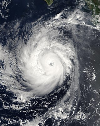
Hurricane Norbert is tied with Hurricane Jimena as the strongest tropical cyclone to strike the west coast of Baja California Sur in recorded history. The fifteenth named storm, seventh hurricane, and second major hurricane of the 2008 hurricane season, Norbert originated as a tropical depression from a tropical wave south of Acapulco on October 3. Strong wind shear initially prevented much development, but the cyclone encountered a more favorable environment as it moved westward. On October 5, the National Hurricane Center (NHC) upgraded the depression to Tropical Storm Norbert, and the system intensified further to attain hurricane intensity by October 6. After undergoing a period of rapid deepening, Norbert reached its peak intensity as a Category 4 on the Saffir–Simpson hurricane wind scale, with maximum sustained winds of 135 mph (217 km/h) and a minimum barometric pressure of 945 mbar. As the cyclone rounded the western periphery of a subtropical ridge over Mexico, it began an eyewall replacement cycle which led to steady weakening. Completing this cycle and briefly reintensifying into a major hurricane, a Category 3 or higher on the Saffir–Simpson hurricane wind scale, Norbert moved ashore Baja California Sur as a Category 2 hurricane late on October 11. After a second landfall at a weaker intensity the following day, the system quickly weakened over land and dissipated that afternoon.

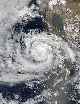
Hurricane Otis was a moderate Category 2 hurricane that threatened the Baja California Peninsula but dissipated before landfall. Otis was the fifteenth and final named storm and seventh hurricane of the 2005 Pacific hurricane season. The storm developed on September 28, 2005, off the western coast of Mexico, from a tropical wave that emerged from the western coast of Africa and traversed the Atlantic Ocean during the preceding several weeks. After attaining tropical storm status on September 29, Otis moved in a generally northwestward direction for most of its duration. It ultimately peaked at Category 2 intensity on the Saffir–Simpson Hurricane Scale before beginning to weaken. The storm degenerated into a tropical depression on October 3 and dissipated fully on October 5, near the coast of Baja California Sur. Preparations for Otis were completed on the Peninsula; tropical cyclone watches and warnings were declared and numerous shelters opened. However, the storm's effects were minimal, and limited to gusty winds with heavy rainfall. No major damage was reported.

Hurricane Frank was a Category 1 hurricane that caused minor damage in Mexico in late August 2010. The ninth tropical cyclone, sixth named storm, and third hurricane of the inactive 2010 Pacific hurricane season, Frank formed from an area of thunderstorms from the Caribbean Sea, and became Tropical Depression Nine-E on August 21 while located just south of the Mexican Coast. It moved northwest, and became Tropical Storm Frank only 12 hours after it was declared a depression. It strengthened to its initial peak as a moderate tropical storm, and weakened due to increasing wind shear late on the August 23. It later recovered, and became a hurricane on August 25. After peaking as a strong Category 1 hurricane, it rapidly weakened, and dissipated on August 28. Although Frank never made landfall, it did impact western Mexico. A total of six people were killed with over 800,000 people affected.

Hurricane Paul was a strong tropical cyclone that threatened the Baja California peninsula during October 2012. The sixteenth tropical cyclone, tenth hurricane, and fifth major hurricane of the season, Paul originated from a trough of low pressure west of the coastline of Mexico on October 13. While turning towards the north, the system quickly organized, reaching hurricane status in the morning of October 15. By that afternoon, Paul had reached its peak intensity as a Category 3 hurricane on the Saffir-Simpson hurricane wind scale (SSHWS) with maximum sustained winds of 120 mph (195 km/h), but began to weaken rapidly thereafter due to land interaction and strong wind shear. Late on October 17, Paul degenerated into a remnant low. The remnants of Paul later moved ashore along the central Baja California Peninsula, before dissipating on October 18.

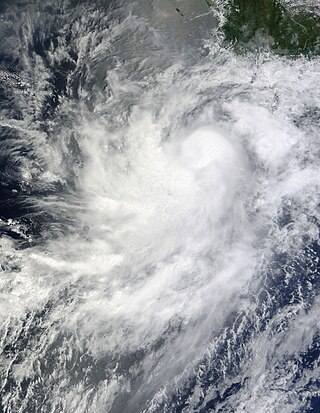
Tropical Storm Ignacio was a strong tropical storm that deluged the Mexican coast with heavy rains. The 9th named storm and 11th tropical cyclone of the 1991 Pacific hurricane season, the system formed from two tropical waves. The pair moved across the Atlantic during the first ten days of September. The second of the two spawned Tropical Storm Erika in the eastern Atlantic. Emerging into the eastern Pacific between the September 10 and September 12, an area of thunderstorms developed southeast of an upper level cyclone off the southern tip of Baja California Sur due to the interaction of the upper cyclone with the pair of tropical waves. By the September 15, the thunderstorm activity organized into bands, indicating the presence of a new tropical depression, the eleventh of the season. The cyclone moved north-northwest due to steering around the upper cyclone, and became a tropical storm by noon on the September 16. Once the upper cyclone moved away from Ignacio, its motion towards the Mexican coast stopped on September 17, and it executed a slow anticyclonic loop that would be completed late on the September 18. Proximity to land and west to southwesterly vertical wind shear weakened the cyclone, and Ignacio regained tropical depression status late on the September 18. The system dissipated as a tropical cyclone that night, and its remnants moved west-southwest into the tropical Pacific, occasionally flaring up new convection over the succeeding couple days.

Hurricane Newton was the first tropical cyclone to make landfall on the Baja California Peninsula at hurricane strength since Hurricane Odile in 2014. The fifteenth tropical depression, fifteenth named storm and ninth hurricane of the 2016 Pacific hurricane season, Newton formed from a tropical wave to the south of Mexico on September 4, 2016. Moving northwards through an environment conducive for additional development, Newton rapidly strengthened, reaching hurricane strength on the following day. Newton made landfall on the Baja California Peninsula just below peak strength on the same day. Interaction with the mountainous terrain of the peninsula caused some slight weakening, but Newton remained a hurricane till it entered the Gulf of California. Increasing wind shear caused Newton to weaken at a faster pace, and the system made landfall in Sonora late on September 6 as a strong tropical storm. The cyclone continued to rapidly weaken over the rugged terrain of Sonora, and it degenerated into a remnant low just south of the Mexico–United States border on September 7. The remnants of Newton dissipated early on the following day.

Tropical Storm Lidia was a large tropical cyclone that caused flooding in Baja California Peninsula and parts of western Mexico. The fourteenth tropical cyclone and twelfth named storm of the 2017 Pacific hurricane season, Lidia developed from a large area of disturbed weather west of the Pacific Coast of Mexico on August 31. The storm intensified while moving generally northward or northwestward, peaking with maximum sustained winds of 65 mph (105 km/h) later that day. On September 1, Lidia made landfall in Mexico near Puerto Chale, Baja California Sur, at peak intensity. The storm weakened while traversing the peninsula, ultimately emerging over the Pacific Ocean on September 3, where the storm degenerated into a remnant low. The system brought thunderstorms and wind gusts to Southern California, before dissipating on September 4.

The 2018 Pacific hurricane season was one of the most active Pacific hurricane seasons on record, producing the highest accumulated cyclone energy value on record in the basin. The season had the fourth-highest number of named storms – 23, tied with 1982. The season also featured eight landfalls, six of which occurred in Mexico. The season officially began on May 15 in the Eastern Pacific, and on June 1 in the Central Pacific; they both ended on November 30. These dates conventionally delimit the period of each year when most tropical cyclones form in the Pacific basin. However, tropical cyclone formation is possible at any time of the year, as illustrated when the first tropical depression formed on May 10, five days prior to the official start of the season.

The 2020 Pacific hurricane season was the least active Pacific hurricane season since 2011. Altogether, 21 tropical cyclones developed. The season was near average in terms of tropical storms, featuring a total of 17, but had a well below average number of hurricanes and major hurricanes, with only 4 hurricanes and 3 major hurricanes forming. Additionally, no tropical cyclones formed in the Central Pacific basin for the first time since 2017, marking the start of a series of seasons with no tropical cyclogenesis occurring there. The season officially began on May 15 in the East Pacific Ocean, and on June 1 in the Central Pacific (from 140°W to the International Date Line, north of the equator; they both ended on November 30. These dates conventionally delimit the period of each year when most tropical cyclones form in the respective regions. However, the formation of tropical cyclones is possible at any time of the year, as illustrated in 2020 by the formation of the season's first system, Tropical Depression One-E, on April 25. This the earliest formation of a tropical cyclone on record in the eastern Pacific basin proper.


