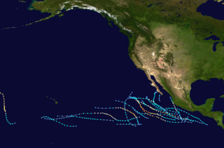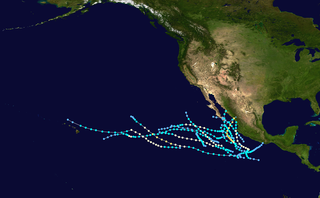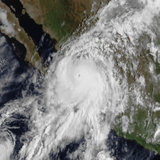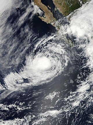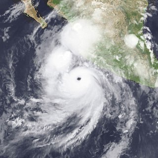
The 2003 Pacific hurricane season was the first season to feature no major hurricanes since 1977. The season officially began on May 15, 2003 in the Eastern North Pacific, and on June 1 in the Central ; both ended on November 30. These dates, adopted by convention, historically describe the period in each year when most tropical cyclogenesis occurs in these regions of the Pacific. The season featured 16 tropical storms, 7 of which intensified into hurricanes, which was then considered an average season. Damage across the basin reached US$129 million, and 23 people were killed by the storms.

The 1993 Pacific hurricane season included more than double the average number of major hurricanes – Category 3 or stronger cyclones on the Saffir–Simpson scale. This activity was the result of an El Niño event, which is the main factor contributing to above-average activity across the Pacific basin. The season featured 15 named storms, 11 hurricanes, and 9 major hurricanes. While the number of named storms was near the long-term average, the number of hurricanes was above the average of 8, and the number of major hurricanes far exceeded the long-term average of 4. Seasonal activity began on May 17 and ended on November 8, within the confines of a traditional hurricane season which begins on May 15 in the East Pacific and June 1 in the Central Pacific. The season ends on November 30 in both basins. These dates conventionally delimit the period during each year when most tropical cyclones form.

The 1987 Pacific hurricane season was the last year in which the Eastern Pacific Hurricane Center was the primary warning center for tropical cyclones in the eastern Pacific Ocean. The season officially started May 15, 1987, in the eastern Pacific, and June 1, 1987, in the central Pacific, and lasted until November 30, 1987. These dates conventionally delimit the period of each year when the vast majority of tropical cyclones form in the northeastern Pacific Ocean.

The 1981 Pacific hurricane season was a slightly below average Pacific hurricane season. The season officially started on May 15 in the eastern Pacific basin and June 1 in the central Pacific basin. Both basins' seasons ended on November 30; these dates conventionally delimit the period during which most tropical cyclones form in the northeastern Pacific Ocean. The first tropical cyclone of the season was designated on May 30, and the final storm of the season, Hurricane Otis, dissipated on October 30. The season produced fifteen named storms and a total of eight hurricanes, which was near normal. However, the total of one major hurricane was below the average of three.

Hurricane Paul was a devastating tropical cyclone which killed a total of 1,625 people and caused US$520 million in damage, ranking it as the second deadliest Pacific hurricane on record, behind the 1959 Mexico Hurricane. The sixteenth named storm and tenth hurricane of the 1982 Pacific hurricane season, Paul developed as a tropical depression just offshore Central America on September 18. The depression briefly moved inland two days later just before heading westward out to sea. The storm changed little in strength for several days until September 25, when it slowly intensified into a tropical storm. Two days later, Paul attained hurricane status, and further strengthened to Category 2 intensity after turning northward. The hurricane then accelerated toward the northeast, reaching peak winds of 110 mph (175 km/h). Paul made landfall over Baja California Sur on September 29, and subsequently moved ashore in Sinaloa the next day.

Hurricane Marty was a Category 2 Pacific hurricane that caused extensive flooding and damage in northwestern Mexico just weeks after Hurricane Ignacio took a similar course. Marty was the thirteenth named storm, fourth hurricane, and the deadliest tropical cyclone of the 2003 Pacific hurricane season. Forming on September 18, it became the 13th tropical storm and fourth hurricane of the year. The storm moved generally northwestward and steadily intensified despite only a marginally favorable environment for development, and became a Category 2 hurricane before making two landfalls on the Baja California peninsula and mainland Mexico.

Hurricane Lane was a powerful tropical cyclone which is tied as the ninth-strongest landfalling Pacific hurricane on record. The thirteenth named storm, ninth hurricane, and sixth major hurricane of the 2006 Pacific hurricane season, Lane developed on September 13 from a tropical wave to the south of Mexico. It moved northwestward, parallel to the coast of Mexico, and steadily intensified in an area conducive to further strengthening. After turning to the northeast, Lane attained peak winds of 125 mph (201 km/h), and made landfall in the state of Sinaloa at peak strength. It rapidly weakened and dissipated on September 17, and later brought precipitation to southern part of the U.S. state of Texas.

Hurricane Isis was the only hurricane to make landfall during the 1998 Pacific hurricane season. The ninth tropical storm and sixth hurricane of the season, Isis developed on September 1 from an interaction between a tropical wave and a large surface circulation to the southwest of Mexico. It moved northward, striking the extreme southeastern portion of the Baja California peninsula before attaining hurricane status in the Gulf of California. Isis made landfall at Topolobampo in the Mexican state of Sinaloa on September 3, and quickly lost its low-level circulation. The remnants persisted for several days before dissipating over the U.S. state of Idaho on September 8.

The 2008 Pacific hurricane season was a near-average Pacific hurricane season which featured seventeen named storms, though most were rather weak and short-lived. Only seven storms became hurricanes, of which two intensified into major hurricanes. This season was also the first since 1996 to have no cyclones cross into the central Pacific. The season officially began on May 15 in the eastern Pacific and on June 1 in the central Pacific. It ended in both regions on November 30. These dates, adopted by convention, historically describe the period in each year when most tropical cyclone formation occurs in these regions of the Pacific. This season, the first system, Tropical Storm Alma, formed on May 29, and the last, Tropical Storm Polo, dissipated on November 5.

Tropical Storm Lowell was a moderate tropical storm that developed during the 2008 Pacific hurricane season. The fourteenth tropical cyclone and thirteen named storm of the season, Lowell formed out of a western side of a trough on September 6. It quickly intensified into Tropical Storm Lowell, peaking as a moderate tropical storm. It pass directly over Socorro Island and began a weakening trend. It weakened into depression before landfall in Baja California Sur and dissipated before striking Sonora. It later joined with a frontal boundary and Hurricane Ike which caused severe damage as far inland as Chicago. In all, the storm had caused 6 deaths and $15.5 million damage.

Hurricane Waldo was a Pacific hurricane whose remnants caused significant flooding in Kansas during October 1985. It was also the only hurricane to make landfall during the extremely active 1985 Pacific hurricane season. The twenty-fourth tropical cyclone, twenty-second named storm, and eleventh hurricane of the season, Waldo originated from a disturbance first detected by ship report on October 5, 1985. After developing into a tropical depression on October 7, it steadily intensified, becoming a tropical storm that day. Waldo reached hurricane intensity on October 8. After peaking as a moderate Category 2 hurricane on the Saffir–Simpson hurricane scale, it re-curved to the east, making landfall at peak intensity near Culiacán. Afterward, it rapidly dissipated. In all, Waldo caused moderate damage in Sonora. The remnants of the storm combined with a cold front over the Great Plains. Significant flooding and one death was recorded in Kansas. Many rivers and creeks overflowed its banks.

Hurricane Norma was one of the two hurricanes to make landfall during the 1981 Pacific hurricane season. It developed on October 8, strengthening into a tropical storm and later a hurricane. Norma moved slowly to the northwest and strengthened into a Category 3 hurricane on the Saffir–Simpson hurricane scale. The storm recurved and accelerated to the northeast on October 11 and weakened to a Category 2. The next day, Norma made landfall near Mazatlán on October 12 and soon dissipated. The hurricane's remnants continued northeastward and entered the United States, crossing into central Texas before being absorbed by a frontal system on October 14. Norma caused $24 million in crop damage and one death in Mexico, as well as up to 10 in (250 mm). In Texas, the storm produced flooding rains that killed five people, caused $50 million in damage and caused many tornadoes. Rainfall was also reported as far inland as Kansas.

Hurricane Lidia was the strongest tropical cyclone of the 1993 Pacific hurricane season. Forming from a tropical wave on September 8, Lidia steadily organized and became a hurricane on September 10. The hurricane continued to strengthen while developing a well-defined eye, and peaked as a Category 4 hurricane on September 11. However, it weakened considerably before making landfall in Sinaloa as a Category 2 storm. Lidia dissipated near Austin on September 14 and was later absorbed by a cold front. Across Mexico, the hurricane killed seven people; over 100,000 people were forced to evacuate their homes. A total of 160 homes were destroyed and 10,000 people were left homeless because of the storm. In the United States, five people suffered injuries and storm damage totaled $8 million.

Tropical Storm Gil had caused squally weather off the eastern coast of Mexico. Gil was a tropical cyclone that had produced high winds and severe weather in Mexico before drifting off at sea. Gil developed off a tropical wave that had gone through the Atlantic and into the Pacific. The wave had emerged off the eastern Pacific on August 27, two days prior to Gil's formation. The tropical wave had an abundant convection system. On the August 29, Tropical Depression 10-E. Six hours later, the storm developed into a tropical storm and was designated as Tropical Storm Gil.

Tropical Storm Lidia was a large tropical cyclone that caused flooding in Baja California Peninsula and parts of western Mexico. The fourteenth tropical cyclone and twelfth named storm of the 2017 Pacific hurricane season, Lidia developed from a large area of disturbed weather west of the Pacific Coast of Mexico on August 31. The storm intensified while moving generally northward or northwestward, peaking with maximum sustained winds of 65 mph (105 km/h) later that day. On September 1, Lidia made landfall in Mexico near Puerto Chale, Baja California Sur, at peak intensity. The storm weakened while traversing the peninsula, ultimately emerging over the Pacific Ocean on September 3, where the storm degenerated into a remnant low. The system brought thunderstorms and wind gusts to Southern California, before dissipating on September 4.

The 2018 Pacific hurricane season was one of the most active Pacific hurricane seasons on record, producing the highest accumulated cyclone energy value on record in the basin. The season had the fourth-highest number of named storms – 23, tied with 1982. The season also featured eight landfalls, six of which occurred in Mexico. The season officially began on May 15 in the Eastern Pacific, and on June 1 in the Central Pacific; they both ended on November 30. These dates conventionally delimit the period of each year when most tropical cyclones form in the Pacific basin. However, tropical cyclone formation is possible at any time of the year, as illustrated when the first tropical depression formed on May 10, five days prior to the official start of the season.

The 2023 Pacific hurricane season was an active and destructive Pacific hurricane season. In the Eastern Pacific basin, 17 named storms formed; 10 of those became hurricanes, of which 8 strengthened into major hurricanes – double the seasonal average. In the Central Pacific basin, no tropical cyclones formed for the fourth consecutive season, though four entered into the basin from the east. Collectively, the season had an above-normal accumulated cyclone energy (ACE) value of approximately 168 units. This season saw the return of El Niño and its associated warmer sea surface temperatures in the basin, which fueled the rapid intensification of several powerful storms. It officially began on May 15, 2023 in the Eastern Pacific, and on June 1 in the Central; both ended on November 30. These dates, adopted by convention, historically describe the period in each year when most tropical cyclogenesis occurs in these regions of the Pacific.

Hurricane Norma was one of four tropical cyclones to strike the Pacific Coast of Mexico in October 2023. The seventeenth tropical depression, fourteenth named storm, ninth hurricane and seventh major hurricane of the 2023 Pacific hurricane season, Norma developed from an area of low pressure that formed off the coast of southern Mexico on October 15, 2023. The disturbance gradually organized as it progressed westward parallel to the coast, and developed into Tropical Storm Norma on October 17. Turning northward, Norma rapidly intensified to a Category 4 hurricane as it continued to parallel the west coast of Mexico. Less favorable environmental conditions caused Norma to gradually weaken as it approached the Baja California peninsula. The cyclone made landfall on the Mexican state of Baja California Sur as a Category 1 hurricane. Norma continued to weaken as it crossed the state. The storm emerged over the Gulf of California on October 22, and made landfall as a tropical depression the following day on the state of Sinaloa. Norma quickly dissipated as it moved inland over Mexico.

The 1993 Pacific hurricane season consisted of the events that occurred in the annual cycle of tropical cyclone formation over the Pacific Ocean north of the Equator and east of the International Date Line. The official bounds of each Pacific hurricane season are dates that conventionally delimit the period each year during which tropical cyclones tend to form in the basin according to the National Hurricane Center, beginning on May 15 in the Eastern Pacific proper and on June 1 in the Central Pacific, and ending on November 30 in both areas. However, tropical cyclogenesis is possible at any time of the year. The first system, Hurricane Adrian, developed on June 11; the final system, Tropical Depression Seventeen-E, dissipated on October 14.


