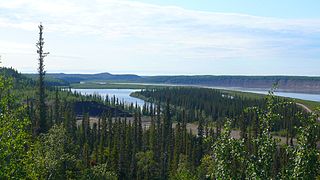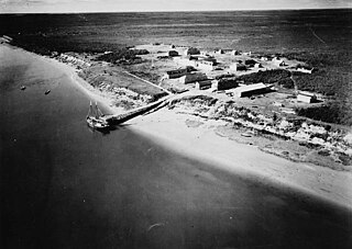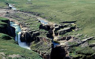
The Mackenzie River is a river in the Canadian boreal forest. It forms, along with the Slave, Peace, and Finlay, the longest river system in Canada, and includes the second largest drainage basin of any North American river after the Mississippi.

The Liard River of the North American boreal forest flows through Yukon, British Columbia and the Northwest Territories, Canada. Rising in the Saint Cyr Range of the Pelly Mountains in southeastern Yukon, it flows 1,115 km (693 mi) southeast through British Columbia, marking the northern end of the Rocky Mountains and then curving northeast back into Yukon and Northwest Territories, draining into the Mackenzie River at Fort Simpson, Northwest Territories. The river drains approximately 277,100 km2 (107,000 sq mi) of boreal forest and muskeg.
The Fond du Lac River is one of the upper branches of the Mackenzie River system, draining into the Arctic Ocean, located in northern Saskatchewan, Canada. The river is 277 kilometres (172 mi) long, has a watershed of 66,800 km2 (25,800 sq mi), and its mean discharge is 300 m3/s (11,000 cu ft/s).

The Hayes River is a river in Northern Manitoba, Canada, that flows from Molson Lake to Hudson Bay at York Factory. It was historically an important river in the development of Canada and is now a Canadian Heritage River and the longest naturally flowing river in Manitoba.

The Missisquoi River is a transboundary river of the east shore of Lake Champlain, approximately 80 miles (130 km) long, in northern Vermont in the United States and southern Quebec in Canada.

The Hood River of Nunavut, Canada, is a 400 km (250 mi) long river draining into the Arctic Ocean from its headwaters in the interior of Canada's tundra at Napaktulik Lake, close to the Northwest Territories border. The river ends at Arctic Sound near the community of Bathurst Inlet. The river is above the Arctic Circle and tree line.

The Jacques-Cartier River is a river in the province of Quebec, Canada. It is 161 km long and its source is Jacques-Cartier Lake in Laurentides Wildlife Reserve, and flows in a predominantly southern direction before ending in the Saint Lawrence River at Donnacona, about 30 km upstream from Quebec City.

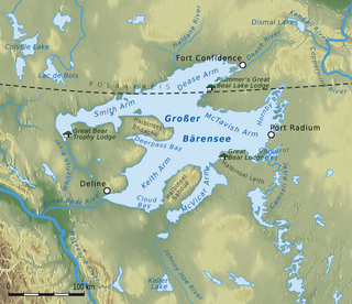
The 113-kilometre-long (70 mi) Great Bear River, which drains the Great Bear Lake westward through marshes into the Mackenzie River, forms an important transportation link during its four ice-free months. It originates at south-west bay of the lake. The river has irregular meander pattern 350-metre-wide (1,150 ft) channel with average depth 6 metres (20 ft). Historic air photos show no evidence of bank erosion or channel migration in a 50-year period.

The Horn River is a river in the Northwest Territories of Canada. It is a major tributary of the Mackenzie River.

The Kakisa River is a major tributary of the Mackenzie River in the Northwest Territories of Canada.

Black Lake is a lake in the Mackenzie River drainage basin in northern Saskatchewan, Canada. It is about 55 kilometres (34 mi) long, 17 kilometres (11 mi) wide, has an area of 464 km2 (179 sq mi), and lies at an elevation of 281 metres (922 ft). The primary inflows are the Chipman River, Cree River, Fond du Lac River, and Souter River; the primary outflow is Fond du Lac River, which flows via the Mackenzie River into the Arctic Ocean.
The Redstone River is a large river in the Northwest Territories of Canada. It is about 289 kilometres (180 mi) long. It is a tributary of the Mackenzie River, joining it on the left bank some 100 kilometres (62 mi) north of Wrigley. Draining a rugged and high area of the Mackenzie Mountains, the Redstone watershed is sparsely populated by people but remains an ecological haven for wildlife including moose, caribou, wolves Dall's Sheep and Bears. It is a pristine mountain wilderness.

Sambaa K’e is a lake in the Dehcho Region of the Northwest Territories of Canada. The only settlement on its shores shares the same name; both were officially known as Trout Lake until 2016, when their names were changed to reflect local usage.

The Ramparts is a 12-kilometre (7.5 mi) canyon on Canada's Mackenzie River, in the Northwest Territories. The river narrows from almost 2 kilometres (6,600 ft) wide to barely more than 100 metres (330 ft) running between limestone walls 80 meters high.

The Wetetnagami River is a tributary of the south shore of Nicobi Lake flowing in Quebec, in Canada, overlapping the administrative areas of:

The Mégiscane River is a tributary of Parent Lake (Abitibi). It flows in the Northwest of Quebec, in Canada, in the administrative regions of:

The Macho River is a tributary of the Mégiscane River, flowing in Quebec, Canada, in the territories of:

The Normandin River is a tributary of the north shore of Ashuapmushuan Lake, flowing into the unorganized territory of Lac-Ashuapmushuan, Quebec, into the Regional County Municipality (RCM) of Le Domaine-du-Roy, in the administrative region of Saguenay-Lac-Saint-Jean, in Quebec, in Canada.

The Manitou River is a river flowing in the unorganized territory of Lac-Jérôme and in the municipality of Rivière-au-Tonnerre, in the Minganie Regional County Municipality, in the Côte-Nord region in the province of Quebec, Canada.
The Napetipi River is a salmon river in the Côte-Nord region of Quebec, Canada. It empties into the Gulf of Saint Lawrence.


