
Weipa is a coastal mining town in the local government area of Weipa Town in Queensland, Australia. It is the largest town on the Cape York Peninsula. It exists because of the enormous bauxite deposits along the coast. The Port of Weipa is mainly involved in exports of bauxite. There are also shipments of live cattle from the port.

Coen is a town and coastal locality in the Shire of Cook, Queensland, Australia. The town of Coen is inland on the Peninsula Developmental Road, the main road on the Cape York Peninsula in far northern Queensland. In the 2016 census, Coen had a population of 364 people.

Far North Queensland is the northernmost part of the state of Queensland, Australia. Centred on the city of Cairns, the region stretches north to the Torres Strait, and west to the Gulf Country. The region has Australia's only international border, with the independent nation of Papua New Guinea.

Malanda is a rural town and locality in the Tablelands Region, Queensland, Australia. In the 2016 census, Malanda had a population of 1,985 people. The economy is based upon agriculture and tourism.

Mapoon is a coastal town in the Aboriginal Shire of Mapoon and a locality split between the Aboriginal Shire of Mapoon and the Shire of Cook in Queensland, Australia. At the 2011 Australian Census the town recorded a population of 263 and 90% of the town's population was of Aboriginal or Torres Strait Islander descent.

Napranum is a small community on the Cape York Peninsula in remote Far North Queensland. Formerly known as Weipa South, Napranum was established in 1898 by Moravian missionaries on behalf of the Presbyterian church. Napranum is now governed by a local Aboriginal council. At the 2006 census, Napranum had a population of 830.

Weipa Airport is an airport in Weipa, Queensland, Australia. The airport is 4 nautical miles southeast of the town.

Leyburn is a town in the Southern Downs Region and a locality split between the South Downs Region and the Toowoomba Region in Queensland, Australia. In the 2011 census, Leyburn had a population of 416 people.

Nanum is a coastal locality in Weipa Town in Far North Queensland, Australia. In the 2011 census, Nanum had a population of 815 people.

Rosedale is a rural town and locality split between the Gladstone Region and the Bundaberg Region in central Queensland, Australia. At the 2011 census, Rosedale and the surrounding area had a population of 448.

The Peninsula Developmental Road (PDR) runs 571 km from Lakeland to Weipa. It is the main road transport link within Cape York Peninsula and to the rest of the Australian mainland.
Archer River is a rural locality in the Shire of Cook, Queensland, Australia. In the 2016 census, Archer River had a population of 22 people.

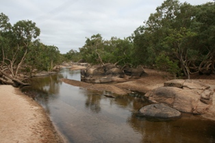
The Mission River is a river located in Far North Queensland, Australia.

Eton is a town and a locality in the Mackay Region, Queensland, Australia.
Weipa Town is a local government area in Far North Queensland, Australia. It covers the town of Weipa on the western coast of the Cape York Peninsula. It is an unusual local government area as it is not governed and managed by a council elected by residents but rather by the company Comalco through a governing body called the Weipa Town Authority. In the 2011 census, Weipa Town had a population of 3,334 people.

The Aboriginal Shire of Napranum is a local government area in Far North Queensland, Australia. It is on the western side of the Cape York Peninsula around Weipa.
Mission River is a coastal locality split between the Shire of Cook and the Aboriginal Shire of Napranum in Queensland, Australia.
Rocky Point is a coastal locality in the Weipa Town, Queensland, Australia.
Evans Landing is a locality in the Weipa Town, Queensland, Australia.
Weipa Airport is a locality in Weipa Town, Queensland, Australia.
