Tullins

Last updated • 1 min readFrom Wikipedia, The Free Encyclopedia

Tullins
Mairie tullins.jpg
The town hall of Tullins
Blason Clermont-Tonnerre.svg
Location of Tullins
Tullins
France location map-Regions and departements-2016.svg
Red pog.svg
Tullins
Auvergne-Rhone-Alpes region location map.svg
Red pog.svg
Tullins
Coordinates: 45°17′54″N5°29′01″E / 45.2983°N 5.4836°E / 45.2983; 5.4836
Country France
Region Auvergne-Rhône-Alpes
Department Isère
Arrondissement Grenoble
Canton Tullins
Intercommunality CA Pays Voironnais
Government
  Mayor (20202026) Gérald Cantournet [1]
Area
1
28.79 km2 (11.12 sq mi)
Population
 (Jan. 2020) [2]
7,755
  Density270/km2 (700/sq mi)
Time zone UTC+01:00 (CET)
  Summer (DST) UTC+02:00 (CEST)
INSEE/Postal code
38517 /38210
Elevation179–784 m (587–2,572 ft)
(avg. 210 m or 690 ft)
1 French Land Register data, which excludes lakes, ponds, glaciers > 1 km2 (0.386 sq mi or 247 acres) and river estuaries.

Tullins (French pronunciation:  [tylɛ̃] ) is a commune in the Isère department in southeastern France.

Contents

Geography

The agglomeration of Tullins is situated in forested foothills that flank Chambaran Plateau. At its foot lies the alluvial plain of the Isère, which is the agricultural and rural part of the area. The town is traversed by the Fure and bordered by the Isère.

It is located 13 kilometres (8.1 mi) from Vinay and Voiron, 17 kilometres (11 mi) from Le Grand-Lemps, 19 kilometres (12 mi) from Grenoble-Isère International Airport, 23 kilometres (14 mi) from Saint-Marcellin, 26 kilometres (16 mi) from La Côte-Saint-André, and 29 kilometres (18 mi) from Grenoble. The city is served by the Tullins-Fures train station on Grenoble line and the A49 autoroute, which can be accessed 3 kilometres (1.9 mi) from the city center.

Population

Historical population
YearPop.±% p.a.
1793 3,500    
1800 3,715+0.86%
1806 3,819+0.46%
1821 3,765−0.09%
1831 3,807+0.11%
1836 4,712+4.36%
1841 4,701−0.05%
1846 4,920+0.91%
1851 4,618−1.26%
1856 4,497−0.53%
1861 4,523+0.12%
1866 4,991+1.99%
1872 4,834−0.53%
1876 4,881+0.24%
1881 4,740−0.58%
1886 4,590−0.64%
1891 4,701+0.48%
1896 4,740+0.17%
YearPop.±% p.a.
1901 4,541−0.85%
1906 4,432−0.48%
1911 4,578+0.65%
1921 4,114−1.06%
1926 4,594+2.23%
1931 4,465−0.57%
1936 4,403−0.28%
1946 4,235−0.39%
1954 4,514+0.80%
1962 4,650+0.37%
1968 5,319+2.27%
1975 5,557+0.63%
1982 6,044+1.21%
1990 6,269+0.46%
1999 7,068+1.34%
2007 7,612+0.93%
2012 7,638+0.07%
2017 7,680+0.11%
Source: EHESS [3] and INSEE (1968-2017) [4]

See also

Related Research Articles

<span class="mw-page-title-main">Isère</span> Department in Auvergne-Rhône-Alpes, France

Isère is a landlocked department in the southeastern French region of Auvergne-Rhône-Alpes. Named after the river Isère, it had a population of 1,271,166 in 2019. Its prefecture is Grenoble. It borders Rhône to the northwest, Ain to the north, Savoie to the east, Hautes-Alpes to the south, Drôme and Ardèche to the southwest and Loire to the west.

<span class="mw-page-title-main">Voiron</span> Commune in Auvergne-Rhône-Alpes, France

Voiron is a commune in the ninth district of the Isère department in southeastern France. It is the capital of the canton of Voiron and has been part of the Grenoble-Alpes Métropole since 2010. Voiron is located 25 km (16 mi) northwest of Grenoble and 85 km (53 mi) southeast of Lyon. Its roughly 20,000 inhabitants are named Voironnais in French.

<span class="mw-page-title-main">Saint-Martin-d'Hères</span> Commune in Auvergne-Rhône-Alpes, France

Saint-Martin-d'Hères is a commune in the Isère department in southeastern France. Part of the Grenoble urban unit (agglomeration), it is the largest suburb of the city of Grenoble and is adjacent to it on the east.

<span class="mw-page-title-main">Saint-Ismier</span> Commune in Auvergne-Rhône-Alpes, France

Saint-Ismier is a commune in the Isère department in southeastern France. It is part of the Grenoble urban unit (agglomeration).

<span class="mw-page-title-main">Vizille</span> Commune in Auvergne-Rhône-Alpes, France

Vizille is a commune in the Isère department in southeastern France.

<span class="mw-page-title-main">Pellafol</span> Commune in Auvergne-Rhône-Alpes, France

Pellafol is a commune in the Isère department in southeastern France.

<span class="mw-page-title-main">Rives, Isère</span> Commune in Auvergne-Rhône-Alpes, France

Rives is a commune in the Isère department in southeastern France.

<span class="mw-page-title-main">Vif, Isère</span> Commune in Auvergne-Rhône-Alpes, France

Vif is a commune in the Isère department in southeastern France.
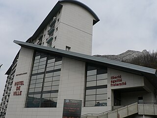
<span class="mw-page-title-main">Saint-Martin-le-Vinoux</span> Commune in Auvergne-Rhône-Alpes, France

Saint-Martin-le-Vinoux is a commune in the Isère department in southeastern France, named after Saint Martin and the region's vineyards. It is part of the Grenoble urban unit (agglomeration). It is located north of the Isère, with an area of 1,006 hectares and altitudes from 205 to 1299 meters.
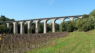
<span class="mw-page-title-main">Saint-Marcellin, Isère</span> Commune in Auvergne-Rhône-Alpes, France

Saint-Marcellin is a commune in the Isère department, in southeastern France, 51 km from Grenoble.

<span class="mw-page-title-main">Biviers</span> Commune in Auvergne-Rhône-Alpes, France

Biviers is a commune in the Isère département in southeastern France.

<span class="mw-page-title-main">Beaucroissant</span> Commune in Auvergne-Rhône-Alpes, France

Beaucroissant is a commune in the Isère department in the Auvergne-Rhône-Alpes region of south-eastern France.

<span class="mw-page-title-main">L'Albenc</span> Commune in Auvergne-Rhône-Alpes, France

L'Albenc is a commune in the Isère department in the Auvergne-Rhône-Alpes region of southeastern France.

<span class="mw-page-title-main">Lus-la-Croix-Haute</span> Commune in Auvergne-Rhône-Alpes, France

Lus-la-Croix-Haute is a commune in the Drôme department in southeastern France.
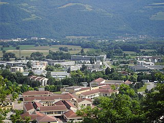
<span class="mw-page-title-main">Montbonnot-Saint-Martin</span> Commune in Auvergne-Rhône-Alpes, France

Montbonnot-Saint-Martin is a commune in the Isère department in southeastern France. It is part of the Grenoble urban unit (agglomeration).

<span class="mw-page-title-main">Saint-Martin-d'Uriage</span> Commune in Auvergne-Rhône-Alpes, France

Saint-Martin-d'Uriage is a commune in the Isère department located in the French Alps, in southeastern France. The nearest major city is Grenoble.

<span class="mw-page-title-main">Saint-Nicolas-de-Macherin</span> Commune in Auvergne-Rhône-Alpes, France

Saint-Nicolas-de-Macherin is a commune in the Isère department within Auvergne-Rhône-Alpes in southeastern France. The area of the commune is 1,060 hectares and the altitude lies between 447 and 952 meters.

<span class="mw-page-title-main">Saint-Quentin-Fallavier</span> Commune in Auvergne-Rhône-Alpes, France

Saint-Quentin-Fallavier is a commune in the Isère department, and the Auvergne-Rhône-Alpes region, in southeastern France.

<span class="mw-page-title-main">Voreppe</span> Commune in Auvergne-Rhône-Alpes, France

Voreppe is a commune in the Isère department in southeastern France. It is part of the Grenoble urban unit (agglomeration). The commune contains the Monastère de Chalais, a Dominican monastery about 7 kilometres (4.3 mi) from the town of Voreppe.

<span class="mw-page-title-main">La Forteresse</span> Commune in Auvergne-Rhône-Alpes, France

La Forteresse is a commune in the Isère department in southeastern France.
References

  1. "Répertoire national des élus: les maires" (in French). data.gouv.fr, Plateforme ouverte des données publiques françaises. 13 September 2022.
  2. "Populations légales 2020". The National Institute of Statistics and Economic Studies. 29 December 2022.
  3. Des villages de Cassini aux communes d'aujourd'hui: Commune data sheet Tullins, EHESS (in French).
  4. Population en historique depuis 1968, INSEE