Typhoon Melor (2009)

Last updated
Map key
  Tropical depression (≤38 mph, ≤62 km/h)
  Tropical storm (39–73 mph, 63–118 km/h)
  Category 1 (74–95 mph, 119–153 km/h)
  Category 2 (96–110 mph, 154–177 km/h)
  Category 3 (111–129 mph, 178–208 km/h)
  Category 4 (130–156 mph, 209–251 km/h)
  Category 5 (≥157 mph, ≥252 km/h)
  Unknown
Storm type
Disc Plain black.svg Tropical cyclone
Solid black.svg Subtropical cyclone
ArrowUp.svg Extratropical cyclone, remnant low, tropical disturbance, or monsoon depression

On September 28, an area of convectional cloudiness formed 370 km (230 mi) to the northeast of Pohnpei. Satellite imagery showed a Low Level Circulation Centre had begun to form. On the evening of September 28, due to a TUTT that was providing good outflow for the system and low level vertical wind shear with a favorable environment, the JTWC issued a Tropical Cyclone Formation Alert. Early on September 29, both JMA and JTWC upgraded the system into a tropical depression. Early on September 30, JMA reported that the depression had intensified into a tropical storm and assigned its international designated name, Melor. At the same time JTWC also classified the depression as a tropical storm. Early on October 1, Melor intensified further from a severe tropical storm into a typhoon. Intensification continued, and by the afternoon of the same day the JTWC reported that Melor had intensified into a Category 1-equivalent typhoon. In just four hours, it intensified rapidly to a Category 3-equivalent typhoon, and continued to track towards northeast Luzon. Early on October 2, it strengthened to a Category 4-equivalent typhoon. After levelling out in intensity, it strengthened again on October 3. Early October 4, JTWC reported that Melor had intensified to a Category-5 equivalent super typhoon, with JMA reporting a central pressure of 910 hPa and winds of 205 km/h. On October 5, PAGASA allocated the name Quedan to the typhoon as the storm moved into Philippine's area of responsibility. It interacted with Typhoon Parma in Parma's second landfall in the Philippines. By the midday of October 8, Melor made landfall on Japan. [1] [2] After landfall, JMA downgraded Melor into a severe tropical storm, while the JTWC downgraded it into an extratropical storm. Late on October 11, the extratropical remnants of Melor were completely absorbed by a newly formed extratropical storm to the north, near Alaska. The new extratropical storm then strengthened into a powerful storm, which then began to impact the west coast of the United States, late on October 13.

Preparations

Late on September 30, the island of Guam, was placed under a tropical storm warning, while the islands of Rota, Tinian and Saipan were placed under a typhoon watch. [3] These warnings stayed in force until late on October 1, when the islands of Tinian and Saipan were placed under a typhoon warning. The warnings for the islands of Rota, Agrihan and Guam were also revised at this time with Rota and Agrihan placed under typhoon watches and tropical storm warnings, while Guam was placed under a tropical storm warning. [4] Late the next day the warnings were once again revised with the tropical storm warning for Guam and while the typhoon watch was cancelled for both Rota and Agrihan, with Agrihan placed under a typhoon warning. [5] Rotas remaining tropical storm warning was then cancelled early on October 3, before all of the warnings were cancelled later that day as Melor moved away from the Mariana Islands. [6] [7]

Japan

The Japan Meteorological Agency forecast that Typhoon Melor would make landfall near Tokyo on October 8 (Thursday). Weather forecasters issued warnings about strong winds and high waves on the sea. Melor moved with wind speeds of 252 kilometers per hour (156 mph) and bore down on the island of Minami Daito. Typhoon Melor, which was located at 512 km from the southeast of Naha in Okinawa on October 6 at 12 p.m. Japan time, was predicted to be on a path for Tokyo. The Japan Meteorological Agency forecast that the typhoon would have a speed of 180 km/h near its center. An official at the agency warned residents that the typhoon could bring very strong winds and high sea waves. [8]

Impact

Mariana Islands

Typhoon Melor near the Mariana Islands on October 3 Typhoon Melor October 3 2009 0339z.jpg
Typhoon Melor near the Mariana Islands on October 3

Although a very powerful typhoon during its passage of the Mariana Islands, Melor produced little damage in the region. The main effects were minor flooded from heavy rainfall in Saipan. High winds also downed a few power lines and trees; however, no structural damage was reported. [9] Roughly 2.5 in (64 mm) of rain fell on the island during the passage of Melor, including 2 in (51 mm) during a six-hour span. [10] At the height of the storm, roughly 500 residences were without power on Tinian and Saipan; this was quickly reduced to 90 residences within several hours. [11]

Japan

Typhoon Melor approaching Japan on October 7 Melor oct 7 2009.jpg
Typhoon Melor approaching Japan on October 7

As a weakened typhoon, Melor made landfall in Japan on October 7 with wind gusts over 155 km/h (100 mph), causing massive power outages. At the height of the storm, an estimated 500,000 residences, mainly around Tokyo, were without power. Trains were canceled during the storm as they were unable to travel in conditions produced by the storm. More than 2 million people, attempting to get to work, were stranded as transportation halted. [12] According to the Fire and Disaster Management Agency, two people were killed during the storm and at least 100 other were injured throughout the country in various incidents. [13] The first death occurred after a man on a motorcycle crashed into a downed tree and the other occurred after a man was struck by a broken tree limb. [14] Roughly 400 homes were damaged or destroyed by Melor and monetary damages amounted to 130 billion yen ($1.5 billion USD). [13]

Another 64 people were injured, according to local media reports, after Melor reached landfall in Japan's Aichi prefecture early Thursday morning.

Typhoon Melor landed south-west of Tokyo on the main island of Honshū on Thursday, October 8, causing at least two deaths and cutting electricity to thousands. Flights were also canceled and people evacuated amid flood and landslide warnings.

Still, initial damage reports suggested the typhoon, while powerful, did not cause the type of widespread devastation initially warned. Meteorologists had been warning that the storm could be the most powerful to hit Japan in more than a decade. Melor was the first typhoon to reach landfall in Japan in two years.

The storm was expected to drift off the country's eastern coast into the Pacific Ocean by Thursday evening. An official at Japan's meteorological agency said the storm weakened as it moved along the eastern coast, preventing heavier damage.

The typhoon brought wind speeds of about 160 kilometers per hour while dumping 30 centimeters of rain in some regions, according to Japan Meteorological Agency.

One 54-year-old man was killed while delivering newspapers when his bike hit a fallen tree in the early morning, while a 69-year-old man died in Saitama prefecture near Tokyo after a tree fell on him, according to local police officials.

Many factories in the manufacturing-rich prefectures in central Japan were also shut from the storm. [15] [16]

California

The extratropical cyclone impacting California, after absorbing Melor's remnants. Melor Satellite off cali.gif
The extratropical cyclone impacting California, after absorbing Melor's remnants.

On October 14, 2009, the extratropical cyclone that had absorbed Melor's remnants impacted California, and broke several rainfall records. [17] Local California media had reported that the remnant of Typhoon Melor was able to kick up winds to as high as 70 mph (110 km/h). Some trees and power lines were downed as a result of this storm. Melor's remnants produced up to 10 inches of rain in California's Santa Cruz Mountains.

Aftermath

Japan

The typhoon left 3 dead and caused $1.5 billion (2009 USD) in damage.

See also

Related Research Articles

<span class="mw-page-title-main">2005 Pacific typhoon season</span> Typhoon season in the Western Pacific Ocean

The 2005 Pacific typhoon season was the least active typhoon season since 2000, producing 23 named storms, of which 13 became typhoons. It was an event in the annual cycle of tropical cyclone formation, in which tropical cyclones form in the western Pacific Ocean. The season ran throughout 2005, though most tropical cyclones typically develop between May and October. The season's first named storm, Kulap, developed on January 13, while the season's last named storm, Bolaven, dissipated on November 20. The season's first typhoon, Haitang, reached typhoon status on July 13, and became the first super typhoon of the year three days later.

<span class="mw-page-title-main">2007 Pacific typhoon season</span> Typhoon season in the Western Pacific Ocean

The 2007 Pacific typhoon season was a below average season which featured 24 named storms, fourteen typhoons, and five super typhoons. It was an event in the annual cycle of tropical cyclone formation, in which tropical cyclones form in the western Pacific Ocean. The season ran throughout 2007, though most tropical cyclones typically develop between May and November. The season's first named storm, Kong-rey, developed on March 30, while the season's last named storm, Mitag, dissipated on November 27. The season's first typhoon, Yutu, reached typhoon status on May 18, and became the first super typhoon of the year on the next day.

<span class="mw-page-title-main">2004 Pacific typhoon season</span> Typhoon season in the Western Pacific Ocean

The 2004 Pacific typhoon season was an extremely active season that featured the second-highest ACE ever recorded in a single season, second only to 1997, which featured 29 named storms, nineteen typhoons, and six super typhoons. It was an event in the annual cycle of tropical cyclone formation, in which tropical cyclones form in the western Pacific Ocean. The season ran throughout 2004, though most tropical cyclones typically develop between May and October. The season's first named storm and also the first typhoon, Sudal, developed on April 4, later was reached typhoon status two days later, and became the first super typhoon of the year three days later. The season's last named storm, Noru, dissipated on December 21.

<span class="mw-page-title-main">2008 Pacific typhoon season</span> Typhoon season in the Western Pacific Ocean

The 2008 Pacific typhoon season was a below average season which featured 22 named storms, eleven typhoons, and two super typhoons. The season had no official bounds; it ran year-round in 2008, but most tropical cyclones tend to form in the northwestern Pacific Ocean between May and November. These dates conventionally delimit the period of each year when most tropical cyclones form in the northwestern Pacific Ocean.

<span class="mw-page-title-main">Typhoon Kong-rey (2007)</span> Pacific typhoon in 2007

Typhoon Kong-rey was a moderate typhoon that affected Guam and the Northern Mariana Islands in early April 2007. The first named storm of the 2007 Pacific typhoon season, Kong-rey became the earliest-occurring typhoon since Typhoon Sudal in 2004. At its peak, it was considered to be a Category 2-equivalent typhoon by the Joint Typhoon Warning Center, though re-analysis increased it to a Category 3-equivalent. Typhoon Kong-rey caused about $10,000 in damages and no injuries along its path.

<span class="mw-page-title-main">Timeline of the 2008 Pacific typhoon season</span>

This timeline documents all the storm formations, strengthening, weakening, landfalls, extratropical transitions, as well as dissipation during the 2008 Pacific typhoon season. The 2008 Pacific typhoon season officially started on January 1, 2008 and ended on January 1, 2009. The first tropical cyclone of the season formed on January 13. The timeline also includes information which was not operationally released, meaning that information from post-storm reviews by the various warning agencies, such as information on a storm that was not operationally warned on, has been included.

<span class="mw-page-title-main">2009 Pacific typhoon season</span> Typhoon season in the Western Pacific Ocean

The 2009 Pacific typhoon season was a below average season that spawned only 22 named storms, 13 typhoons, and five super typhoons. It was also recognized as the deadliest season in the Philippines for decades. The first half of the season was very quiet whereas the second half of the season was extremely active. The season's first named storm, Kujira, developed on May 3 while the season's last named storm, Nida, dissipated on December 3.

<span class="mw-page-title-main">Typhoon Dolphin (2008)</span> Pacific typhoon in 2008

Typhoon Dolphin, known in the Philippines as Typhoon Ulysses, was the final named storm and typhoon of the 2008 Pacific typhoon season. The only impact that was reported from Dolphin was to the M/Bca Mae Jan, which was a cargo passenger ship which sank on December 14, due to rough seas caused by Dolphin. There were 46 people reported dead while seven were reported as missing.

<span class="mw-page-title-main">Typhoon Tingting</span> Pacific typhoon in 2004

Typhoon Tingting was a destructive tropical cyclone that produced record-breaking rains in Guam. The eighth named storm of the 2004 Pacific typhoon season, Tingting originated from a tropical depression over the open waters of the western Pacific Ocean. The storm gradually intensified as it traveled northwest, becoming a typhoon on June 28 and reaching its peak the following day while passing through the Mariana Islands. After maintaining typhoon intensity for three days, a combination of dry air and cooler sea surface temperatures caused the storm to weaken as it traveled northward. On July 1, the storm passed by the Bonin Islands, off the coast of Japan, before moving out to sea. By July 4, Tinting had transitioned into an extratropical cyclone. The remnants were last reported by the Japan Meteorological Agency, the Regional Specialized Meteorological Center for the western Pacific basin, near the International Date Line on July 13.

<span class="mw-page-title-main">Tropical Storm Faxai (2007)</span> Pacific severe tropical storm in 2007

Severe Tropical Storm Faxai, known in the Philippines as Tropical Storm Juaning, was a short-lived tropical storm that had minor effects on land. The twentieth named storm of the 2007 Pacific typhoon season, Faxai originated from a tropical depression over the open waters of the western Pacific Ocean in late October. The storm quickly strengthened, becoming a severe tropical storm on October 26 as it rapidly traveled toward the northeast. The storm became extratropical the following day as it brushed Japan. The remnants dissipated on October 28.

<span class="mw-page-title-main">Tropical Depression 18W (2009)</span> Pacific tropical depression in 2009

Tropical Depression 18W was a weak, short-lived tropical cyclone that brought heavy rains to parts of the Mariana Islands ahead of the more intense Typhoon Melor. Forming from an area of low pressure on September 26, 18W was first monitored by the Japan Meteorological Agency (JMA) as a tropical depression. Tracking generally towards the west, deep convection gradually developed around the system and the Joint Typhoon Warning Center (JTWC) issued their first advisory on the depression early on September 28. Although the depression initially struggled to maintain deep convection, it eventually became better organized and was upgraded to a tropical storm on September 29 by the JTWC. Several hours after reaching this intensity, the system began to rapidly dissipate as its inflow and outflow were severely disrupted by two nearby storms, Parma to the west and Melor to the east. The cyclone fully dissipated near Guam early on September 30 before being absorbed by Typhoon Parma.

<span class="mw-page-title-main">Typhoon Choi-wan (2009)</span> Pacific typhoon in 2009

Typhoon Choi-wan was a powerful typhoon that became the first Category 5-equivalent super typhoon to form during the 2009 Pacific typhoon season. Forming on September 11, 2009, about 1,100 km (700 mi) to the east of Guam, the initial disturbance rapidly organized into a tropical depression. By September 12, the depression intensified into a tropical storm, at which time it was given the name Choi-wan. The following day, rapid intensification took place through September 14. Choi-wan attained its peak intensity on September 15, as it moved through the Northern Mariana Islands with the Japan Meteorological Agency reporting peak 10-minute sustained winds of 195 km/h (121 mph). Additionally, the Joint Typhoon Warning Center reported the storm to have attained 1-minute sustained winds of 260 km/h (160 mph). The typhoon remained very powerful until September 17 when the storm's outflow weakened. The typhoon underwent an eyewall replacement cycle, leading to intensity fluctuations. By September 19, Choi-wan rapidly weakened as strong wind shear caused convection to diminish. The following day, the system transitioned into an extratropical cyclone and dissipated several hours later over open waters.

<span class="mw-page-title-main">Typhoon Mirinae (2009)</span> Pacific typhoon in 2009

Typhoon Mirinae, known in the Philippines as Typhoon Santi, was the 34th depression and the 14th typhoon in the 2009 Pacific typhoon season. It came several weeks after Typhoons Ketsana and Parma devastated the Philippines, thus adding additional damage wrought by the two preceding typhoons.

<span class="mw-page-title-main">2015 Pacific typhoon season</span> Typhoon season in the Western Pacific Ocean

The 2015 Pacific typhoon season was a slightly above average season that produced 27 tropical storms, 18 typhoons, and nine super typhoons. The season ran throughout 2015, though most tropical cyclones typically develop between May and November. The season's first named storm, Mekkhala, developed on January 15, while the season's last named storm, Melor, dissipated on December 17. The season saw at least one named tropical system forming in each of every month, the first time since 1965. Similar to the previous season, this season saw a high number of super typhoons. Accumulated cyclone energy (ACE) during 2015 was extremely high, the third highest since 1970, and the 2015 ACE has been attributed in part to anthropogenic warming.

<span class="mw-page-title-main">2018 Pacific typhoon season</span> Typhoon season in the Western Pacific Ocean

The 2018 Pacific typhoon season was at the time, the costliest Pacific typhoon season on record, until the record was beaten by the following year. The season was well above-average, producing 29 storms, 13 typhoons, and 7 super typhoons. It was an event in the annual cycle of tropical cyclone formation, in which tropical cyclones form in the western Pacific Ocean. The season ran throughout 2018, though most tropical cyclones typically develop between May and October. The season's first named storm, Bolaven, developed on January 3, while the season's last named storm, Man-yi, dissipated on November 28. The season's first typhoon, Jelawat, reached typhoon status on March 29, and became the first super typhoon of the year on the next day.

<span class="mw-page-title-main">Typhoon Joan (1997)</span> Pacific typhoon in 1997

Typhoon Joan was the longest-lasting super typhoon at the time, maintaining 1-minute maximum sustained winds of at least 240 km/h (150 mph) for 4.5 days. Joan, concurrently with Typhoon Ivan to its west, also became the strongest typhoons at the same time in the northwest Pacific Ocean. The 25th named storm during the hyperactive 1997 Pacific typhoon season, Joan developed from the same trough as Typhoon Ivan on October 11. It moved northwestward and later to the west, undergoing explosive deepening to its peak intensity on October 15. One typhoon warning agency estimated that Joan was among the strongest storms on record in the basin, and that Ivan and Joan marked the first occurrence of simultaneous super typhoons. While near peak intensity, Joan passed between Anatahan and Saipan in the Northern Marianas Islands. Later, the typhoon weakened and turned to the north and east, becoming extratropical on October 24.

<span class="mw-page-title-main">Timeline of the 2014 Pacific typhoon season</span>

This timeline documents all of the events of the 2014 Pacific typhoon season. Most of the tropical cyclones forming between May and November. The scope of this article is limited to the Pacific Ocean, north of the equator between 100°E and the International Date Line. Tropical storms that form in the entire Western Pacific basin are assigned a name by the Japan Meteorological Agency. Tropical depressions that form in this basin are given a number with a "W" suffix by the United States' Joint Typhoon Warning Center. In addition, the Philippine Atmospheric, Geophysical and Astronomical Services Administration (PAGASA) assigns names to tropical cyclones that enter or form in the Philippine area of responsibility. These names, however, are not in common use outside of the Philippines.

<span class="mw-page-title-main">Typhoon Rammasun</span> Pacific typhoon in 2014

Typhoon Rammasun, known in the Philippines as Typhoon Glenda, was one of the only three Category 5 super typhoons on record in the South China Sea, with the other ones being Pamela in 1954 and Rai in 2021. Rammasun had destructive impacts across the Philippines, South China, and Vietnam in July 2014. Rammasun is a Siamese word for thunder god. After Lingling and Kajiki earlier in 2014, Rammasun became the third tropical cyclone, and first typhoon to directly impact the Philippines in 2014. The ninth named storm and the third typhoon of the annual typhoon season, Rammasun formed in the Intertropical Convergence Zone, an area near the equator where the northeast and southeast trade winds come together, and slowly drifted northwest. Having passed through the islands of Micronesia, the system turned west and quickly moved under the influence of a subtropical ridge (STR). Rammasun posed a significant threat to the Philippine island of Luzon, as it was expected to reach typhoon intensity before making landfall there. Though initially forecast to make landfall in Cagayan Valley, the storm followed a more westerly path and was later forecast to make landfall in the Bicol Region and then pass through Bataan and Zambales before brushing past Metro Manila.

<span class="mw-page-title-main">Tropical Storm Bavi (2015)</span> Pacific tropical storm in 2015

Tropical Storm Bavi, known in the Philippines as Tropical Storm Betty, influenced the trade winds over the Pacific Ocean and was partially responsible for one of the strongest trade wind reversals ever observed. The system was first noted as a tropical disturbance during March 8, 2015, while it was located to the southeast of Kwajalein Atoll in the Marshall Islands. Over the next couple of days the system moved north-westwards through the Marshall Islands, before it was classified as a tropical depression during March 10. The system subsequently moved north-westwards and continued to develop further, before it was classified as the third tropical storm of the 2015 Pacific typhoon season and named Bavi by the Japan Meteorological Agency (JMA) during March 11. After continuing its north-westwards movement, the system peaked as a tropical storm during March 14, before it started to weaken as it approached the Mariana Islands. The system subsequently passed over Guam during the next day, before continuing its west-northwestwards movement as it gradually weakened over the next few days. The system entered the Philippine area of responsibility, where it was named Betty by PAGASA during March 17 as the system weakened into a tropical depression. The system was subsequently last noted during March 21, as it dissipated over the Philippines.

<span class="mw-page-title-main">Typhoon Hagibis</span> Pacific typhoon in 2019

Typhoon Hagibis, known in Japan as Typhoon No.19 or Reiwa 1 East Japan Typhoon, was a large and costly tropical cyclone that caused widespread destruction in Japan. The thirty-eighth depression, ninth typhoon, and third super typhoon of the 2019 Pacific typhoon season, it was the strongest typhoon to strike mainland Japan in decades, and one of the largest typhoons ever recorded, with a peak gale-force diameter of 825 nautical miles. The typhoon raised global media attention, as it greatly affected the 2019 Rugby World Cup being hosted by Japan. Hagibis was also the deadliest typhoon to strike Japan since Typhoon Fran in 1976.

References

  1. "台風第18号による暴風・大雨". www.data.jma.go.jp (in Japanese). 気象庁 . Retrieved 2022-11-11.
  2. "2009年 台風18号 (自然災害の映像記録)" (in Japanese). NHK . Retrieved 2022-11-11.
  3. Dan Mundell (2009-09-30). "Tropical Storm Melor (20W) Advisory Number 6 2009-09-30 16z". National Weather Service Forecast Office in Tiyan Guam. Archived from the original on 2009-11-19. Retrieved 2009-11-19.
  4. Dan Mundell & Derek Williams (2009-10-01). "Tropical Storm Melor (20W) Advisory Number 11 2009-10-01 22z". National Weather Service Forecast Office in Tiyan Guam. Archived from the original on May 27, 2010. Retrieved 2009-11-19.
  5. Carl Mcelroy & Derek Williams (2009-10-02). "Tropical Storm Melor (20W) Advisory Number 15 2009-10-02 22z". National Weather Service Forecast Office in Tiyan Guam. Archived from the original on 2009-11-19. Retrieved 2009-11-19.
  6. Paul Stanko (2009-10-03). "Tropical Storm Melor (20W) Advisory Number 17 2009-10-03 10z". National Weather Service Forecast Office in Tiyan Guam. Archived from the original on 2009-11-19. Retrieved 2009-11-19.
  7. Clint Simpson (2009-10-03). "Tropical Storm Melor (20W) Advisory Number 19 2009-10-03 22z". National Weather Service Forecast Office in Tiyan Guam. Archived from the original on 2009-11-19. Retrieved 2009-11-19.
  8. "Typhoon Melor Japan"
  9. Laura Matthews (2009-10-05). "Typhoon Melor spares Marianas". Pacific Daily News: Guam. Archived from the original on October 17, 2009. Retrieved 2009-10-17.
  10. "Typhoon Melor begins move from Northern Marianas". Associated Press. 2009-10-03. Archived from the original on October 10, 2009. Retrieved 2009-10-17.
  11. Moneth Deposa (2009-10-05). "90 homes still without power due to typhoon". Saipan Tribune. Archived from the original on 2009-10-17. Retrieved 2009-10-17.
  12. "Typhoon cuts power, disrupts travel in Japan". NBC News. Associated Press. 2009-10-08. Retrieved 2009-10-17.
  13. 1 2 Aaron Sheldrick (2009-10-09). "Japan Recovers From Typhoon Melor as New Storm Forms (Update1)". Bloomberg News.
  14. "Two killed as typhoon wreaks havoc on Japan". The Star. Associated Press. 2009-10-08. Archived from the original on October 11, 2009. Retrieved 2009-10-27.
  15. Daisuke Wakabayashi (October 9, 2009). "Typhoon Melor Hits Japan, Halts Trains, Suspends Flights". The Wall Street Journal. Retrieved January 30, 2014.
  16. "Typhoon lashes Japan on landfall". BBC News. October 8, 2009. Retrieved January 30, 2014.
  17. "List of California hurricanes"
Typhoon Melor (Quedan)
Melor Oct 4 2009 0115Z (alternate).jpg
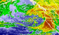
Melor prior to peak intensity on October 4