
This timeline documents all of the events of the 2005 Pacific typhoon season, the period that tropical cyclones formed in the Western Pacific Ocean during the year. The scope of this article is limited to the Pacific Ocean, north of the equator between 100°E and the International Date Line. Tropical depressions that form in the basin were given a number with a "W" suffix by the United States' Joint Typhoon Warning Center (JTWC). If a depression intensified into a tropical storm, it would be assigned a name by the Japan Meteorological Agency (JMA). In addition, the Philippine Atmospheric, Geophysical and Astronomical Services Administration (PAGASA) assigned names to tropical cyclones which were in their area of responsibility.

The 2008 Pacific typhoon season was a below average season which featured 22 named storms, eleven typhoons, and two super typhoons. The season had no official bounds; it ran year-round in 2008, but most tropical cyclones tend to form in the northwestern Pacific Ocean between May and November. These dates conventionally delimit the period of each year when most tropical cyclones form in the northwestern Pacific Ocean.

This timeline documents all the storm formations, strengthening, weakening, landfalls, extratropical transitions, as well as dissipation during the 2008 Pacific typhoon season. The 2008 Pacific typhoon season officially started on January 1, 2008 and ended on January 1, 2009. The first tropical cyclone of the season formed on January 13. The timeline also includes information which was not operationally released, meaning that information from post-storm reviews by the various warning agencies, such as information on a storm that was not operationally warned on, has been included.
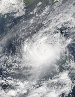
Severe Tropical Storm Halong, known in the Philippines as Typhoon Cosme, was the fourth severe tropical storm named by the Japan Meteorological Agency (JMA), which is the Regional Specialized Meteorological Centre for the Northwestern Pacific Ocean. The Joint Typhoon Warning Center also recognized Halong as the fifth tropical depression, the fourth tropical storm, as well as the third typhoon of the 2008 Pacific typhoon season.

Typhoon Rammasun, known in the Philippines as Typhoon Butchoy, was recognized as the second typhoon of the 2008 Pacific typhoon season by the Japan Meteorological Agency (JMA) and the Philippine Atmospheric, Geophysical and Astronomical Services Administration (PAGASA). Rammasun was also recognised as the third tropical storm, the second typhoon and the first super typhoon of the 2008 Pacific typhoon season by the Joint Typhoon Warning Center (JTWC).

Severe Tropical Storm Maysak, known in the Philippines as Tropical Storm Quinta-Siony, was recognised as the 19th tropical storm by the Japan Meteorological Agency. It was also recognised as the 24th tropical depression and the 22nd tropical storm by the Joint Typhoon Warning Center of the 2008 Pacific typhoon season.
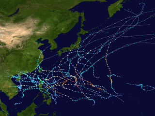
The 2009 Pacific typhoon season was a below average season that spawned only 22 named storms, 13 typhoons, and five super typhoons. It was also recognized as the deadliest season in the Philippines for decades. The first half of the season was very quiet whereas the second half of the season was extremely active. The season's first named storm, Kujira, developed on May 3 while the season's last named storm, Nida, dissipated on December 3.
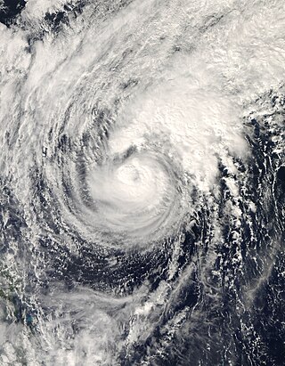
Typhoon Dolphin, known in the Philippines as Typhoon Ulysses, was the final named storm and typhoon of the 2008 Pacific typhoon season. The only impact that was reported from Dolphin was to the M/Bca Mae Jan, which was a cargo passenger ship which sank on December 14, due to rough seas caused by Dolphin. There were 46 people reported dead while seven were reported as missing.

Typhoon Chan-hom, known in the Philippines as Typhoon Emong, was the sixth tropical depression and the second tropical storm to develop during the 2009 Pacific typhoon season. Chan-hom developed out of an area of convectional cloudiness associated with an area of disturbed weather which originated from the remnants of Tropical Depression Crising and formed southeast of Nha Trang, Vietnam on May 2. Moving towards the northeast, it slowly organized according to JTWC who issued a TCFA, and JMA classified Chan-hom as a minor tropical depression later that day. The next day, both JTWC and JMA upgraded the depression to a tropical storm and named it Chan-hom. On May 6, the storm intensified into a Category 1 typhoon, and on May 7, Chan-hom intensified into a Category 2 typhoon equivalent. However, Chan-hom weakened into a severe tropical storm after passing northern Luzon. On May 14, Chan-hom regenerated into a Tropical Depression, before dissipating late on May 15.

This timeline documents all of the events of the 2009 Pacific typhoon season which was the period that tropical cyclones formed in the Western Pacific Ocean during 2009, with most of the tropical cyclones forming between May and November. The scope of this article is limited to the Pacific Ocean, north of the equator between 100°E and the International Date Line. Tropical storms that form in the entire Western Pacific basin are assigned a name by the Japan Meteorological Agency. Tropical depressions that form in this basin are given a number with a "W" suffix by the United States' Joint Typhoon Warning Center. In addition, the Philippine Atmospheric, Geophysical and Astronomical Services Administration (PAGASA) assigns names to tropical cyclones that enter or form in the Philippine area of responsibility. These names, however, are not in common use outside of the Philippines.

Typhoon Kujira, known in the Philippines as Typhoon Dante, was first reported by the Joint Typhoon Warning Center (JTWC) on April 28. It was the fourth depression and the first typhoon of the season. The disturbance dissipated later that day however it regenerated early on April 30 within the southern islands of Luzon. It was then designated as a Tropical Depression during the next morning by the Philippine Atmospheric, Geophysical and Astronomical Services Administration (PAGASA) and the Japan Meteorological Agency (JMA), with PAGASA assigning the name Dante to the depression. However the JTWC did not designate the system as a depression until early on May 2 which was after the depression had made landfall on the Philippines. Later that day Dante was upgraded to a Tropical Storm and was named as Kujira by the JMA. The cyclone started to rapidly intensify becoming a typhoon early on May 4, and then reaching its peak winds of 155 km/h (100 mph) (10-min), 215 km/h (135 mph) (1-min) later that day after a small clear eye had developed.
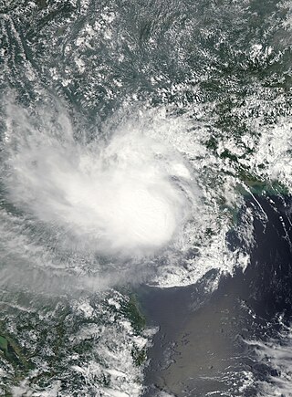
Tropical Storm Mujigae, known in the Philippines as Tropical Depression Maring was a tropical storm that affected the Philippines, China, Hong Kong, and Vietnam in September 2009. Mujigae originated from an area of convection that developed along with a monsoon trough with favorable conditions on 8 September. The disturbance organized to a tropical depression and was assigned the names 14W by the Joint Typhoon Warning Center and Maring by PAGASA later that day. Tropical Depression 14W would rapidly develop and attain tropical storm status by the JMA and be assigned the name Mujigae on 10 September. Mujigae soon encountered unfavorable conditions with wind shear and make landfall in Hainan Island on 11 September and Vietnam on 12 September before rapidly weakening and dissipating.
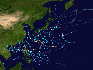
The 2011 Pacific typhoon season was a below average season that produced a total of 21 named storms, 8 typhoons, and four super typhoons. This season was much more active than the previous season, although both seasons were below the Pacific typhoon average of 26. The season ran throughout 2011, though most tropical cyclone tend to develop between May and October. The season's first named storm, Aere, developed on May 7 while the season's last named storm, Washi dissipated on December 19.

The 2013 Pacific typhoon season was the most active Pacific typhoon season since 2004, and the deadliest since 1975. It featured Typhoon Haiyan, one of the most powerful storms and one of the strongest landfalling tropical cyclones in history. It was an above-average season with 31 named storms, 13 typhoons, and five super typhoons. The season's first named storm, Sonamu, developed on January 4 while the season's last named storm, Podul, dissipated on November 15. Despite the activity, most of the first seventeen named storms before mid-September were relatively weak, as only two of them reached typhoon intensity. Total damage amounted to at least $26.41 billion (USD), making it at the time the costliest Pacific typhoon season on record; it is currently the fourth costliest, behind the 2018, 2019 and 2023 seasons.
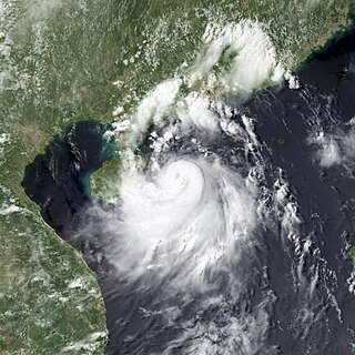
Severe Tropical Storm Rumbia, known in the Philippines as Tropical Storm Gorio, was a tropical cyclone that brought widespread flooding in areas of the Philippines and China late June and early July 2013. The sixth internationally named storm of the season, Rumbia formed from a broad area of low pressure situated in the southern Philippine Sea on June 27. Steadily organizing, the initial tropical depression moved towards the northwest as the result of a nearby subtropical ridge. On June 28, the disturbance strengthened to tropical storm strength, and subsequently made its first landfall on Eastern Samar in the Philippines early the following day. Rumbia spent roughly a day moving across the archipelago before emerging into the South China Sea. Over open waters, Rumbia resumed strengthening, and reached its peak intensity with winds of 95 km/h (50 mph) on July 1, ranking it as a severe tropical storm. The tropical cyclone weakened slightly before moving ashore the Leizhou Peninsula late that day. Due to land interaction, Rumbia quickly weakened into a low pressure area on July 2 and eventually dissipated soon afterwards.

Most of the tropical cyclones of the 2013 Pacific typhoon season formed between May and November of that year. The scope of this article is the Pacific Ocean north of the equator, between 100°E and the International Date Line. Tropical storms which form in the Western Pacific basin are assigned a name by the Japan Meteorological Agency (JMA). Tropical depressions forming in this basin are given a number with a "W" suffix by the United States' Joint Typhoon Warning Center (JTWC). The Philippine Atmospheric, Geophysical and Astronomical Services Administration (PAGASA) assigns names to tropical cyclones that enter or form in the Philippine area of responsibility, but these names are not in common use outside the Philippines.
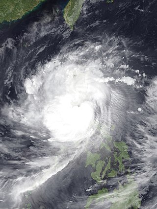
Typhoon Nari, known in the Philippines as Typhoon Santi, was a strong and deadly tropical cyclone that first struck Luzon before striking Vietnam. The storm was the 41st depression and the 8th typhoon in the 2013 typhoon season. Typhoon Nari was a deadly typhoon that made landfall in the Philippines and Vietnam. Nari made landfall on October 14, 2013 as a moderate category 1 typhoon.

Tropical Storm Lingling, known in the Philippines as Tropical Depression Agaton, was a weak but deadly tropical cyclone that affected the Philippines in January 2014. The first named storm of the annual typhoon season, this early-season cyclone remained very disorganized throughout its lifespan. Lingling was the first major natural disaster in the Philippines after Typhoon Haiyan just two months earlier, as it caused widespread landslide incidents and floods in Mindanao, resulting in 70 deaths and damage amounting to over 566 million pesos on the island.

The effects of the 2013 Pacific typhoon season in the Philippines were considered some of the worst in decades. Throughout the year, a series of typhoons impacted the country, with the worst impacts coming from Typhoon Haiyan, especially in death toll, during November.

Typhoon Koppu, known in the Philippines as Super Typhoon Lando, was a powerful and devastating tropical cyclone that struck Luzon in October 2015. It was the twenty-fourth named storm and the fifteenth typhoon of the annual typhoon season. Similar to Goni earlier in the year, Koppu originated from a tropical disturbance east of the Mariana Islands on October 10. Moving briskly west, the system consolidated into a tropical depression the following day and further into a tropical storm on October 13. Situated over the warm waters of the Philippine Sea, Koppu quickly deepened. The storm reached its peak intensity on October 17 with ten-minute sustained winds of 185 km/h (115 mph) according to the Japan Meteorological Agency (JMA). The Joint Typhoon Warning Center assessed Koppu to have been a Category 4-equivalent super typhoon with one-minute sustained winds of 240 km/h (150 mph). The storm subsequently made landfall at this strength near Casiguran, Philippines. Rapid weakening ensued due to interaction with the mountainous terrain of Luzon and the disheveled core of Koppu emerged over the South China Sea on October 19. Unfavorable environmental conditions inhibited reorganization and the system diminished to a tropical depression on October 21.


