Upnor Formation

Last updated
Upnor Formation
Stratigraphic range: Thanetian
~58.7–55.8  Ma
O
S
D
C
P
T
J
K
Pg
N
Lambeth Group Gilbert's Pit.jpg
Exposure in Gilbert's Pit. Dark grey clays, and light grey shelly clays of the Woolwich Formation overlying yellow-brown weathering sands of the Upnor Formation
Type Formation
Unit of Lambeth Group
Sub-unitsBeltinge Fish Bed
Underlies Reading Formation, Woolwich Formation
Overlies Thanet Sand, Chalk Group
Thickness<2–15 m (6.6–49.2 ft)
Lithology
Primary Sandstone
Location
Coordinates 51°24′N1°06′E / 51.4°N 1.1°E / 51.4; 1.1
Approximate paleocoordinates 45°54′N1°00′W / 45.9°N 1.0°W / 45.9; -1.0
Regionsouthern England
CountryFlag of the United Kingdom.svg  United Kingdom
Extent London Basin
Type section
Named for Upnor
England relief location map.jpg
Orange pog.svg
Upnor Formation (England)

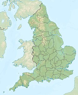
The Upnor Formation is a geological formation found in the London Basin of southeastern England. [1] It is of Thanetian (Upper Paleocene) age. It lies unconformably on the Thanet Formation for most of its outcrop, but in the west it lies directly on Chalk Group. [2] It is generally overlain either by the Reading Formation or the Woolwich Formation, but locally in north and east Kent it is overlain unconformably by the Harwich Formation. It forms the lowermost part of the Lambeth Group. The type section is at Lower Upnor Pit, north Kent. The formation has provided fossils of the eutherian mammal Arctocyonides arenae . [3]
Related Research Articles

<span class="mw-page-title-main">Old Red Sandstone</span> Assemblage of rocks in the North Atlantic region

Old Red Sandstone, abbreviated ORS, is an assemblage of rocks in the North Atlantic region largely of Devonian age. It extends in the east across Great Britain, Ireland and Norway, and in the west along the eastern seaboard of North America. It also extends northwards into Greenland and Svalbard. These areas were a part of the paleocontinent of Euramerica (Laurussia). In Britain it is a lithostratigraphic unit to which stratigraphers accord supergroup status and which is of considerable importance to early paleontology. The presence of Old in the name is to distinguish the sequence from the younger New Red Sandstone which also occurs widely throughout Britain.

The geology of Shropshire is very diverse with a large number of periods being represented at outcrop. The bedrock consists principally of sedimentary rocks of Palaeozoic and Mesozoic age, surrounding restricted areas of Precambrian metasedimentary and metavolcanic rocks. The county hosts in its Quaternary deposits and landforms, a significant record of recent glaciation. The exploitation of the Coal Measures and other Carboniferous age strata in the Ironbridge area made it one of the birthplaces of the Industrial Revolution. There is also a large amount of mineral wealth in the county, including lead and baryte. Quarrying is still active, with limestone for cement manufacture and concrete aggregate, sandstone, greywacke and dolerite for road aggregate, and sand and gravel for aggregate and drainage filters. Groundwater is an equally important economic resource.

<span class="mw-page-title-main">London Basin</span> The basin of river Thames in London

The London Basin is an elongated, roughly triangular sedimentary basin approximately 250 kilometres (160 mi) long which underlies London and a large area of south east England, south eastern East Anglia and the adjacent North Sea. The basin formed as a result of compressional tectonics related to the Alpine orogeny during the Palaeogene period and was mainly active between 40 and 60 million years ago.

The Wapiti Formation is a geological formation of the Western Canada Sedimentary Basin in northwestern Alberta, and northeastern British Columbia, Canada. Its deposition spanned the time interval from the lower Campanian through to the upper Maastrichtian, between approximately 80 and 68 Ma. It was named by G.M. Dawson in 1881, presumably for exposures along the lower part of the Wapiti River and downstream along the Smoky River in Alberta.

<span class="mw-page-title-main">Lower Greensand Group</span> Geological unit

The Lower Greensand Group is a geological unit present across large areas of Southern England. It was deposited during the Aptian and Albian stages of the Early Cretaceous. It predominantly consists of sandstone and unconsolidated sand that were deposited in shallow marine conditions.

<span class="mw-page-title-main">Elk Point Group</span>

The Elk Point Group is a stratigraphic unit of Early to Middle Devonian age in the Western Canada and Williston sedimentary basins. It underlies a large area that extends from the southern boundary of the Northwest Territories in Canada to North Dakota in the United States. It has been subdivided into numerous formations, number of which host major petroleum and natural gas reservoirs.

The Slave Point Formation is a stratigraphical unit of Middle Devonian age in the Western Canadian Sedimentary Basin.

<span class="mw-page-title-main">Hebridean Terrane</span> Part of the Caledonian orogenic belt in northwest Scotland

The Hebridean Terrane is one of the terranes that form part of the Caledonian orogenic belt in northwest Scotland. Its boundary with the neighbouring Northern Highland Terrane is formed by the Moine Thrust Belt. The basement is formed by Archaean and Paleoproterozoic gneisses of the Lewisian complex, unconformably overlain by the Neoproterozoic Torridonian sediments, which in turn are unconformably overlain by a sequence of Cambro–Ordovician sediments. It formed part of the Laurentian foreland during the Caledonian continental collision.

The Bouldnor Formation is a geological formation in the Hampshire Basin of southern England. It is the youngest formation of the Solent Group and was deposited during the uppermost Eocene and lower Oligocene.

<span class="mw-page-title-main">Geology of the Isle of Skye</span>

The geology of the Isle of Skye in Scotland is highly varied and the island's landscape reflects changes in the underlying nature of the rocks. A wide range of rock types are exposed on the island, sedimentary, metamorphic and igneous, ranging in age from the Archaean through to the Quaternary.

The geology of Kent in southeast England largely consists of a succession of northward dipping late Mesozoic and Cenozoic sedimentary rocks overlain by a suite of unconsolidated deposits of more recent origin.

<span class="mw-page-title-main">Deadwood Formation</span> Geologic formation of the Williston Basin and Western Canada Sedimentary Basin

The Deadwood Formation is a geologic formation of the Williston Basin and Western Canada Sedimentary Basin. It is present in parts of North and South Dakota and Montana in the United States, and in parts of Alberta, Saskatchewan, and southwestern corner of Manitoba in Canada. It is of Late Cambrian to Early Ordovician age and was named for exposures in Whitewood Creek near Deadwood, South Dakota. It is a significant aquifer in some areas, and its conglomerates yielded significant quantities of gold in the Black Hills of South Dakota.

<span class="mw-page-title-main">Mint Canyon Formation</span> Miocene geologic formation in the Sierra Pelona of California

The Mint Canyon Formation (Tm) is a Miocene geologic formation in the Sierra Pelona Mountains of Los Angeles County, southern California. The formation preserves fossils dating back to the Middle to Late Miocene.

<span class="mw-page-title-main">Thanet Formation</span>

The Thanet Formation is a geological formation found in the London Basin of southeastern England. It is of early to mid-Thanetian age and gave its name to that stratigraphic interval. It was previously known as the Thanet Beds, the Thanet Sands and the Thanet Sand Formation. It was named after the Isle of Thanet. The type sections are Herne Bay in Kent for the upper part of the formation and Pegwell Bay for the lower part. It lies unconformably on the Late Cretaceous Chalk Group. It unconformably underlies the Lambeth Group, generally the Upnor Formation but in Essex it is the Reading Formation.

The Golden Valley Formation is a stratigraphic unit of Late Paleocene to Early Eocene age in the Williston Basin of North Dakota. It is present in western North Dakota and was named for the city of Golden Valley by W.E. Benson and W.M. Laird in 1947. It preserves significant assemblages of fossil plants and vertebrates, as well as mollusk and insect fossils.

This article describes the geology of the New Forest, a national park in Hampshire, in Southern England.

Toad Formation, Grayling Formation, and Toad-Grayling Formation are obsolete names for the strata of the Early to Middle Triassic Doig and Montney Formations. They were applied in the foothills and Rocky Mountains of northeastern British Columbia, on the western edge of the Western Canada Sedimentary Basin. Although the names are considered obsolete, their usage persists.

Guyana occurs within the northern part of the Guiana Shield. The Guiana Shield forms the northern part of the Amazonian Craton, the core of the South American continent.

The Algoa Group is one of five geological groups which comprise the coastal Cenozoic geological deposits in South Africa. The Algoa Group contains six formations which range from Middle Eocene to Late Holocene in age.

The geology of Loch Lomond and The Trossachs National Park in the southwestern part of the Scottish Highlands consists largely of Neoproterozoic and Palaeozoic bedrock faulted and folded and subjected to low grade metamorphism during the Caledonian orogeny. These older rocks, assigned to the Dalradian Supergroup, lie to the northwest of the northeast – southwest aligned Highland Boundary Fault which defines the southern edge of the Highlands. A part of this mountainous park extends south of this major geological divide into an area characterised by younger Devonian rocks which are assigned to the Old Red Sandstone.

References

  1. Upnor Formation at Fossilworks.org
  2. "Upnor Formation". The BGS Lexicon of Named Rock Units. British Geological Survey . Retrieved 31 July 2016.
  3. Hooker & Millbank, 2001

Bibliography