Upper North Fork Feather River Project

Last updated
Satellite view of Lake Almanor (center left); Butt Valley Reservoir is partly visible at bottom left. The large body of water at right is Mountain Meadows Reservoir, part of PG&E's separate Hamilton Branch Project. Wfm lake almanor mountain meadows reservoir andsat.jpg
Satellite view of Lake Almanor (center left); Butt Valley Reservoir is partly visible at bottom left. The large body of water at right is Mountain Meadows Reservoir, part of PG&E's separate Hamilton Branch Project.

The Upper North Fork Feather River Project is a hydroelectric scheme in the Sierra Nevada of California, within Lassen and Plumas Counties. The project consists of three dams, five power plants, and multiple conduits and tunnels in the headwaters of the North Fork Feather River, a major tributary of the FeatherSacramento River systems. The total installed capacity is 362.3 megawatts (MW), producing an annual average of 1,171.9 gigawatt hours (GWh). The project is also contracted for the delivery of irrigation water between March 31 and October 31 of each year. The project is owned and operated by Pacific Gas and Electric Company. [1]

Contents

The project is one of several on the North Fork and its tributaries, forming a hydroelectric system so extensive it has been dubbed the "Stairway of Power". [2] [3]

Background

The project was conceived in the early 1900s under the Great Western Power Company to provide hydroelectricity and water storage for irrigation in the Sacramento Valley. In 1908, the Big Bend or Las Plumas powerhouse was completed on the North Fork southeast of Paradise, generating 40 MW (later uprated to 70 MW) of hydroelectricity, which was sent as far away as Oakland, 154 miles (248 km) away. The power station replaced an earlier 1880 plant built by the Big Bend Tunnel and Mining Company for gold mining operations in the area which ultimately were unprofitable. In 1910, the Big Bend Dam, first permanent dam on the Feather River, was completed to increase the hydraulic head available to the powerhouse. [4] :110–113

During the early years of the project, few roads existed in this rugged section of the Sierra, so construction supplies were delivered via the Western Pacific Railroad, which was also under construction at the time. At its completion, the Big Bend power plant had the largest turbines, transformers and penstocks of any hydroelectric plant in the world. However, year-round generation at the plant was an impossibility due to seasonal fluctuations in the flow of the river. [3]

A large storage reservoir was first proposed to be built at Big Meadows, about 40 miles (64 km) upstream from Big Bend, by engineer Julius M. Howells. Great Western Power Company began to buy land in the valley for the future reservoir, but encountered bitter local opposition. The small town of Prattville in Big Meadows was burned to the ground July 4, 1909; arson was suspected, but has never been proven. [5] :98–99

Construction of the Canyon Dam to impound Lake Almanor at Big Meadows began in 1910. A rough one-way road was blazed from Greenville in the same year to transport workers and construction materials to the site, where a company town called Canyondam was established. [5] :99 Although originally conceived as a multiple-arch dam by its designers John S. Eastwood and H.H. Sinclair, concerns over the safety of this relatively new construction technique led to a change in the design. In March 1913, with over 40 percent of the dam completed, a state commission declared the structure unsafe. The partly completed dam was dynamited and a new earthfill structure, containing over 250,000 cubic yards (190,000 m3) of material, was built. [4] :128 The reservoir's name is a combination of the names of the daughters of Guy C. Earl, the vice president of Great Western. [5] :101 [6]

The construction of this reservoir, which at the time, had a capacity of 220,000 acre-feet (270,000,000 m3), ensured a steady water supply for the powerhouse and for irrigation during the summer. A Great Western Power Company subsidiary, the Western Canal Company, would manage the distribution of water to farmers on the lower Feather River near Oroville in Butte County. [6] Between 1919 and 1921, the first Caribou Powerhouse was built on the tributary Butt Creek, and a tunnel was excavated from Lake Almanor to the creek to provide water for the powerhouse. A high dam on Butt Creek was built in 1924 to increase the total water storage and power capacity. [6] Between 1925 and 1927, the Canyon Dam was expanded, increasing Lake Almanor's capacity to 880,000 acre-feet (1.09 km3). [5] :101–102

In 1930, Pacific Gas and Electric Company (PG&E) acquired the Great Western Power Company and the Upper North Fork Project. However, the Western Canal Company (now known as the Western Canal Water District) continued to hold water rights to Lake Almanor and other PG&E reservoirs along the Feather River, ensuring the continuation of irrigation deliveries. [6] The third project dam, Belden Forebay, was built on the North Fork in 1958 to serve as an afterbay for the Caribou powerplant. The Caribou No. 2 powerplant was also built in 1958 to increase the total project generating capacity. In 1962, the Canyon Dam was raised again, enlarging the lake to its present capacity of 1,308,000 acre-feet (1.613×10⁹ m3). [6]

Six years later, in 1968, the giant Oroville Dam was completed on the Feather River as part of the California State Water Project, forming Lake Oroville, which flooded out most of the lower North Fork, including Big Bend Powerhouse and the Big Bend Dam. PG&E completed the Belden Powerhouse in 1969 to replace the lost capacity. [3]

The last component of the project, Oak Flat Powerhouse, was built in 1985 to generate power from fishery releases, as federal law requires a minimum flow to be maintained in the otherwise dewatered river stretches between the dams.

Infrastructure

Canyon Dam, Lake Almanor, and Butt Valley Powerhouse

Located southeast of Chester, Lake Almanor, formed by the 130-foot (40 m) high, 1,250-foot (380 m) long earthfill Canyon Dam (also known as Almanor Dam), is the primary storage facility for the project, with a capacity of 1,308,000 acre-feet (1.613 km3) of water. At 28,160 acres (11,400 ha), Almanor is one of California's largest artificial lakes by surface area. The dam and reservoir control runoff from a watershed of 503 square miles (1,300 km2), whose headwaters lie in Lassen Volcanic National Park to the northwest. [3]

Water from Lake Almanor is diverted southwest through the short Prattville Tunnel to Butt Valley Powerhouse, completed in 1958. The powerhouse is located on Butt Creek just above Butt Valley Reservoir. The 41 MW powerhouse has a gross hydraulic head of 362 feet (110 m) and a maximum flow capacity of 2,118 cubic feet per second (60.0 m3/s). The powerhouse generates about 156.1 GWh per year. [6]

Butt Valley Dam and the Caribou Powerhouses

The dam on Butt Creek, a tributary of the North Fork Feather River located south of Lake Almanor, was completed in 1924. The 84-foot (26 m) high, 1,370-foot (420 m) long dam forms a reservoir of 49,891-acre-foot (0.061540 km3) which serves as an afterbay for the Butt Valley Powerhouse. Water from Butt Creek as well as North Fork water diverted through the Butt Valley Powerhouse is fed through tunnels from Butt Valley Reservoir to two powerhouses on the North Fork near Caribou. [3] [6]

The 75 MW Caribou No. 1 powerhouse, completed in 1921, has an average head of 1,150 feet (350 m) and a flow capacity of 1,114 cubic feet per second (31.5 m3/s), generating 171.4 GWh annually. The larger Caribou No. 2 powerhouse, completed in 1958, has a capacity of 120 MW, with the same hydraulic head as No. 1 but a larger flow capacity, 1,464 cubic feet per second (41.5 m3/s). The plant generates 442.2 GWh per year. [6]

Because Caribou No. 2 has more efficient, newer turbines than No. 1, it is run throughout the year while No. 1 is now only operated in times of higher demand or when service is required at No. 2. [6]

Belden Dam and Belden Powerhouse

Belden Dam (also known as Caribou Afterbay Dam) is a small earthfill diversion dam located on the North Fork Feather River, about 6 miles (9.7 km) downstream from Canyon Dam. Completed in 1958, the dam is 84 feet (26 m) high and 400 feet (120 m) long, with a storage capacity of 2,477 acre-feet (3,055,000 m3). The dam and reservoir serve as an afterbay for the Caribou 1 and 2 powerhouses and operate as a run-of-the-river facility, meaning that inflows from the powerhouses and the North Fork must be passed downstream at approximately the same rate. [6]

Oak Flat Powerhouse is located at Belden Dam and generates power from water released into the North Fork for fish and wildlife conservation purposes, as the river would otherwise be dry because of the diversion to Belden Powerhouse. Completed in 1985, the 1.3 MW plant generates about 6.7 GWh per year from a maximum flow of 140 cubic feet per second (4.0 m3/s). [6]

Most of the water, however, is diverted through a 5-mile (8.0 km) long tunnel to the Belden Powerhouse, which is located on Rock Creek Reservoir, another small reservoir on the North Fork. Rock Creek Reservoir is not part of the Upper North Fork project, but rather part of PG&E's separate Rock Creek-Cresta Hydroelectric Project. The 125 MW Belden Powerhouse, completed in 1969, has an average head of 770 feet (230 m) and a flow capacity of 2,410 cu ft/s (68 m3/s). The plant generates about 395.5 GWh per year. [6]

See also

Related Research Articles

<span class="mw-page-title-main">Pit River</span> River in California, United States

The Pit River is a major river draining from northeastern California into the state's Central Valley. The Pit, the Klamath and the Columbia are the only three rivers in the U.S. that cross the Cascade Range.

<span class="mw-page-title-main">Feather River</span> River in California, United States

The Feather River is the principal tributary of the Sacramento River, in the Sacramento Valley of Northern California. The river's main stem is about 73 miles (117 km) long. Its length to its most distant headwater tributary is just over 210 miles (340 km). The main stem Feather River begins in Lake Oroville, where its four long tributary forks join—the South Fork, Middle Fork, North Fork, and West Branch Feather Rivers. These and other tributaries drain part of the northern Sierra Nevada, and the extreme southern Cascades, as well as a small portion of the Sacramento Valley. The total drainage basin is about 6,200 square miles (16,000 km2), with approximately 3,604 square miles (9,330 km2) above Lake Oroville.

<span class="mw-page-title-main">Lake Oroville</span> Reservoir in Butte County, California, U.S.

Lake Oroville is a reservoir formed by the Oroville Dam impounding the Feather River, located in Butte County, northern California. The lake is situated 5 miles (8 km) northeast of the city of Oroville, within the Lake Oroville State Recreation Area, in the western foothills of the Sierra Nevada. Known as the second-largest reservoir in California, Lake Oroville is treated as a keystone facility within the California State Water Project by storing water, providing flood control, recreation, freshwater releases to assist in controlling the salinity intrusion into the Sacramento-San Joaquin Delta and protecting fish and wildlife.

<span class="mw-page-title-main">Lajoie Dam</span> Dam in British Columbia, Canada

Lajoie Dam is the uppermost of the storage dams of BC Hydro's Bridge River Power Project, which is located in the southwestern Interior of British Columbia. It is located just west of the small semi-ghost town of Gold Bridge. An earthfill structure, it is 87 m and impounds c. 570,000 acre-feet (700,000,000 m3) of water in Downton Lake Reservoir. The Lajoie Powerhouse generates 22 MW with an average generating capacity of 170 GWh/year. A few miles downstream is Carpenter Lake, which is formed by Terzaghi Dam, the largest of the Bridge River Power Project's structures.

<span class="mw-page-title-main">California State Water Project</span> Flood control, energy production, and water conveyance infrastructure

The California State Water Project, commonly known as the SWP, is a state water management project in the U.S. state of California under the supervision of the California Department of Water Resources. The SWP is one of the largest public water and power utilities in the world, providing drinking water for more than 27 million people and generating an average of 6,500 GWh of hydroelectricity annually. However, as it is the largest single consumer of power in the state itself, it has a net usage of 5,100 GWh.

<span class="mw-page-title-main">Union Valley Reservoir</span> Reservoir in El Dorado County, California

Union Valley Reservoir is a reservoir in eastern El Dorado County, California, about 20 miles (32 km) northeast of Placerville. The 277,000 acre-feet (342,000,000 m3) lake is in Eldorado National Forest in the Sierra Nevada at an elevation of 4,870 feet (1,480 m).

<span class="mw-page-title-main">Lake Almanor</span> Reservoir in Plumas County, California

Lake Almanor is a large reservoir in northwestern Plumas County, northeastern California, United States. The reservoir has a capacity of 1,308,000 acre-feet (1.613×10⁹ m3) and a maximum depth of about 90 feet (27 meters). It is formed by Canyon Dam on the North Fork of the Feather River, as well as Benner and Last Chance Creeks, Hamilton Branch, and various natural springs.

<span class="mw-page-title-main">Ross Dam</span> Dam in Washington, USA

Ross Dam is a 540-foot (160 m)-high, 1,300-foot (400 m)-long concrete thin arch dam across the Skagit River, forming Ross Lake. The dam is in Washington state, while Ross Lake extends 23 miles (37 km) north to British Columbia, Canada. Both dam and reservoir are located in Ross Lake National Recreation Area, is bordered on both sides by Stephen Mather Wilderness and combined with Lake Chelan National Recreation Area they make up North Cascades National Park Complex.

<span class="mw-page-title-main">North Fork Feather River</span> River in California, United States

The North Fork Feather River is a watercourse of the northern Sierra Nevada and southern Cascades in the U.S. state of California. It flows generally southwards from its headwaters near Lassen Peak to Lake Oroville, a reservoir formed by Oroville Dam in the foothills of the Sierra, where it runs into the Feather River. The river drains about 2,100 square miles (5,400 km2) of the western slope of the Sierras. By discharge, it is the largest tributary of the Feather.

<span class="mw-page-title-main">Bear River (Feather River tributary)</span> River in California, United States

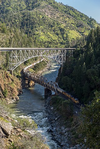
The Bear River is a tributary of the Feather River in the Sierra Nevada, winding through four California counties: Yuba, Sutter, Placer, and Nevada. About 73 miles (117 km) long, the river flows generally southwest through the Sierra then west through the Central Valley, draining a narrow, rugged watershed of 295 square miles (760 km2).

<span class="mw-page-title-main">Oroville–Thermalito Complex</span>

The Oroville–Thermalito Complex is a group of reservoirs, structures, and facilities located in and around the city of Oroville in Butte County, California. The complex serves not only as a regional water conveyance and storage system, but is the headwaters for, and therefore perhaps is the most vital part of, the California Department of Water Resources' State Water Project, as one of the largest publicly built and operated water and power development and conveyance systems.

<span class="mw-page-title-main">Lake Van Arsdale</span> Reservoir in Mendocino County, California

Lake Van Arsdale, also known as Van Arsdale Reservoir, is a reservoir on the Eel River in California, part of the Potter Valley Project. Located in Mendocino County, 4 miles (6.4 km) north of the town of Potter Valley, California, the reservoir supplies water to users as far south as Marin County.

<span class="mw-page-title-main">Feather Headwaters</span>

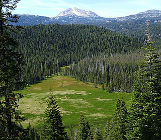
The Feather Headwaters is the watershed of the Feather River above Lake Oroville, totaling 3,450 sq mi (8,900 km2). Subdivided into 3 watersheds, the North Fork Feather Watershed is 1,090 sq mi (2,800 km2)—including the West Branch drainage of about 282.5 sq mi (732 km2), the East Branch North Fork Feather Watershed is 1,010 sq mi (2,600 km2), and the Middle Fork Feather Watershed is 1,350 sq mi (3,500 km2)—including the South Fork drainage of about 132 sq mi (340 km2). Headwaters drainage is impaired by the Palermo Canal at Oroville Dam, the Hendricks Canal at the West Branch Feather River, and the Miners Ranch Canal at the South Fork's Ponderosa Reservoir. Additionally, the Pacific Gas and Electric Company releases Upper Feather water into the Hyatt Generating-Pumping Plant for hydroelectric generation during daily peak demand.

<span class="mw-page-title-main">North Fork Kings River</span> River in California, United States

The North Fork Kings River is a 40.3-mile (64.9 km) tributary of the Kings River, in the U.S. state of California. The river's main stem is entirely within Fresno County, and its watershed drains about 387 square miles (1,000 km2) of the southern Sierra Nevada mountain range.

<span class="mw-page-title-main">Canyon Dam (California)</span> Dam in near Westwood, California

Canyon Dam is an embankment dam on the North Fork Feather River in northern California, 16 mi (26 km) southwest of Westwood. Located about 8 miles (13 km) southeast of Chester, the dam forms Lake Almanor, a large and shallow reservoir surrounded by the Cascade mountains.

<span class="mw-page-title-main">Big Creek Hydroelectric Project</span> Hydroelectric Power Scheme on upper San Joaquin River System, Sierra Nevada, Central California

The Big Creek Hydroelectric Project is an extensive hydroelectric power scheme on the upper San Joaquin River system, in the Sierra Nevada of central California. The project is owned and operated by Southern California Edison (SCE). The use and reuse of the waters of the San Joaquin River, its South Fork, and the namesake of the project, Big Creek – over a vertical drop of 6,200 ft (1,900 m) – have over the years inspired a nickname, "The Hardest Working Water in the World".

Kerckhoff Dam is a concrete arch dam on the San Joaquin River in Fresno County, California, about 10 mi (16 km) southwest of Big Creek. The 114 ft (35 m) tall dam is a run-of-the-river facility impounding 4,252 acre⋅ft (5,245,000 m3) of water and is the primary feature of Pacific Gas and Electric's Kerckhoff hydroelectric project. The dam and its 160-acre (65 ha) reservoir provide water for the Kerckhoff Powerhouses No. 1 and No. 2. Powerhouse No. 1 has three Francis turbines producing a maximum of 38 megawatts (MW) and Powerhouse No. 2 has a single Francis turbine rated at 155 MW for a total project capacity of 193 MW. An annual 579.1 million KWh of electricity are generated here.

<span class="mw-page-title-main">Yuba–Bear Hydroelectric Project</span>

The Yuba–Bear Hydroelectric Project is a complex hydroelectric scheme in the northern Sierra Nevada in California, tapping the upper Yuba River and Bear River drainage basins. The project area encompasses approximately 400 square miles (1,000 km2) in Nevada, Placer, and Sierra Counties. Owned by the Nevada Irrigation District, it consists of 16 storage dams plus numerous diversion and regulating dams, and four generating stations producing 425 million kilowatt hours of electricity each year. The Yuba–Bear Hydroelectric Project consists of the Bowman development, Dutch Flat No. 2 development, Chicago Park development, and Rollins development.

Moccasin Dam is a small dam on Moccasin Creek in Tuolumne County, California, in the town of Moccasin, west of Yosemite. It holds the Moccasin Reservoir. The dam, reservoir and associated hydroelectric power plant are part of the Hetch Hetchy Project, which provide water and power to the city of San Francisco. The dam is located near the junction of Highway 120 and Highway 49.

References

  1. "Final Environmental Impact Statement (FEIS) favors relicensing of Upper North Fork Feather River Hydropower Project (P-2105-089) in California". Federal Energy Regulatory Commission. 2005-11-10. Retrieved 2014-02-05.
  2. "Rock Creek-Cresta" (PDF). Hydropower Reform Coalition. 2005. Retrieved 2014-02-05.
  3. 1 2 3 4 5 Brehm, Frank. "Feather River "Stairway of Power"". Western Pacific Railroad History Online. Retrieved 2014-02-03.
  4. 1 2 Jackson, Donald Conrad (2005). Building the Ultimate Dam: John S. Eastwood and the Control of Water in the West. University of Oklahoma Press. ISBN   0-80613-733-9.
  5. 1 2 3 4 Young, Jim (2003). Plumas County; History of the Feather River Region. Arcadia Publishing. ISBN   0-73852-409-3.
  6. 1 2 3 4 5 6 7 8 9 10 11 12 "Project Facts". Project 2105 Committee. 2014-01-16. Archived from the original on 2013-02-14. Retrieved 2014-02-03.

40°10′21″N121°08′36″W / 40.1725°N 121.1432°W / 40.1725; -121.1432