Upton, Somerset

Last updated

Upton
St James's Church, Upton, Somerset.jpg
Church of St James, Upton
Somerset UK location map.svg
Red pog.svg
Upton
Location within Somerset
Population250 (2011) [1]
OS grid reference SS993287
District
Shire county
Region
Country England
Sovereign state United Kingdom
Post town Taunton
Postcode district TA4
Police Avon and Somerset
Fire Devon and Somerset
Ambulance South Western
UK Parliament
List of places
UK
England
Somerset
51°02′56″N3°26′15″W / 51.0489°N 3.4376°W / 51.0489; -3.4376

Upton is a village and civil parish north of Skilgate in Somerset, England. It is situated on a hill above the eastern end of Wimbleball Lake.

Contents

History

The parish of Upton was part of the Williton and Freemanners Hundred. [2]

Pepperpot Castle, which is also known as Haddon Lodge, was built By Lady Harriet Acland, during the long period of her widowhood, 1778–1815, as a lodge to the drive to connect Pixton Park in Dulverton where her daughter the Countess of Carnarvon lived, with her own estates near Wiveliscombe. [3]

Governance

The parish council has responsibility for local issues, including setting an annual precept (local rate) to cover the council’s operating costs and producing annual accounts for public scrutiny. The parish council evaluates local planning applications and works with the local police, district council officers, and neighbourhood watch groups on matters of crime, security, and traffic. The parish council's role also includes initiating projects for the maintenance and repair of parish facilities, as well as consulting with the district council on the maintenance, repair, and improvement of highways, drainage, footpaths, public transport, and street cleaning. Conservation matters (including trees and listed buildings) and environmental issues are also the responsibility of the council.
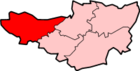
The village falls within the non-metropolitan district of Somerset West and Taunton, which was established on 1 April 2019. It was previously in the district of West Somerset, which was formed on 1 April 1974 under the Local Government Act 1972, and part of Dulverton Rural District before that. [4] The district council is responsible for local planning and building control, local roads, council housing, environmental health, markets and fairs, refuse collection and recycling, cemeteries and crematoria, leisure services, parks, and tourism.

Somerset County Council is responsible for running the largest and most expensive local services such as education, social services, libraries, main roads, public transport, policing and fire services, trading standards, waste disposal and strategic planning.

It is also part of the Tiverton and Minehead county constituency represented in the House of Commons of the Parliament of the United Kingdom. It elects one Member of Parliament (MP) by the first past the post system of election.

Religious sites

The remains of the Old Church of St James, which dates from the 14th century can still be seen. [5] The current parish church of St James was built in 1870. [6]

The non conformist Ebenezer Chapel dates from 1878. [7]

Related Research Articles

<span class="mw-page-title-main">Dulverton</span> Human settlement in England

Dulverton is a town and civil parish in west Somerset, England, near the border with Devon. The town had a population of 1,408 at the 2011 Census. The parish includes the hamlets of Battleton and Ashwick which is located approximately 4 miles (6.4 km) north west of Dulverton.

<span class="mw-page-title-main">Bishop's Hull</span> Human settlement in England

Bishop's Hull is a village and civil parish in Somerset, England, in the western suburbs of Taunton. It includes the areas of Rumwell, Rumwell Park, Roughmoor and Longaller and is close to the River Tone. The parish, which includes the hamlet of Netherclay, has a population of 2,975 in total.

<span class="mw-page-title-main">Chipstable</span> Human settlement in England

Chipstable is a village and civil parish in Somerset, England, situated beside Heydon Hill 10 miles (16.1 km) west of Taunton. The parish has a population of 309.

<span class="mw-page-title-main">Oake</span> Human settlement in England

Oake is a village and civil parish in Somerset, England, situated 5 miles (8.0 km) west of Taunton. The village has a population of 765.

<span class="mw-page-title-main">Orchard Portman</span> Human settlement in England

Orchard Portman is a village and civil parish in Somerset, England, situated 2 miles (3.2 km) south of Taunton. The village has a population of 150.

<span class="mw-page-title-main">Otterford</span> Human settlement in England

Otterford is a village and civil parish in Somerset, England. It is situated on the Blackdown Hills, 7 miles (11.3 km) south of Taunton. The village has a population of 356.

<span class="mw-page-title-main">Wiveliscombe</span> Town in Somerset, England

Wiveliscombe is a town and civil parish in Somerset, England, situated 9 miles (14 km) west of Taunton. The town has a population of 2,893. The Square, fronted by several listed structures, held the former market. The parish includes the nearby hamlet of Maundown.

<span class="mw-page-title-main">Buckland St Mary</span> Human settlement in England

Buckland St Mary is a village and parish in Somerset, England, situated 6 miles (9.7 km) to the west of Ilminster and 8 miles (12.9 km) south of Taunton in the South Somerset district, close to the A303. The village has a population of 521. The parish is within the Blackdown Hills Area of Outstanding Natural Beauty and includes the hamlet of Birchwood.

<span class="mw-page-title-main">Bicknoller</span> Human settlement in England

Bicknoller is a village and civil parish on the western slopes of the Quantock Hills in the English county of Somerset.

<span class="mw-page-title-main">Brompton Regis</span> Human settlement in England

Brompton Regis is a village and civil parish in the Somerset West and Taunton district of Somerset, England about 5 miles (8.0 km) north-east of Dulverton. It is situated on the River Pulham in the Brendon Hills within the Exmoor National Park, close to Wimbleball Lake, a water supply reservoir constructed in the 1970s and completed in 1979. According to the 2011 census the village had a population of 449. The parish boundary is marked by the River Exe which is crossed by the medieval Chilly Bridge and Hele Bridge. The Haddeo is crossed by Bury Bridge.

<span class="mw-page-title-main">Brushford, Somerset</span> Human settlement in England

Brushford is a village and civil parish 2 miles (3.2 km) south of Dulverton and 12 miles (19 km) north of Tiverton in Devon, in the Somerset West and Taunton district of Somerset, England. According to the 2001 census, it had a population of 535 in 243 households, reducing to 519 at the 2011 Census. It covers an area of 1,149 hectares (11 km2) of which 3 hectares (0.030 km2) is within the Exmoor National Park.

<span class="mw-page-title-main">Withypool</span> Human settlement in England

Withypool is a small village and former civil parish, now in the parish of Withypool and Hawkridge, in the Somerset district, in the ceremonial county of Somerset, England, near the centre of Exmoor National Park and close to the border with Devon. The word Withy means "willow". The parish of Withypool and Hawkridge, covers 3,097 hectares, includes the village of Hawkridge and has a population around 201.

<span class="mw-page-title-main">Exford, Somerset</span> Human settlement in England

Exford is a rural village at the centre of Exmoor National Park, 7 miles (11 km) north-west of Dulverton, and 10 miles (16 km) south-west of Minehead, in Somerset, England. Less than a mile away is the hamlet of Lyncombe.

<span class="mw-page-title-main">Old Cleeve</span> Human settlement in England

Old Cleeve is a village 5 miles (8 km) south east of Minehead in the Somerset West and Taunton district of Somerset, England, and also a civil parish. The civil parish of Old Cleeve covers an area of 2,092 hectares and includes the villages of Old Cleeve, Roadwater and Washford as well as hamlets such as Bilbrook, Chapel Cleeve, Golsoncott and Leighland Chapel. Approximately half the parish lies within the Exmoor National Park. The remaining half is on the southern edge of Exmoor. The village has been in existence since the early 13th century. The village held its first council meeting in 1711. By the 1720s the parish had several churches, in which to meet. The town hall was built in 1727. The first church here was built in 1694, built by the Eastern Christian Society. This church was destroyed in a fire in 1847, and has been rebuilt and restored. In 2011, the population of the parish was 1,672.

<span class="mw-page-title-main">Winsford, Somerset</span> Human settlement in England

Winsford is a village and civil parish in Somerset, England, located about 5 miles (8 km) north-west of Dulverton.

<span class="mw-page-title-main">Huish Champflower</span> Human settlement in England

Huish Champflower is a village and civil parish in Somerset, England, three miles north-west of Wiveliscombe and ten miles north of Wellington. It has a population of 301.

<span class="mw-page-title-main">Cutcombe</span> Human settlement in England

Cutcombe is a village and civil parish 9 miles (14 km) south of Minehead and north of Dulverton straddling the ridge between Exmoor and the Brendon Hills in Somerset. It has a population of 361.

<span class="mw-page-title-main">Elworthy</span> Human settlement in England

Elworthy is a small village and civil parish in the Brendon Hills 5 miles (8 km) south-east of Watchet, and 12 miles (19 km) west of Taunton, in the Somerset West and Taunton district of Somerset, England. The parish includes the hamlet of Willett.

<span class="mw-page-title-main">Exton, Somerset</span> Human settlement in England

Exton is a village and civil parish 5 miles (8 km) north-east of Dulverton and 9 miles (14 km) south-west of Dunster in Somerset, England. It lies on the River Exe on Exmoor. The parish includes the village of Bridgetown and covers 2,017 ha, all of which is within the national park.

<span class="mw-page-title-main">Skilgate</span> Human settlement in England

Skilgate is a village and civil parish 5 miles (8 km) east of Dulverton and 8 miles (13 km) west of Wiveliscombe in the Somerset West and Taunton district of Somerset, England. It has a population of 96.

References

  1. "Statistics for Wards, LSOAs and Parishes — SUMMARY Profiles" (Excel). Somerset Intelligence. Retrieved 4 January 2014.
  2. "Somerset Hundreds". GENUKI. Retrieved 23 October 2011.
  3. Historic England. "Pepperpot Castle (1248097)". National Heritage List for England . Retrieved 13 December 2008.
  4. "Dulverton RD". A vision of Britain Through Time. University of Portsmouth. Retrieved 5 January 2014.
  5. Historic England. "Remains of the Church of St James (1248084)". National Heritage List for England . Retrieved 13 December 2008.
  6. Historic England. "Church of St James (1263817)". National Heritage List for England . Retrieved 13 December 2008.
  7. Historic England. "Ebenezer Chapel (1248095)". National Heritage List for England . Retrieved 13 December 2008.

Commons-logo.svg Media related to Upton, Somerset West and Taunton at Wikimedia Commons