Uurainen

Last updated
Uurainen
Municipality
Uuraisten kunta
Uurainens kommun
Uuraisten kirkko.jpg
Uurainen Church
Uurainen.vaakuna.svg
Uurainen sijainti Suomi.svg
Location of Uurainen in Finland
Coordinates: 62°30′N025°26.2′E / 62.500°N 25.4367°E / 62.500; 25.4367
CountryFlag of Finland.svg  Finland
Region Central Finland
Sub-region Jyväskylä sub-region
Charter 1868
Government
  Municipal managerJuha Valkama
Area
 (2018-01-01) [1]
  Total372.26 km2 (143.73 sq mi)
  Land347.98 km2 (134.36 sq mi)
  Water24.22 km2 (9.35 sq mi)
  Rank 221st largest in Finland
Population
 (2023-12-31) [2]
  Total3,615
  Rank 201st largest in Finland
  Density10.39/km2 (26.9/sq mi)
Population by native language
[3]
   Finnish 98.3% (official)
   Swedish 0.1%
  Others1.6%
Population by age
[4]
  0 to 1425.3%
  15 to 6454.5%
  65 or older20.2%
Time zone UTC+02:00 (EET)
  Summer (DST) UTC+03:00 (EEST)
Website uurainen.fi

Uurainen (Swedish : Uurainen, also Urais) is a municipality of Finland.

Contents

It is part of the Central Finland region. The municipality has a population of 3,615 (31 December 2023) [2] and covers an area of 372.26 square kilometres (143.73 sq mi) of which 24.22 km2 (9.35 sq mi), or roughly 6.5%, is water. [1] The population density is 10.39 inhabitants per square kilometre (26.9/sq mi).

Neighbouring municipalities are Jyväskylä, Laukaa, Multia, Petäjävesi, Saarijärvi and Äänekoski.

The municipality is unilingually Finnish.

Etymology

The name Uurainen is derived from the lakes Iso-Uurainen and Pieni-Uurainen. The root word for these lake names is most likely uuro, a dialectal word meaning "riverbed", referring to the Takapuro river between the two lakes, as it has been a strait in the past. [5] Uurainen is also the name of a register village in the municipality.

Geography

Lakes

There are all together 125 lakes in Uurainen. The biggest lakes are Kyynämöinen, Sääkspää and Iso-Uurainen. [6]

Villages

Settlements: [7]

  • Kotaperä
  • Linnanperä
  • Pohjanperä
  • Kelloperä
  • Haukimäki
  • Kyynämöinen
  • Hepomäki
  • Höytiä
  • Tehlo
  • Kirkonkylä
  • Hiirola
  • Jokihaara
  • Vihtaperä
  • Oikarinperä
  • Murtoperä
  • Kummunkylä
  • Pirttiperä
  • Myllyperä
  • Kangashäkki
  • Sälliperä
  • Hirvaskylä

Register villages: [7]

History

Six possible Stone Age settlements have been found on the territory of modern Uurainen. Four of these sites are in Kuukkajärvi, one in the village of Uurainen and another one in Höytiä. Evidence for permanent Iron Age settlement has not been found. [8]

The area of modern Uurainen was devoid of a permanent settled population in the Middle Ages. In the 15th and early 16th centuries, these lands were held as hunting grounds by Tavastians. The first settler of Uurainen was Paavo Minkkinen, who in 1548 established a farm named Salmela in the hunting grounds of Heinäjoensuu, owned by the men of the village of Laitikkala in Kulsiala (nowadays in Pälkäne). This area would later become the register village of Kuukkajärvi. Paavo Minkkinen, like almost all settlers of Uurainen, was a Savonian. The Minkkinen family likely originated from Pellosniemi near modern Mikkeli. [9]

The first register villages to be established in the area were Kuukkajärvi and Akonjärvi, both of which were first mentioned in 1561. Akonjärvi was merged into Kuukkajärvi in 1586. [10]

Uurainen was originally a part of the parish of Saarijärvi. It was mentioned in 1741 under the Swedish name Uhrais. The area got its own chapel in 1801 and was variously called Uurainen, Kuukkajärvi, Kuukka and Minkkilä. The area had multiple names as the vicarage (pappila) was located in the register village of Uurainen while the church was located in the village of Kuukkajärvi on the lands of the Minkkilä farm. [5]

Uurainen became a separate parish in 1868, though the separation effectively happened in 1887. [11] The northern part of Nyrölä, which at that time included Höytiä, was transferred from the Jyväskylä parish to Uurainen in 1868. [12]

Related Research Articles

<span class="mw-page-title-main">Jyväskylä</span> City in Central Finland, Finland

Jyväskylä is a city in Finland and the regional capital of Central Finland. It is located in the Finnish Lakeland. The population of Jyväskylä is approximately 148,000, while the sub-region has a population of approximately 191,000. It is Finland's 7th most populous municipality, and fifth most populous urban area.

<span class="mw-page-title-main">Muurame</span> Municipality in Central Finland, Finland

Muurame is a municipality of Finland, located 16 kilometres (10 mi) south-west of Jyväskylä. Muurame itself is located between two lakes, Lake Päijänne and Lake Muuratjärvi. These two lakes are connected to each other via River Muurame. All together there are 37 lakes in Muurame. Biggest lakes beside Päijänne are Muuratjärvi and Lake Kuusjärvi. River Muurame streams through the population center of Muurame. Muurame was founded in 1921.

<span class="mw-page-title-main">Asikkala</span> Municipality in Päijänne Tavastia, Finland

Asikkala is a municipality of Finland. Its seat is in Vääksy, at the shores of the Lake Päijänne. It is located in the province of Southern Finland and is part of the Päijänne Tavastia region. Asikkala's neighboring municipalities are Hämeenlinna, Heinola, Hollola, Lahti, Padasjoki and Sysmä.

<span class="mw-page-title-main">Äänekoski</span> Town in Central Finland, Finland

Äänekoski is a town in Finland. It is located in the Central Finland region, about 45 kilometres (28 mi) north of Jyväskylä, the region's capital city. Äänekoski has a population of 17,971, as of 31 December 2023, and covers an area of 1,138.39 square kilometres (439.53 sq mi) of which 253.84 km2 (98.01 sq mi), or 22%, is water. The population density is 20.32 inhabitants per square kilometre (52.6/sq mi).

<span class="mw-page-title-main">Jyväskylän maalaiskunta</span> Former municipality in Western Finland Province, Finland

Jyväskylän maalaiskunta, 'The Rural Municipality of Jyväskylä' is a former municipality of Finland. Together with Korpilahti, Jyväskylän maalaiskunta was consolidated with Jyväskylä on 1 January 2009. It was the last municipality to carry the name maalaiskunta.

<span class="mw-page-title-main">Hankasalmi</span> Municipality in Central Finland, Finland

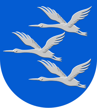
Hankasalmi is a municipality of Finland.

<span class="mw-page-title-main">Laukaa</span> Municipality in Central Finland, Finland

Laukaa is a municipality of Finland. It is located next to Jyväskylä and is part of the Central Finland region. The municipality has a population of 18,762 and covers an area of 825.59 square kilometres (318.76 sq mi) of which 177.09 km2 (68.37 sq mi) is water. The population density is 28.93 inhabitants per square kilometre (74.9/sq mi).

<span class="mw-page-title-main">Luhanka</span> Municipality in Central Finland, Finland

Luhanka is a municipality of Finland. It is located in the Central Finland region. The municipality has a population of 702 and covers an area of 313.25 square kilometres (120.95 sq mi) of which 98.73 km2 (38.12 sq mi) is water.

<span class="mw-page-title-main">Myrskylä</span> Municipality in Uusimaa, Finland

Myrskylä is a municipality in Finland, located in the southern interior of the country. Myrskylä is situated in the eastern part of the Uusimaa region, and it is the smallest municipality in the region in relation to its population. The population of Myrskylä is approximately 2,000, while the sub-region has a population of approximately 59,000. It is the 271st most populous municipality in Finland.

<span class="mw-page-title-main">Petäjävesi</span> Municipality in Central Finland, Finland

Petäjävesi is a municipality of Finland. It is located in the province of Western Finland, next to the city of Jyväskylä, and is part of the Central Finland region. The municipality has a population of 3,596 and covers an area of 495.41 square kilometres (191.28 sq mi) of which 39.01 km2 (15.06 sq mi), or almost 8%, is water. The population density is 7.88 inhabitants per square kilometre (20.4/sq mi).

<span class="mw-page-title-main">Saarijärvi</span> Town in Central Finland, Finland

Saarijärvi is a town and municipality of Finland located in the Central Finland region. The municipality has a population of 8,847, as of 31 December 2023, and covers an area of 1,422.72 square kilometres (549.32 sq mi) of which 170.8 km2 (65.9 sq mi), or 12%, is water. The population density is 7.07 inhabitants per square kilometre (18.3/sq mi).

<span class="mw-page-title-main">Soini, Finland</span> Municipality in Southern Ostrobothnia, Finland

Soini is a municipality of Finland. It is located in the Southern Ostrobothnia region. The municipality has a population of 1,873 and covers an area of 574.22 square kilometres (221.71 sq mi) of which 22.17 km2 (8.56 sq mi) is water. The population density is 3.39 inhabitants per square kilometre (8.8/sq mi).

<span class="mw-page-title-main">Sysmä</span> Municipality in Päijänne Tavastia, Finland

Sysmä is a municipality of Finland. It is situated in the Päijät-Häme region. The municipality has a population of 3,496 (31 December 2023) and covers an area of 936.18 square kilometres (361.46 sq mi) of which 269.14 km2 (103.92 sq mi) is water. The population density is 5.24 inhabitants per square kilometre (13.6/sq mi). Neighbouring municipalities are Asikkala, Hartola, Heinola, Kuhmoinen, Luhanka, and Padasjoki. The municipality is unilingually Finnish.

<span class="mw-page-title-main">Toivakka</span> Municipality in Central Finland, Finland

Toivakka is a municipality of Finland. It is located in the Central Finland region, near Jyväskylä. The municipality has a population of 2,368 (31 December 2023) and covers an area of 413.94 square kilometres (159.82 sq mi) of which 52.44 km2 (20.25 sq mi) is water. The population density is 6.55 inhabitants per square kilometre (17.0/sq mi). The municipality is unilingually Finnish.

<span class="mw-page-title-main">Nyrölä</span> District of Jyväskylä in Central Finland, Finland

Nyrölä is a district and village of Jyväskylä, Finland located 30 kilometres (19 mi) from the city centre. Prior to 2009, it was one of the villages of Jyväskylän maalaiskunta.

Keljo is a district of Jyväskylä, in Central Finland, and a former village of Jyväskylän maalaiskunta. The distance to central Jyväskylä is about 4 kilometres (2.5 mi).

<span class="mw-page-title-main">Vesanka</span> District of Jyväskylä in Central Finland, Finland

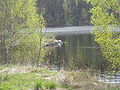
Vesanka is a village and a district of the city of Jyväskylä, in Central Finland. Before 2009, it was one of the villages of Jyväskylän maalaiskunta. It is located in the far western part of Jyväskylä near its borders with Petäjävesi, Muurame and, until 2009, Korpilahti.

<span class="mw-page-title-main">Tikka-Mannila</span> District of Jyväskylä in Central Finland, Finland

Tikka-Mannila or Tikkamannila is a village and a district of Jyväskylä in Finland. It was a part of Jyväskylän maalaiskunta until its disestablishment in 2009. It is located to the southeast of Tikkakoski. The national road 4 passes through Tikka-Mannila.

<span class="mw-page-title-main">Puuppola</span> District of Jyväskylä in Central Finland, Finland

Puuppola is a district of Jyväskylä and a village in Central Finland. Before 2009, it was a part of Jyväskylän maalaiskunta. The national road 4 passes by Puuppola. The distance to central Jyväskylä is roughly 11 km.

<span class="mw-page-title-main">Haapaniemi, Jyväskylä</span> District of Jyväskylä in Central Finland, Finland

Haapaniemi is a district of Jyväskylä in Central Finland, located to the south of Vaajakoski. Before 2009, it was a part of Jyväskylän maalaiskunta and was one of its register villages. The distance to central Jyväskylä is roughly 6 km.

References

  1. 1 2 "Area of Finnish Municipalities 1.1.2018" (PDF). National Land Survey of Finland. Retrieved 30 January 2018.
  2. 1 2 "Population growth biggest in nearly 70 years". Population structure. Statistics Finland. 2024-04-26. ISSN   1797-5395 . Retrieved 2024-04-29.
  3. "Population growth biggest in nearly 70 years". Population structure. Statistics Finland. 2024-04-26. ISSN   1797-5395 . Retrieved 2024-04-29.
  4. "Population according to age (1-year) and sex by area and the regional division of each statistical reference year, 2003–2020". StatFin. Statistics Finland . Retrieved 2 May 2021.
  5. 1 2 "SuomalainenPaikannimikirja_e-kirja_kuvallinen.pdf" (PDF). kaino.kotus.fi (in Finnish). p. 481. Retrieved August 17, 2022.
  6. "Uurainen (kunta)". Järviwiki. Finland's Environmental Administration. 2012. Retrieved 27 February 2012.
  7. 1 2 Kuukan kappelista nykypäivään, pages 26-27.
  8. Sinisalo, Hannu (1993). Uurainen: Kuukan kappelista nykypäivään 1868-1993 (in Finnish). Jyväskylä: Gummerus Kirjapaino Oy. p. 19. ISBN   951-96762-0-1.
  9. Kuukan kappelista nykypäivään, page 20.
  10. Kuukan kappelista nykypäivään, page 21.
  11. "Suomen Sukututkimusseura - Uurainen". hiski.genealogia.fi (in Finnish). Retrieved June 10, 2023.
  12. Lappalainen, Jussi T. (1977). Jyväskylän maalaiskunnan kirja (in Finnish). Jyväskylä: Jyväskylän maalaiskunta ja maaseurakunta. p. 53. ISBN   951-99104-3-3.

Commons-logo.svg Media related to Uurainen at Wikimedia Commons