
Kangasniemi is a municipality in the Southern Savonia region, Finland. The municipality has a population of 5,084 and covers an area of 1,326.75 square kilometres (512.26 sq mi) of which 256.86 km2 (99.17 sq mi) is water. The population density is 4.76 inhabitants per square kilometre (12.3/sq mi).
Äänekoski is a town in Finland. It is located in the Central Finland region, about 45 kilometres (28 mi) north of Jyväskylä, the region's capital city. Äänekoski has a population of 17,818, as of 31 October 2024, and covers an area of 1,138.39 square kilometres (439.53 sq mi) of which 253.84 km2 (98.01 sq mi), or 22%, is water. The population density is 20.14 inhabitants per square kilometre (52.2/sq mi).
Leivonmäki is a former municipality of Finland in the Central Finland region. The municipality was consolidated with Joutsa in 2008. The population of Leivonmäki was 1,135 in 2007.

Hankasalmi is a municipality of Finland, located in the Central Finland region. The municipality has a population of 4,515 (31 October 2024) and covers an area of 687.75 square kilometres (265.54 sq mi) of which 115.89 km2 (44.75 sq mi) is water. The population density is 7.9 inhabitants per square kilometre (20/sq mi).
Hartola is a municipality of Finland. It is located in the Itä-Häme, Päijänne Tavastia region. The municipality has a population of 2,503 (31 October 2024), which make it the smallest municipality in Päijänne Tavastia in terms of population. It covers an area of 675.38 square kilometres (260.77 sq mi) of which 132.18 km2 (51.03 sq mi) is water. The population density is 4.61 inhabitants per square kilometre (11.9/sq mi). Neighbouring municipalities are Heinola, Joutsa, Luhanka, Pertunmaa and Sysmä.
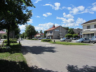
Hirvensalmi is a municipality of Finland.
Joutsa is a municipality of Finland. It is located in the province of Western Finland and is part of the Central Finland region. Jyväskylä is located about 70 kilometres (43 mi) north of the Joutsa municipality.

Kannonkoski is a Finnish municipality located in the Central Finland region. The municipality has a population of 1,188 and covers an area of 549.88 square kilometres (212.31 sq mi) of which 104.87 km2 (40.49 sq mi), or 19%, is water. The population density is 2.67 inhabitants per square kilometre (6.9/sq mi). Neighbouring municipalities are Karstula, Kivijärvi, Saarijärvi, Viitasaari and Äänekoski.

Konnevesi is a municipality of Finland. It is located in the former province of Western Finland and is part of the Central Finland region. The municipality has a population of 2,458 and covers an area of 680.85 square kilometres (262.88 sq mi) of which 167.95 km2 (64.85 sq mi), or almost 25%, is water. Neighbouring municipalities are Hankasalmi, Laukaa, Rautalampi, Vesanto and Äänekoski. The municipality is unilingually Finnish.

Korpilahti is a former municipality of Finland. Together with Jyväskylän maalaiskunta, Korpilahti was consolidated with Jyväskylä on January 1, 2009.

Kyyjärvi is a municipality of Finland. It is located in the Central Finland region, about 120 kilometres (75 mi) northwest of Jyväskylä. The municipality has a population of 1,160 and covers an area of 469.61 square kilometres (181.32 sq mi) of which 21.39 km2 (8.26 sq mi) is water. The population density is 2.59 inhabitants per square kilometre (6.7/sq mi). The municipality is unilingually Finnish.

Laukaa is a municipality of Finland. It is located next to Jyväskylä and is part of the Central Finland region. The municipality has a population of 18,869 and covers an area of 825.59 square kilometres (318.76 sq mi) of which 177.09 km2 (68.37 sq mi) is water. The population density is 29.1 inhabitants per square kilometre (75/sq mi).

Lumijoki is a municipality of Finland.

Mäntyharju is a municipality of Finland. It is located in the Southern Savonia region, about 40 kilometres (25 mi) southwest of Mikkeli. The municipality has a population of 5,518 (31 October 2024) and covers an area of 1,210.98 square kilometres (467.56 sq mi) of which 229.23 km2 (88.51 sq mi) is water. The coastline is almost 1,520 kilometers (940 mi). The population density is 6.2 inhabitants per km².

Oulainen is a town and a municipality of Finland. It is located in the Northern Ostrobothnia region, 101 kilometres (63 mi) south of the city of Oulu. The municipality has a population of 6,934 (31 October 2024) and covers an area of 597.53 square kilometres (230.71 sq mi) of which 10.01 km2 (3.86 sq mi) is water. The population density is 11.8 inhabitants per square kilometre (31/sq mi). Oulainen is founded in 1865, and it received township rights in 1977.

Rautalampi is a municipality of Finland. It is located in the Northern Savonia region. The municipality has a population of 2,922 and covers an area of 761.98 square kilometres (294.20 sq mi) of which 222.99 km2 (86.10 sq mi) is water. The population density is 5.42 inhabitants per square kilometre (14.0/sq mi). The municipality is unilingually Finnish.

Sysmä is a municipality of Finland. It is situated in the Päijät-Häme region. The municipality has a population of 3,435 (31 October 2024) and covers an area of 936.18 square kilometres (361.46 sq mi) of which 269.14 km2 (103.92 sq mi) is water. The population density is 5.15 inhabitants per square kilometre (13.3/sq mi). Neighbouring municipalities are Asikkala, Hartola, Heinola, Kuhmoinen, Luhanka, and Padasjoki. The municipality is unilingually Finnish.

Toivakka is a municipality of Finland. It is located in the Central Finland region, near Jyväskylä. The municipality has a population of 2,361 (31 October 2024) and covers an area of 413.94 square kilometres (159.82 sq mi) of which 52.44 km2 (20.25 sq mi) is water. The population density is 6.53 inhabitants per square kilometre (16.9/sq mi). The municipality is unilingually Finnish.

Uurainen is a municipality of Finland.
Lake Päijänne is the second largest lake in Finland. The lake drains into the Gulf of Finland via the Kymi River. The major islands are from north to south Vuoritsalo, Muuratsalo, Onkisalo, Judinsalo, Edessalo, Taivassalo, Haukkasalo, Vehkasalo, Mustassalo, Virmailansaari and Salonsaari. The largest island is Virmailansaari. The word saari means an island. Salo once meant a great island, nowadays it means a great forest area.


