Varese Prealps

Last updated
Varese Prealps
Western Lugano Prealps
Gita 14gen07 001.jpg
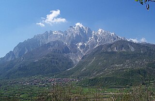
Monte Tamaro, the highest mountain in the Varese Prealps
Highest point
Peak Monte Tamaro
Elevation 1,967 m (6,453 ft)
Naming
Native namePrealpi Varesine (Italian)
Geography
Countries Switzerland and Italy
Canton, Region Ticino and Lombardy
Parent range Lugano Prealps
Borders on Comasche Prealps, Lepontine Alps and Po plain
Geology
Orogeny Alpine orogeny
Type of rock Sedimentary rocks

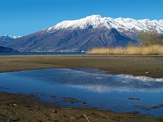
The Varese Prealps (Italian : Prealpi Varesine) are a subsection of the Lugano Prealps, located between the Italian Province of Varese and Canton Ticino in Switzerland, between Lake Maggiore, Lake Lugano, the Val d'Agno and the Po Plain. [1] [2]

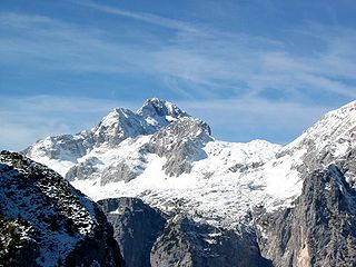
They include two main ranges, separated by the Tresa valley: to the north the Tamaro-Gambarogno-Lema range, and to the south the Piambello-Campo dei Fiori-Nudo range. The Tamaro-Gambarogno-Lema range includes the tallest mountains in the Varese Prealps, Monte Tamaro (1,967 m), Monte Gradiccioli (1,936 m) and Monte Lema (1,621 m). [3] [4]

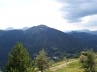
The Piambello-Campo dei Fiori-Nudo range is further divided in a number of massifs. The Campo dei Fiori massif, whose highest peak is Punta di Mezzo (1,227 m), is located just north of Varese, between Lake Varese to the south, the Val di Rasa to the east and the Valcuvia to the north. The Martica-Chiusarella massif, whose highest peak is Monte Martica (1,032 m), lies to its east, between Varese, the Val di Rasa, the Valcuvia and the Valganna. Further to the east is the Minisfreddo-Poncione massif, which includes Monte Minisfreddo (the highest at 1,042 m), Monte San Bernardo, Poncione di Ganna and Monte Rho di Arcisate. [5] [6]

The Piambello massif is located east of the Valganna, southwest of Lake Lugano and northwest of Valceresio. Its peaks include Monte Piambello (the highest at 1,129 m), Monte Sette Termini, Monte La Nave, Monte Mezzano and Monte Castelvecchio. South-east of it is the San Giorgio-Pravello massif, consisting of Monte San Giorgio (1,097 m), Monte Pravello (1,015 m), Monte Orsa and Monte Sant'Elia. Finally, the Valcuvia massif is located between Valcuvia, Valtravaglia and Lake Maggiore; it includes Monte Nudo, the highest peak in the southern Varese Prealps at 1,235 meters above sea level, as well as Sasso del Ferro (1,062 m), Poggio Sant'Elsa, Pizzo di Cuvignone (1,018 m), the Pizzoni di Laveno (1,035 m), Monte San Martino (1,087 m) and Monte Pian Nave (1,058 m). [7] [8]

The Campo dei Fiori Regional Park and the Cinque Vette Park are located in the Varese Prealps.

Main peaks

The main mountains, arranged by descending elevation above sea level, are:

Related Research Articles

<span class="mw-page-title-main">Gazzirola</span> Mountain in Switzerland

The Gazzirola is a mountain of the Lugano Prealps on the Swiss-Italian border. Its summit is the highest point of the municipality of Lugano.

<span class="mw-page-title-main">Monte Tamaro</span> Mountain in Switzerland

Monte Tamaro is a mountain of the Lugano Prealps, overlooking Lake Maggiore in the Swiss canton of Ticino. Reaching a height of 1,962 metres above sea level, it is the highest summit of the chain located between Lake Maggiore and Lake Lugano, which also includes Monte Lema. It is also the most prominent summit of the canton.

<span class="mw-page-title-main">Monte Lema</span> Mountain in Switzerland

Monte Lema is a mountain of the Lugano Prealps, located on the border between Switzerland and Italy. Its summit can easily reached by cable car from the village of Miglieglia (Ticino).

<span class="mw-page-title-main">Pizzo Camino</span> Mountain in Italy

Pizzo Camino is a mountain in the Bergamo Prealps, with a height of 2,492 metres (8,176 ft).

<span class="mw-page-title-main">Concarena</span> Mountain in Italy

The Concarena is a mountain in Lombardy, northern Italy. It is multi summited and its highest peak is the Cima della Bacchetta, with a height of 2,549 m.

<span class="mw-page-title-main">Monte Carmo di Loano</span> Mountain in Italy

Monte Carmo di Loano is a mountain in Liguria, northern Italy, part of the Ligurian Prealps. It is located in the province of Savona. It lies at an altitude of 1389 metres.

<span class="mw-page-title-main">Monte Bregagno</span> Mountain in Italy

Monte Bregagno is a mountain of Lombardy, Italy, It has an elevation of 2,107 metres.

<span class="mw-page-title-main">Monte Grona</span> Mountain in Italy

Monte Grona is a mountain of Lombardy, Italy. It has an elevation of 1,736 metres and belongs to the province of Como.

<span class="mw-page-title-main">Monte Manos</span> Mountain in Italy

Monte Manos is a mountain of Lombardy, Italy. It has an elevation of 1,517 metres. It administratively belongs to the province of Brescia.

<span class="mw-page-title-main">Monte Nudo</span> Mountain in Italy

Monte Nudo is a mountain of Lombardy, Italy. It has an elevation of 1,237 metres. Administratively it belongs to the province of Varese.

<span class="mw-page-title-main">Monte Tombea</span> Mountain in Italy

Monte Tombea is a mountain of Lombardy, Italy. It has an elevation of 1,976 metres.

<span class="mw-page-title-main">Pizzo di Gino</span> Mountain in Italy

Pizzo di Gino is a mountain of Lombardy, Italy. With an elevation of 2,245 m it is the highest peak of the Lugano Prealps.

<span class="mw-page-title-main">Monte Tremalzo</span> Mountain in Italy

Monte Tremalzo is a mountain between Lombardy and Trentino Alto Adige, Italy.

<span class="mw-page-title-main">Monte Vesta</span> Mountain in Italy

Monte Vesta is a mountain of Lombardy, Italy. It administratively belongs to the province of Brescia.

<span class="mw-page-title-main">SOIUSA</span>

SOIUSA is a proposal for a new classification system of the Alps from the geographic and toponomastic point of view. It was designed by Sergio Marazzi, Italian researcher and author of the Orographic Atlas of the Alps SOIUSA. His book was presented with the patronage of the Italian Alpine Club on 23 Jan 2006, but has yet to receive any formal acceptance.

<span class="mw-page-title-main">Lugano Prealps</span> Mountain range in the Alps

The Lugano Prealps are a mountain range in the western part of the Alps. They are located in Canton Ticino and Lombardy.

<span class="mw-page-title-main">Julian Alps and Prealps</span>

The Julian Alps and Prealps are a mountain range in the eastern part of the Alps. They are located in Slovenia and in Italy.

<span class="mw-page-title-main">Col Nudo</span> Mountain in Italy

The Col Nudo is a mountain in the Alps located in Italy. It is the highest peak of the Venetian Prealps and the 30th most prominent summit of the Alps.

<span class="mw-page-title-main">Monte Cadria</span> Mountain in Italy

Monte Cadria is a mountain in the Alps located in Italy. It is the highest peak of the Brescia and Garda Prealps.

<span class="mw-page-title-main">Campo dei Fiori Regional Park</span> Nature reserve in Lombardy, Italy

The Campo dei Fiori Regional Park is a nature reserve in Lombardy, Italy. Established in 1984 and enlarged in 2009, it comprises the Campo dei Fiori and Martica massifs in the Varese Prealps, between the Valganna, the Valcuvia and the city of Varese.

References

  1. Sergio Marazzi, Atlante Orografico delle Alpi. SOIUSA, pp. 15-23-34-45-51-55-57-60-129-142.
  2. Prealpi
  3. Sergio Marazzi, Atlante Orografico delle Alpi. SOIUSA, pp. 15-23-34-45-51-55-57-60-129-142.
  4. Prealpi
  5. Sergio Marazzi, Atlante Orografico delle Alpi. SOIUSA, pp. 15-23-34-45-51-55-57-60-129-142.
  6. Prealpi
  7. Sergio Marazzi, Atlante Orografico delle Alpi. SOIUSA, pp. 15-23-34-45-51-55-57-60-129-142.
  8. Prealpi