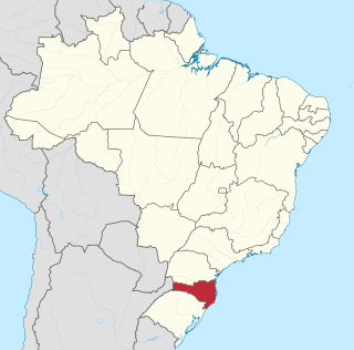
Santa Catarina is one of the 27 federative units of Brazil. It is located in the centre of the country's Southern region. It is bordered to the north by the state of Paraná, to the south by the state of Rio Grande do Sul, to the east by the Atlantic Ocean, and to the west by the Argentine province of Misiones.

Florianópolis is the capital and second largest city of the state of Santa Catarina, in the South region of Brazil. The city encompasses Santa Catarina Island and surrounding small islands, as well as part of the mainland. It has a population of 537,211, according to the 2022 Brazilian census, the second-most populous city in the state, and the 39th in Brazil. The metropolitan area has an estimated population of 1,111,702, the 21st largest in the country. The city is known for having the country's third highest Human Development Index score among all Brazilian cities (0.847).

Chapecó is a municipality in the state of Santa Catarina, in the Southern Region of Brazil. Being a major industrial, financial and educational center, it is a major producer of industrialized food products. Considered a medium city, with a population estimated at 224,013 inhabitants, it is among the four most important cities in the state. It belongs to the Meso-region of Western Santa Catarina and to the Microregion of Chapecó.

Laguna is a Brazilian municipality located in the southern state of Santa Catarina, 120 kilometers south of the state's capital, Florianópolis, and north east of Porto Alegre. The population is 46,122 in an area of 336.4 km². Elevation is 2 m. The BR-101 coastal highway passes through the municipality.

Cascavel is a municipality in the state of Paraná in Brazil. It is the fifth most populous city in the state with 348,051 inhabitants, according to IBGE 2022 Census. The distance to Curitiba, the state capital, is 491 kilometers by freeway.

Criciúma is a city in the Brazilian state of Santa Catarina. At 28°40′39″S49°22′11″W, it is located 180 km south of Florianópolis, the state capital and around 900 km south of São Paulo. The city is the center of Brazil's flooring and home materials industry, and is the second-largest such center in the world.

Indaial is a city in the state of Santa Catarina, Brazil. It is located on the left bank of Itajaí River, and 160 km from the capital of the state, Florianópolis.

São Francisco do Sul is a municipality in the Brazilian state of Santa Catarina. It covers an area of 540 km2 and had an estimated population of 53,746 in 2020.
Xanxerê is a city in Santa Catarina, southern Brazil. Italian and German are the mainstream cultures, having been brought by immigrants in the early 20th century through the migration of the "gauchos".

Joinville is the largest city in Santa Catarina, in the Southern Region of Brazil. It is the third largest municipality in the southern region of Brazil, after the much larger state capitals of Curitiba and Porto Alegre. Joinville is also a major industrial, financial and commerce center.
Araranguá is a city located in the southern part of Santa Catarina state, in the south of Brazil. It has 68,867 inhabitants and was settled mainly by Portuguese and Italians. Araranguá is known as "A Cidade das Avenidas" because of its wide roads.
Portuguese is the official and national language of Brazil being widely spoken by most of the population. Brazil is the most populous Portuguese-speaking country in the world, with its lands comprising the majority of Portugal's former colonial holdings in the Americas.

Júlio de Castilhos is a municipality of the central part of the state of Rio Grande do Sul, Brazil. The population is 19,224 in an area of 1,929.38 km². Its elevation is 529 m, 516 m at the meteorological station and 503.81 m at the railway station. It is located 627 km west of the state capital of Porto Alegre, northeast of Alegrete. The city is considered the Brazilian capital of the Charolais cattle.

Campos Novos is a city in Santa Catarina, in the Southern Region of Brazil. Campos Novos is a pioneer in production of pollen and the biggest grain and oat producer of Santa Catarina. The municipality invests also into fat stock and poultry farming.

Brusque is a city in the state of Santa Catarina, Brazil. It was founded in 1860, by 55 German immigrants.

Fraiburgo is a Brazilian municipality located in the countryside of the Santa Catarina state. The city is strongly influenced by European immigrants, especially Germans and Italians. However, other nationalities also contributed to the formation of the city's character in terms of e.g.: architecture, gastronomy, religion and economy, amongst other factors. Its multiculturality is a remarkable characteristic not exclusively attributed to Fraiburgo but many other Southern Brazilian municipalities.

São Joaquim is a municipality in the state of Santa Catarina, situated in southern Brazil. Its population in 2020 was 27,139 inhabitants. Located in the Planalto Serrano, it lies 136 km from Tubarão, 81 km from Lages and 227 km from Florianópolis. The town is home to a variety of ethnic groups, including Italian, German, Portuguese, Japanese and Afro-Brazilians. There are also many people from other states in Brazil, especially from Rio Grande do Sul.

São Miguel do Oeste is a Brazilian municipality in the state of Santa Catarina, in the southern region of Brazil, 655 km from the state capital, Florianópolis. Its population in 2022, according to the Brazilian Institute of Geography and Statistics Demographic Census, was 44 330 inhabitants.
Major Vieira is a municipality in the state of Santa Catarina in the South region of Brazil.

Urussanga is a municipality in the state of Santa Catarina in the South region of Brazil. The name means "very cold water" in the Tupi language.