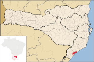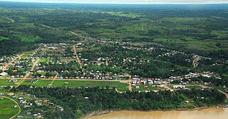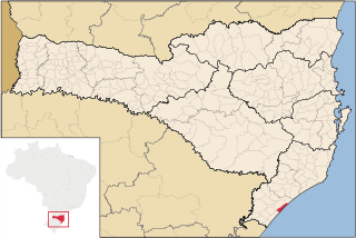
Chapecó is a municipality in the state of Santa Catarina, in the Southern Region of Brazil. Being a major industrial, financial and educational center, it is a major producer of industrialized food products. Considered a medium city, with a population estimated at 213,279 inhabitants, it is among the four most important cities in the state. It belongs to the Meso-region of Western Santa Catarina and to the Microregion of Chapecó.

Montijo is a municipality in Setúbal District in Portugal. Its name was Aldeia Galega do Ribatejo or simply Aldeia Galega until 1930. The population in 2011 was 51,222, in an area of 348.62 km2. The town of Montijo proper had a population of 25,719 in 2001.

Santa Catarina is a concelho (municipality) of Cape Verde. It is situated in the western part of the island of Santiago. Its seat is the city of Assomada. Its population was 45,920 in 2017 (estimate). Its area is 242.6 km2 (93.7 sq mi).

Araranguá is a city located in the southern part of Santa Catarina state, in the south of Brazil. It has 59,134 inhabitants and was settled mainly by Azoreans and Italians. Araranguá is known as "A Cidade das Avenidas" because of its wide roads.

Santa Bárbara d'Oeste is a municipality in the State of São Paulo in Brazil. It is part of the Metropolitan Region of Campinas. It lies about 138 kilometres (86 mi) northwest of the State capital. It occupies an area of 272.2 square kilometres (105.1 sq mi), of which 43.1 square kilometres (16.6 sq mi) is urban. In 2010, the population was estimated at 180,148 by the Brazilian Institute of Geography and Statistics, making it the 43rd most populous city in São Paulo and the sixth largest in the metropolitan region of Campinas.

Portuguese is the official and national language of Brazil and is widely spoken by most of the population. The Portuguese dialects spoken in Brazil are collectively known as Brazilian Portuguese. The Brazilian Sign Language also has official status at the federal level.

Manoel Urbano is a municipality located in the center-western region of the Brazilian state of Acre. As of 2010 it was one of the poorest municipalities in Brazil, with a low Human Development Index.

Arroio do Tigre is a municipality in the state of Rio Grande do Sul, Brazil.

Não-Me-Toque is a Brazilian municipality located in the state of Rio Grande do Sul.

São Joaquim is a municipality in the state of Santa Catarina, situated in southern Brazil. It is located at latitude 28° 17' 38" south and longitude 49° 55' 54" west, with an altitude of 1,360 meters (4,460 ft). Its population in 2004 was 23,114 inhabitants. Located in the Planalto Serrano, it lies 136 km from Tubarão, 81 km from Lages and 227 km from Florianópolis. The town is home to a variety of ethnic groups, including Italian, Portuguese, Japanese and Afro- Brazilians, though composed mainly of descendants of German and Swedish immigrants. There is also a large proportation of the population from other states in Brazil, especially from Rio Grande do Sul.

Araquari is a municipality in the state of Santa Catarina in the South region of Brazil.

Faxinal dos Guedes is a Brazilian Municipality located in the state of Santa Catarina, in the Southern Region of Brazil. It is located in the Immediate Geographical Region of Xanxerê and in the Intermediate Geographical Region of Chapecó and at 307 miles away from the capital of Santa Catarina, Florianópolis. Its estimated population in 2016, according to the IBGE, was 10,758 inhabitants. It is the second municipality in highest elevation of the west of Santa Catarina being to 3297,244 ft of the level of the sea.
São João do Oeste is a municipality in the state of Santa Catarina in the South region of Brazil.

Caçador is a municipality in the state of Santa Catarina in the South region of Brazil.

Urupema is a municipality in the state of Santa Catarina in the South region of Brazil. It has an area of approximately 353 km² and a population of over 2,400 inhabitants as of 2018. It is often cited as the coldest city in Brazil.

Balneário Arroio do Silva is a municipality in the state of Santa Catarina in the South region of Brazil.
Treviso, Santa Catarina is a municipality in the state of Santa Catarina in the South region of Brazil.

Urussanga is a municipality in the state of Santa Catarina in the South region of Brazil. The name means "very cold water" in the Tupi language.
Balneário Piçarras is a municipality in the state of Santa Catarina in the South region of Brazil.
Vidal Ramos is a municipality in the state of Santa Catarina in the South region of Brazil.


