Garopaba

Last updated
Garopaba
Municipality
29122005Garopaba 070CapelaMaior.jpg
Bandeira-garopaba.png
Brasao Garopaba SantaCatarina Brasil.jpg
Brazil location map.svg
Red pog.svg
Garopaba
Location in Brazil
Coordinates: 28°01′24″S48°37′20″W / 28.0233°S 48.6222°W / -28.0233; -48.6222 Coordinates: 28°01′24″S48°37′20″W / 28.0233°S 48.6222°W / -28.0233; -48.6222
CountryFlag of Brazil.svg  Brazil
Region South
State Santa Catarina
MesoregionSul Catarinense
Population
 (2020 [1] )
  Total23,579
Time zone UTC−3 (BRT)

Garopaba is a municipality in the state of Santa Catarina in the South region of Brazil. [2] [3] [4] [5]

Contents

See also

Related Research Articles

Monte Castelo is a municipality in Santa Catarina in the South region of Brazil.

Cunhataí is a municipality in the state of Santa Catarina in the South region of Brazil.

<span class="mw-page-title-main">Maravilha, Santa Catarina</span> Municipality in South, Brazil

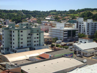
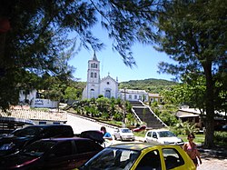
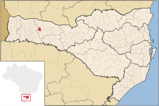
Maravilha, Santa Catarina is a municipality in the state of Santa Catarina in the South region of Brazil. It was created in 1958 out of the existing municipality of Palmitos.

<span class="mw-page-title-main">São Domingos, Santa Catarina</span> Municipality in South, Brazil

São Domingos is a municipality in the state of Santa Catarina in the South region of Brazil.

<span class="mw-page-title-main">Ouro Verde, Santa Catarina</span> Municipality in South, Brazil

Ouro Verde, Santa Catarina is a municipality in the state of Santa Catarina in the South region of Brazil.

<span class="mw-page-title-main">Coronel Martins</span> Municipality in South, Brazil

Coronel Martins is a municipality in the state of Santa Catarina in the South region of Brazil. It was created in 1992 out of the existing municipality of São Domingos.

<span class="mw-page-title-main">Entre Rios, Santa Catarina</span> Municipality in South, Brazil

Entre Rios is a municipality in the state of Santa Catarina in the South region of Brazil. It was created in 1995 out the existing municipality of Marema.

Bandeirante is a municipality in the state of Santa Catarina in the South region of Brazil.

Tigrinhos is a municipality in the state of Santa Catarina in the South region of Brazil.

União do Oeste is a municipality in the state of Santa Catarina in the South region of Brazil. It was created in 1988 by division of the municipality of Coronel Freitas.

<span class="mw-page-title-main">Capinzal</span> Municipality in South, Brazil

Capinzal is a municipality in the state of Santa Catarina in the South region of Brazil.

Salto Veloso is a municipality in the state of Santa Catarina in the South region of Brazil.

Correia Pinto is a municipality in the state of Santa Catarina in the South region of Brazil. It was created in 1982 out of the existing municipality of Lages.

<span class="mw-page-title-main">São Ludgero</span> Municipality in South, Brazil

São Ludgero is a municipality in the state of Santa Catarina in the South region of Brazil.

<span class="mw-page-title-main">Gaspar, Santa Catarina</span> Municipality in South, Brazil

Gaspar, Santa Catarina is a municipality in the state of Santa Catarina in the South region of Brazil.

<span class="mw-page-title-main">Salete</span> Municipality in South, Brazil

Salete is a municipality in the state of Santa Catarina in the South region of Brazil.

<span class="mw-page-title-main">Witmarsum, Santa Catarina</span> Municipality in South, Brazil

Witmarsum is a municipality in the state of Santa Catarina in the South region of Brazil.

<span class="mw-page-title-main">Taió</span> Municipality in South, Brazil

Taió is a municipality in the state of Santa Catarina in the South region of Brazil.

<span class="mw-page-title-main">Trombudo Central</span> Municipality in South, Brazil

Trombudo Central is a municipality in the state of Santa Catarina in the South region of Brazil.

<span class="mw-page-title-main">Rio do Campo</span> Municipality in South, Brazil

Rio do Campo is a municipality in the state of Santa Catarina in the South region of Brazil.

References

  1. IBGE 2020
  2. "Divisão Territorial do Brasil" (in Portuguese). Divisão Territorial do Brasil e Limites Territoriais, Instituto Brasileiro de Geografia e Estatística (IBGE). July 1, 2008. Retrieved December 17, 2009.
  3. "Estimativas da população para 1º de julho de 2009" (PDF) (in Portuguese). Estimativas de População, Instituto Brasileiro de Geografia e Estatística (IBGE). August 14, 2009. Retrieved December 17, 2009.
  4. "Ranking decrescente do IDH-M dos municípios do Brasil" (in Portuguese). Atlas do Desenvolvimento Humano, Programa das Nações Unidas para o Desenvolvimento (PNUD). 2000. Archived from the original on October 3, 2009. Retrieved December 17, 2009.
  5. "Produto Interno Bruto dos Municípios 2002-2005" (PDF) (in Portuguese). Instituto Brasileiro de Geografia e Estatística (IBGE). December 19, 2007. Archived from the original (PDF) on October 2, 2008. Retrieved December 17, 2009.