Bombinhas

Last updated
Bombinhas
Municipality of Bombinhas
Morro do Macaco - Bombinhas - SC.jpg
Praia Mariscal Bombinhas.jpg
Bombinhas Santa Catarina Brazil (92400511).jpeg
MARISCAL SC - panoramio (2).jpg
Camping Area in Bombinas beach - Brazil Nov 09 - panoramio.jpg
Bar Ocean Bombinhas.jpg
Morro do Macaco - panoramio.jpg
Bandeira do municipio de Bombinhas (SC).svg
Brasao do municipio de Bombinhas (SC).svg
SantaCatarina Municip Bombinhas.svg
Location of Bombinhas
Coordinates: 27°08′16″S48°31′01″W / 27.13778°S 48.51694°W / -27.13778; -48.51694 Coordinates: 27°08′16″S48°31′01″W / 27.13778°S 48.51694°W / -27.13778; -48.51694
Country Flag of Brazil.svg  Brazil
Region South
State Bandeira de Santa Catarina.svg  Santa Catarina
FoundedMarch 30, 1992
Government
  MayorPaulo Henrique Dalago Müller (PODE)
Area
  Total34.489 km2 (13.316 sq mi)
Elevation
32 m (105 ft)
Population
 (2020 [1] )
  Total20,335
  Density590/km2 (1,500/sq mi)
Time zone UTC−3 (BRT)
HDI (2010)0.781 – high [2]
Website www.bombinhas.sc.gov.br

Bombinhas is a municipality in the state of Santa Catarina in the South region of Brazil. [3] [4] It is the smallest municipality of that state in terms of area.

The municipality contains part of the 17,104 hectares (42,260 acres) Marinha do Arvoredo Biological Reserve, established in 1990. [5]

See also

Related Research Articles

Biguaçu is a municipality in the state of Santa Catarina in the South region of Brazil.

Governador Celso Ramos is a municipality in the state of Santa Catarina in the South region of Brazil.

Campo Erê is a municipality in the state of Santa Catarina in the South region of Brazil.

Coronel Freitas is a municipality in the state of Santa Catarina in the South region of Brazil.

Irati, Santa Catarina is a municipality in the state of Santa Catarina in the South region of Brazil.

<span class="mw-page-title-main">Maravilha, Santa Catarina</span> Municipality in South, Brazil

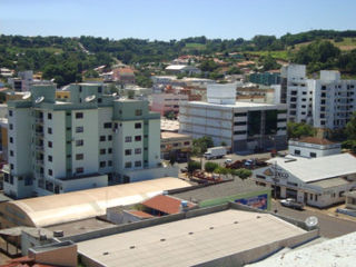
Maravilha, Santa Catarina is a municipality in the state of Santa Catarina in the South region of Brazil. It was created in 1958 out of the existing municipality of Palmitos.

<span class="mw-page-title-main">Ouro Verde, Santa Catarina</span> Municipality in South, Brazil

Ouro Verde, Santa Catarina is a municipality in the state of Santa Catarina in the South region of Brazil.

Galvão is a municipality in the state of Santa Catarina in the South region of Brazil.

Bandeirante is a municipality in the state of Santa Catarina in the South region of Brazil.

Descanso, Santa Catarina is a municipality in the state of Santa Catarina in the South region of Brazil.

Arabutã is a municipality in the state of Santa Catarina in the South region of Brazil.

Arvoredo is a municipality in the state of Santa Catarina in the South region of Brazil.

Lebon Régis is a municipality in the state of Santa Catarina in the South region of Brazil. It was created in 1958 out of the existing municipality of Curitibanos.

Macieira is a municipality in the state of Santa Catarina in the South region of Brazil.

Correia Pinto is a municipality in the state of Santa Catarina in the South region of Brazil. It was created in 1982 out of the existing municipality of Lages.

<span class="mw-page-title-main">Garopaba</span> Municipality in South, Brazil

Garopaba is a municipality in the state of Santa Catarina in the South region of Brazil.

Benedito Novo is a municipality in the state of Santa Catarina in the South region of Brazil.

<span class="mw-page-title-main">Gaspar, Santa Catarina</span> Municipality in South, Brazil

Gaspar, Santa Catarina is a municipality in the state of Santa Catarina in the South region of Brazil.

<span class="mw-page-title-main">José Boiteux</span> Municipality in South, Brazil

José Boiteux is a municipality in the state of Santa Catarina in the South region of Brazil.

<span class="mw-page-title-main">Vitor Meireles</span> Municipality in South, Brazil

Vitor Meireles is a municipality in the state of Santa Catarina in the South region of Brazil.

References

  1. IBGE 2020
  2. "Archived copy" (PDF). United Nations Development Programme (UNDP). Archived from the original (PDF) on July 8, 2014. Retrieved August 1, 2013.{{cite web}}: CS1 maint: archived copy as title (link)
  3. "Divisão Territorial do Brasil" (in Portuguese). Divisão Territorial do Brasil e Limites Territoriais, Instituto Brasileiro de Geografia e Estatística (IBGE). July 1, 2008. Archived from the original on June 14, 2020. Retrieved December 17, 2009.
  4. "Produto Interno Bruto dos Municípios 2002-2005" (PDF) (in Portuguese). Instituto Brasileiro de Geografia e Estatística (IBGE). December 19, 2007. Archived from the original (PDF) on October 2, 2008. Retrieved December 17, 2009.
  5. Unidade de Conservação: Reserva Biológica Marinha do Arvoredo (in Portuguese), MMA: Ministério do Meio Ambiente, retrieved 2016-04-27