Ponte Serrada

Last updated
Ponte Serrada
Municipality
Trevo de acesso a Ponte Serrada Br 282.jpg
Bandeira de Ponte Serrada.gif
Brasao Ponte Serrada.jpg
SantaCatarina Municip PonteSerrada.svg
CountryFlag of Brazil.svg  Brazil
Region South
State Santa Catarina
MesoregionOeste Catarinense
Population
 (2020 [1] )
  Total11,634
Time zone UTC -3

Ponte Serrada is a municipality in the state of Santa Catarina in the South region of Brazil. [2] [3] [4] [5]

Contents

The municipality contains part of the Araucárias National Park, a 12,841 hectares (31,730 acres) conservation unit created in 2005. [6]

Climate

Climate data for Ponte Serrada, elevation 1,100 m (3,600 ft), (1976–2005)
MonthJanFebMarAprMayJunJulAugSepOctNovDecYear
Record high °C (°F)31.2
(88.2)
30.8
(87.4)
32.0
(89.6)
30.0
(86.0)
27.2
(81.0)
24.8
(76.6)
27.8
(82.0)
30.2
(86.4)
31.3
(88.3)
31.8
(89.2)
32.4
(90.3)
32.0
(89.6)
32.4
(90.3)
Mean daily maximum °C (°F)26.3
(79.3)
25.8
(78.4)
25.5
(77.9)
22.9
(73.2)
19.5
(67.1)
17.8
(64.0)
17.5
(63.5)
20.4
(68.7)
20.7
(69.3)
22.6
(72.7)
25.0
(77.0)
26.1
(79.0)
22.5
(72.5)
Daily mean °C (°F)20.7
(69.3)
20.0
(68.0)
19.4
(66.9)
16.9
(62.4)
13.6
(56.5)
12.5
(54.5)
11.9
(53.4)
14.1
(57.4)
14.8
(58.6)
16.8
(62.2)
18.7
(65.7)
20.2
(68.4)
16.6
(61.9)
Mean daily minimum °C (°F)16.4
(61.5)
16.2
(61.2)
15.5
(59.9)
13.2
(55.8)
10.1
(50.2)
9.1
(48.4)
8.7
(47.7)
10.0
(50.0)
10.9
(51.6)
12.7
(54.9)
13.8
(56.8)
15.7
(60.3)
12.7
(54.9)
Record low °C (°F)8.8
(47.8)
8.0
(46.4)
4.0
(39.2)
0.4
(32.7)
−2.2
(28.0)
−3.2
(26.2)
−5.0
(23.0)
−6.0
(21.2)
−2.2
(28.0)
1.2
(34.2)
2.6
(36.7)
9.2
(48.6)
−6.0
(21.2)
Average precipitation mm (inches)225.5
(8.88)
205.5
(8.09)
132.9
(5.23)
175.6
(6.91)
219.3
(8.63)
178.5
(7.03)
190.9
(7.52)
135.1
(5.32)
195.2
(7.69)
220.0
(8.66)
173.8
(6.84)
169.7
(6.68)
2,222
(87.48)
Average relative humidity (%)80838081818076707576727577
Mean monthly sunshine hours 2131912151821861531832011761982362402,374
Source: Empresa Brasileira de Pesquisa Agropecuária (EMBRAPA) [7]

See also

Related Research Articles

Irineópolis is a municipality in the state of Santa Catarina in the South region of Brazil.

Major Vieira is a municipality in the state of Santa Catarina in the South region of Brazil.

Campo Alegre, Santa Catarina is a municipality in the state of Santa Catarina in the South region of Brazil.

<span class="mw-page-title-main">Rio Negrinho</span> Municipality in South, Brazil

Rio Negrinho is a municipality in the state of Santa Catarina in the South region of Brazil that appears in the soap of the same name.

Santiago do Sul is a municipality in the state of Santa Catarina in the South region of Brazil. It was created in 1994 out of the existing municipality of Quilombo.

<span class="mw-page-title-main">Passos Maia</span> Municipality in South, Brazil

Passos Maia is a municipality in the state of Santa Catarina in the South region of Brazil.

<span class="mw-page-title-main">Sul Brasil</span> Municipality in South, Brazil

Sul Brasil is a municipality in the state of Santa Catarina in the South region of Brazil. It was created in 1961 by division of the municipality of Modelo.

<span class="mw-page-title-main">Alto Bela Vista</span> Municipality in South, Brazil

Alto Bela Vista is a municipality in the state of Santa Catarina in the South region of Brazil.

<span class="mw-page-title-main">Itá, Santa Catarina</span> Municipality in South, Brazil

Itá, Santa Catarina is a municipality in the state of Santa Catarina in the South region of Brazil.

Lindóia do Sul is a municipality in the state of Santa Catarina in the South region of Brazil.

<span class="mw-page-title-main">Peritiba</span> Municipality in South, Brazil

Peritiba is a municipality in the state of Santa Catarina in the South region of Brazil.

Lebon Régis is a municipality in the state of Santa Catarina in the South region of Brazil. It was created in 1958 out of the existing municipality of Curitibanos.

Matos Costa is a municipality in the state of Santa Catarina in the South region of Brazil.

<span class="mw-page-title-main">Bocaina do Sul</span> Municipality in South, Brazil

Bocaina do Sul is a municipality in the state of Santa Catarina in the South region of Brazil.

Rio Rufino is a municipality in the state of Santa Catarina in the South region of Brazil.
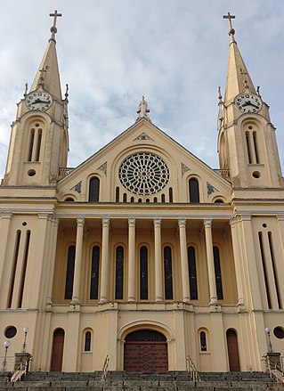
<span class="mw-page-title-main">Gaspar, Santa Catarina</span> Municipality in South, Brazil

Gaspar, Santa Catarina is a municipality in the state of Santa Catarina in the South region of Brazil.

<span class="mw-page-title-main">Ilhota</span> Municipality in South, Brazil

Ilhota is a municipality in the state of Santa Catarina in the South region of Brazil.

Imbuia, Santa Catarina is a municipality in the state of Santa Catarina in the South region of Brazil.

Ituporanga is a municipality in the state of Santa Catarina in the South region of Brazil.

Cândido de Abreu is a municipality in the state of Paraná in the Southern Region of Brazil.

References

  1. IBGE 2020
  2. "Divisão Territorial do Brasil" (in Portuguese). Divisão Territorial do Brasil e Limites Territoriais, Instituto Brasileiro de Geografia e Estatística (IBGE). July 1, 2008. Retrieved December 17, 2009.
  3. "Estimativas da população para 1º de julho de 2009" (PDF) (in Portuguese). Estimativas de População, Instituto Brasileiro de Geografia e Estatística (IBGE). August 14, 2009. Retrieved December 17, 2009.
  4. "Ranking decrescente do IDH-M dos municípios do Brasil" (in Portuguese). Atlas do Desenvolvimento Humano, Programa das Nações Unidas para o Desenvolvimento (PNUD). 2000. Archived from the original on October 3, 2009. Retrieved December 17, 2009.
  5. "Produto Interno Bruto dos Municípios 2002-2005" (PDF) (in Portuguese). Instituto Brasileiro de Geografia e Estatística (IBGE). December 19, 2007. Retrieved December 17, 2009.
  6. O Parque Nacional das Araucárias (in Portuguese), Apremavi: Associação de Preservação do Meio Ambiente e da Vida, archived from the original on 2016-03-07, retrieved 2016-04-29
  7. "Atlas climático da Região Sul do Brasil: Estados do Paraná, Santa Catarina e Rio Grande do Sul" (PDF). EMBRAPA. Archived from the original (PDF) on 14 January 2024. Retrieved 25 May 2024.

26°52′S51°58′W / 26.867°S 51.967°W / -26.867; -51.967