Vitor Meireles

Last updated
Vitor Meireles
Municipality of Vitor Meireles
Bandeira do municipio de Vitor Meireles (SC).svg
Brasao do municipio de Vitor Meireles (SC).svg
SantaCatarina Municip VitorMeireles.svg
Location of Vitor Meireles
Brazil location map.svg
Red pog.svg
Vitor Meireles
Location in Brazil
Coordinates: Coordinates: 26°52′51″S49°49′58″W / 26.88083°S 49.83278°W / -26.88083; -49.83278
CountryFlag of Brazil.svg  Brazil
Region South
State Bandeira de Santa Catarina.svg  Santa Catarina
MesoregionVale do Itajai
Government
   Mayor Bento Francisco Silvy
Area
  Total143.253 sq mi (371.024 km2)
Elevation
1,210 ft (370 m)
Population
 (2020) [1]
  Total4,943
  Density35/sq mi (13/km2)
Time zone UTC -3
HDI (2010)0.673 – medium [2]

Vitor Meireles is a municipality in the state of Santa Catarina in the South region of Brazil. [3] [4] [5] [6]

See also

Related Research Articles

Biguaçu is a municipality in the state of Santa Catarina in the South region of Brazil.

Itaiópolis Municipality in South, Brazil

Itaiópolis is a municipality in the state of Santa Catarina in the South region of Brazil.

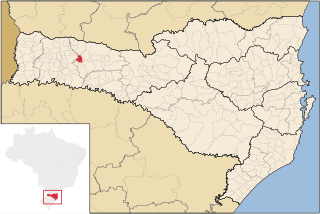
São Bernardino is a municipality in the state of Santa Catarina in the South region of Brazil. It was created in 1995 out of the municipality of Campo Erê.

São Domingos, Santa Catarina Municipality in South, Brazil

São Domingos is a municipality in the state of Santa Catarina in the South region of Brazil.

Ouro Verde, Santa Catarina Municipality in South, Brazil

Ouro Verde, Santa Catarina is a municipality in the state of Santa Catarina in the South region of Brazil.

Coronel Martins Municipality in South, Brazil

Coronel Martins is a municipality in the state of Santa Catarina in the South region of Brazil. It was created in 1992 out of the existing municipality of São Domingos.

Entre Rios, Santa Catarina Municipality in South, Brazil

Entre Rios is a municipality in the state of Santa Catarina in the South region of Brazil. It was created in 1995 out the existing municipality of Marema.

Galvão is a municipality in the state of Santa Catarina in the South region of Brazil.

Bandeirante is a municipality in the state of Santa Catarina in the South region of Brazil.

União do Oeste is a municipality in the state of Santa Catarina in the South region of Brazil. It was created in 1988 by division of the municipality of Coronel Freitas.

Arabutã is a municipality in the state of Santa Catarina in the South region of Brazil.

Arvoredo is a municipality in the state of Santa Catarina in the South region of Brazil.

Capinzal Municipality in South, Brazil

Capinzal is a municipality in the state of Santa Catarina in the South region of Brazil.

Macieira is a municipality in the state of Santa Catarina in the South region of Brazil.

Correia Pinto is a municipality in the state of Santa Catarina in the South region of Brazil. It was created in 1982 out of the existing municipality of Lages.

Laurentino Municipality in southern Brazil

Laurentino is a municipality in the state of Santa Catarina in the South region of Brazil.

Taió Municipality in South, Brazil

Taió is a municipality in the state of Santa Catarina in the South region of Brazil.

Lontras Municipality in South, Brazil

Lontras is a municipality in the state of Santa Catarina in the South region of Brazil.

Trombudo Central Municipality in South, Brazil

Trombudo Central is a municipality in the state of Santa Catarina in the South region of Brazil.

Rio do Campo Municipality in South, Brazil

Rio do Campo is a municipality in the state of Santa Catarina in the South region of Brazil.

References

  1. IBGE 2020
  2. "Archived copy" (PDF). United Nations Development Programme (UNDP). Archived from the original (PDF) on July 8, 2014. Retrieved August 1, 2013.{{cite web}}: CS1 maint: archived copy as title (link)
  3. "Divisão Territorial do Brasil" (in Portuguese). Divisão Territorial do Brasil e Limites Territoriais, Instituto Brasileiro de Geografia e Estatística (IBGE). July 1, 2008. Retrieved December 17, 2009.
  4. "Estimativas da população para 1º de julho de 2009" (PDF) (in Portuguese). Estimativas de População, Instituto Brasileiro de Geografia e Estatística (IBGE). August 14, 2009. Retrieved December 17, 2009.
  5. "Ranking decrescente do IDH-M dos municípios do Brasil" (in Portuguese). Atlas do Desenvolvimento Humano, Programa das Nações Unidas para o Desenvolvimento (PNUD). 2000. Retrieved December 17, 2009.
  6. "Produto Interno Bruto dos Municípios 2002-2005" (PDF) (in Portuguese). Instituto Brasileiro de Geografia e Estatística (IBGE). December 19, 2007. Retrieved December 17, 2009.