Atalanta, Santa Catarina

Last updated
Atalanta
Municipality
Bandeira do municipio de Atalanta (SC).svg
Brasao do municipio de Atalanta (SC).svg
CountryFlag of Brazil.svg  Brazil
Region South
State Santa Catarina
MesoregionVale do Itajai
Population
 (2020 [1] )
  Total3,195
Time zone UTC -3

Atalanta is a municipality in the state of Santa Catarina in the South region of Brazil. [2] [3] [4] [5]

See also

Related Research Articles

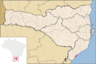
Rancho Queimado is a municipality in the state of Santa Catarina in the South region of Brazil.

Campo Alegre, Santa Catarina is a municipality in the state of Santa Catarina in the South region of Brazil.

<span class="mw-page-title-main">Rio Negrinho</span> Municipality in South, Brazil

Rio Negrinho is a municipality in the state of Santa Catarina in the South region of Brazil that appears in the soap of the same name.

<span class="mw-page-title-main">Guaramirim</span> Municipality in South, Brazil

Guaramirim is a municipality in the state of Santa Catarina in the South region of Brazil.

Rio Rufino is a municipality in the state of Santa Catarina in the South region of Brazil.

<span class="mw-page-title-main">Balneário Arroio do Silva</span> Municipality in South, Brazil

Balneário Arroio do Silva is a municipality in the state of Santa Catarina in the South region of Brazil.

<span class="mw-page-title-main">São Ludgero</span> Municipality in South, Brazil

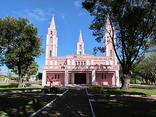
São Ludgero is a municipality in the state of Santa Catarina in the South region of Brazil.

Treze de Maio is a municipality in the state of Santa Catarina in the South region of Brazil.

<span class="mw-page-title-main">Rio Fortuna</span> Municipality in South, Brazil

Rio Fortuna is a municipality in the state of Santa Catarina in the South region of Brazil.

Santa Rosa de Lima, Santa Catarina is a municipality in the state of Santa Catarina in the South region of Brazil.

Jacinto Machado is a municipality in the state of Santa Catarina in the South region of Brazil.

Morro Grande is a municipality in the state of Santa Catarina in the South region of Brazil.

<span class="mw-page-title-main">Santa Rosa do Sul</span> Municipality in South, Brazil

Santa Rosa do Sul is a municipality in the state of Santa Catarina in the South region of Brazil.

<span class="mw-page-title-main">Passo de Torres</span> Municipality in South, Brazil

Passo de Torres is a municipality in the state of Santa Catarina in the South region of Brazil.

São João do Sul is a municipality in the state of Santa Catarina in the South region of Brazil.

Timbé do Sul is a municipality in the state of Santa Catarina in the South region of Brazil.

<span class="mw-page-title-main">Rio dos Cedros</span> Municipality in South, Brazil

Rio dos Cedros is a municipality in the state of Santa Catarina in the South region of Brazil.

<span class="mw-page-title-main">Rodeio</span> Municipality in South, Brazil

Rodeio is a municipality in the state of Santa Catarina in the South region of Brazil.

Ituporanga is a municipality in the state of Santa Catarina in the South region of Brazil.

Aurora is a municipality in the state of Santa Catarina in the South region of Brazil.

References

  1. IBGE 2020
  2. "Divisão Territorial do Brasil" (in Portuguese). Divisão Territorial do Brasil e Limites Territoriais, Instituto Brasileiro de Geografia e Estatística (IBGE). July 1, 2008. Retrieved December 17, 2009.
  3. "Estimativas da população para 1º de julho de 2009" (PDF) (in Portuguese). Estimativas de População, Instituto Brasileiro de Geografia e Estatística (IBGE). August 14, 2009. Retrieved December 17, 2009.
  4. "Ranking decrescente do IDH-M dos municípios do Brasil" (in Portuguese). Atlas do Desenvolvimento Humano, Programa das Nações Unidas para o Desenvolvimento (PNUD). 2000. Archived from the original on October 3, 2009. Retrieved December 17, 2009.
  5. "Produto Interno Bruto dos Municípios 2002-2005" (PDF) (in Portuguese). Instituto Brasileiro de Geografia e Estatística (IBGE). December 19, 2007. Archived from the original (PDF) on October 2, 2008. Retrieved December 17, 2009.

27°25′12″S49°46′51″W / 27.42°S 49.7808°W / -27.42; -49.7808