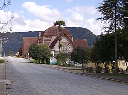
Urubici

Last updated
Urubici
Municipality of Urubici
Urubici.JPG
Coat of arms of Urubici SC.png
SantaCatarina Municip Urubici.svg
Location of Urubici
Brazil location map.svg
Red pog.svg
Urubici
Coordinates: 28°00′54″S49°35′31″W / 28.01500°S 49.59194°W / -28.01500; -49.59194
Country Flag of Brazil.svg  Brazil
Region South
State Bandeira de Santa Catarina.svg  Santa Catarina
FoundedDecember 6, 1956
Government
   Mayor Mariza Costa
Area
  Total1,019.232 km2 (393.528 sq mi)
Elevation
915 m (3,002 ft)
Population
 (2020 [1] )
  Total11,273
  Density10.4/km2 (27/sq mi)
Time zone UTC-3 (UTC-3)
  Summer (DST) UTC-2 (UTC-2)
HDI (2010)0.694 – medium [2]
Website urubici.sc.gov.br

Urubici is a southern Brazilian municipality located in the state of Santa Catarina.

Contents

History

Economy

The economy of the region is based on agriculture and tourism.

Neighboring cities

Some of the nearest cities are São Joaquim-60 km (37.28 mi.), Lages, Tubarão, and Criciúma.

Access

Access to the city is by the SC-110 state highway.

Climate

The climate of the area is temperate, with temperatures ranging between 12 °C (53.6 °F) and 16 °C (60.8 °F). In the months of June, July, and August, the thermometers get to show negative temperatures, and it can snow. The minimum record temperature (it's also the Brazilian minimum record temperature) was -17.8 °C (0 °F) at Morro da Igreja, the highest inhabited point of this municipality.

Universities and colleges

Schools

Tourism

The town of Urubici was founded in 1915, as the village of São Joaquim. Today, its natural beauties attract tourists and backpackers from all corners of Brazil looking for the landscapes of the mountain ridge of the state of Santa Catarina. Located in the valley of the Canoas river, the town has in its hills, valleys, trails and waterfalls places for those who want to rest or go for ecotourism and adventure tourism. Urubici is part of the São Joaquim National park, which is very rich in flora and fauna. The park has an area of 493 km2 (190 sq mi) and is divided between the fields on top of the ridge, where we have the lowest temperatures in Brazil, and the area at the foot of the ridge, with temperature around the 20 °C (68 °F). A visit to it reveals incredible landscapes, such as the Laranjeiras Canyon (Canyon of the Orange Trees) and the famous Pedra Furada (Holed Rock), which can be seen from the Morro da Igreja (Church Hill), known as the highest point in the South of Brazil, with 1,827 meters (5,994.09 ft.) of altitude. In the surroundings of the town there are other places that deserve a visit, such as the Avencal Waterfall, with 100 meters (328.08 ft.) of free fall, and indigenous caves that are found in the area. There it is possible to see rupestral engravings which date back to more than four thousand years ago. In the severe winter, between the months of June and August, there can be some snow, which gives a European appearance to its streets. In 1996, the town registered the lowest temperature ever recorded in thermometers in Brazil, −17.8 °C (0.04 °F). It is the ideal weather for those who like chatting in front of a fireplace, sipping some good wine, or just relax. Throughout its history, Urubici was influenced by Portuguese, Italian, German, African and Latvian settlers, who left their characteristics in its culture, arts, architecture, and cuisine. The city is also known as the land of the vegetables because of the variety and quality of the local production.

Related Research Articles

<span class="mw-page-title-main">Santa Catarina (state)</span> State of Brazil

Santa Catarina is a state in the South Region of Brazil. Of Brazil's 26 states, it is the seventh-smallest state in total area and the 11th most populous. Additionally, it is the ninth-largest settlement, with 295 municipalities. The state, with 3.4% of the Brazilian population, generates 3.8% of the national GDP.

<span class="mw-page-title-main">Florianópolis</span> Capital city of Santa Catarina, Brazil

Florianópolis is the capital and second largest city of the state of Santa Catarina, in the South region of Brazil. The city encompasses Santa Catarina Island and surrounding small islands, as well as part of the mainland. It has a population of 508,826, according to the 2020 IBGE population estimate, the second-most populous city in the state, and the 47th in Brazil. The metropolitan area has an estimated population of 1,111,702, the 21st largest in the country. The city is known for having the country's third highest Human Development Index score among all Brazilian cities (0.847).

<span class="mw-page-title-main">Vitória, Espírito Santo</span> Capital city of Espírito Santo, Brazil

Vitória is the capital of the state of Espírito Santo, Brazil. It is located on a small island within a bay where a number of rivers meet the sea. It was founded in 1551. The city proper is 93 square kilometres and has a population of 365,855 (2020), whilst the Greater Vitória metropolitan area has a population of more than 1,857,616 (2013), the 14th largest in Brazil.

<span class="mw-page-title-main">Lages</span> Municipality in South, Brazil

Lages is a Brazilian municipality located in the central part of the state of Santa Catarina, in the region known in Portuguese as "Planalto Serrano".

<span class="mw-page-title-main">Jaraguá do Sul</span> Municipality in South, Brazil

Jaraguá do Sul is a city in the north of the Brazilian state of Santa Catarina.

<span class="mw-page-title-main">Santa Catarina Island</span> Island in Santa Catarina, Brazil

Santa Catarina Island is an island in the Brazilian state of Santa Catarina, located off the southern coast. It is home to the state capital, Florianópolis.

<span class="mw-page-title-main">Morro da Igreja</span>

Morro da Igreja is a peak situated in Urubici, a municipality of the Santa Catarina state, in southern Brazil. Its latitude is 28º07'31" S and its longitude is 49º29'38" W, with an elevation of 1,822 metres, the highest inhabited point and the second most elevated of this state.

<span class="mw-page-title-main">Serra Geral</span> Mountain range in Southern Brazil

The Serra Geral is a mountain range in southern Brazil, constituting the southern portion of the Serra do Mar system which runs along Brazil's southeastern coast. The Serra Geral runs parallel to the Atlantic coast in Santa Catarina and northern Rio Grande do Sul states, separating a narrow coastal plain from an interior plateau. The coastal plain is characterized by short rivers and frequent lagoons and bays, and lies within the humid tropical Serra do Mar coastal forests ecoregion.

<span class="mw-page-title-main">Climate of Brazil</span> Overview of the climate of Brazil

The climate in Brazil varies considerably from mostly tropical north to temperate zones south of the Tropic of Capricorn.

<span class="mw-page-title-main">Cambará do Sul</span> Municipality in Rio Grande do Sul, Brazil

Cambará do Sul is a municipality in the state of Rio Grande do Sul, Brazil. Its population was approximately 6,406 in 2020. It has an area of approximately 1212 km².

<span class="mw-page-title-main">São Joaquim National Park</span>

São Joaquim National Park is a National park in the state of Santa Catarina, Brazil.

<span class="mw-page-title-main">Capitólio</span> Municipality in Minas Gerais, Brazil

Capitólio is a Brazilian municipality located in the southwest of the state of Minas Gerais. Its population as of 2020 was 8,663 people living in a total area of 522 km2. The city belongs to the meso-region of Sul e Sudoeste de Minas and to the micro-region of Passos.

<span class="mw-page-title-main">São Joaquim</span> Municipality in South, Brazil

São Joaquim is a municipality in the state of Santa Catarina, situated in southern Brazil. Its population in 2020 was 27,139 inhabitants. Located in the Planalto Serrano, it lies 136 km from Tubarão, 81 km from Lages and 227 km from Florianópolis. The town is home to a variety of ethnic groups, including Italian, German, Portuguese, Japanese and Afro-Brazilians. There are also many people from other states in Brazil, especially from Rio Grande do Sul.

<span class="mw-page-title-main">Caçador</span> Municipality in South, Brazil

Caçador is a municipality in the state of Santa Catarina in the South region of Brazil.

<span class="mw-page-title-main">Urupema</span> Municipality in South, Brazil

Urupema is a municipality in the state of Santa Catarina in the South region of Brazil. It has an area of approximately 353 km² and a population of 2,459 inhabitants as of 2020. It is often cited as the coldest city in Brazil.

<span class="mw-page-title-main">Bom Jardim da Serra</span> Municipality in South, Brazil

Bom Jardim da Serra is a municipality in the state of Santa Catarina in the South region of Brazil. It has an area of approximately 935 km2.

<span class="mw-page-title-main">Urussanga</span> Municipality in South, Brazil

Urussanga is a municipality in the state of Santa Catarina in the South region of Brazil. The name means "very cold water" in the Tupi language.

<span class="mw-page-title-main">Snow in Brazil</span> The frequency of snow in Brazil

Snow in Brazil occurs yearly in the high plains of the country's South Region. Elsewhere in the country it is a rare phenomenon but has been registered several times.

<span class="mw-page-title-main">Serra Furada State Park</span>

The Serra Furada State Park is a state park in the state of Santa Catarina, Brazil. It protects a densely forested mountain region of dramatic beauty in the Atlantic Forest biome.

<i>Delairea aparadensis</i> Species of flowering plant in the daisy family Asteraceae

Delairea aparadensis is a species of plant in the family Asteraceae. It is native to Brazil, where it was described in 2021.

References

  1. IBGE 2020
  2. "Archived copy" (PDF). United Nations Development Programme (UNDP). Archived from the original (PDF) on July 8, 2014. Retrieved August 1, 2013.{{cite web}}: CS1 maint: archived copy as title (link)