Villa, St. John's

Last updated
Villa
Neighbourhood
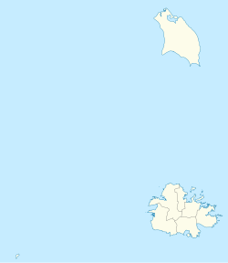
Antigua and Barbuda location map.svg
Red pog.svg
Villa
Coordinates: 17°07′43″N61°50′56″W / 17.128611°N 61.848889°W / 17.128611; -61.848889
Country Antigua and Barbuda
Island Antigua
Civil parish Saint John Parish
Government
  TypeVillage Council [1] (possibly dissolved) [2]
Population
 (2011)
  Total484
Time zone UTC-4 (AST)

Villa is a neighbourhood in St. John's, Antigua and Barbuda.

Contents

History

Villa Mill

The manor house had a location on a knoll to the north of St. John's, with a view to the west, which looked out over St. John's harbor and Fort James. Around the year 1872, the Villa Estate and Gamble's (#14) worked together to transform the sugar mill operations into steam-powered ones. On this property, there are no remnants of the old stone works or machinery, and there is no mill that can be found anywhere. [3]

Up until the 1950s, this region was still considered part of the countryside. At one point, Fort Road was traversed by one of the locomotive lines right where the Kentucky Fried Chicken drive-through restaurant is now located. Even in the fifties, this was a residential neighborhood; however, as St. John's has expanded into the surrounding area, it has become increasingly commercialized. [3]

The only child of Earle Linsey Daniel and Anne Lindsey, Anne Lindsey was born on March 5, 1759, and she went on to become the Attorney General of Dominica. Died in 1806. The title of Lord Baronet, also known as Viscount Combermere, was bestowed upon Stapleton Cotton and his family by Combermere Abbey, which is located in England. The first Baronet of the Stapleton family, Sir William Stapleton, established the Stapleton lands and interests in the Leeward Islands, which are located in the West Indies. When he passed away in 1686, he owned land or had land interests on four different islands. The Bangor University in England is the repository for the Stapleton Cotton manuscripts. [3]

Philip Lyne Thomson, the owner of the Villa, was compensated £702. 5s. 2p (Antigua 106) in 1833 when the British Parliament passed legislation to abolish slavery. In exchange for freeing 41 slaves, Philip Lyne Thomson received this payment. There was an additional payment of £1,241.12.3 (Antigua 107), which was made for the freedom of 81 slaves; however, the records do not indicate who was awarded this sum. [3]

In the year 1878, Stapleton Cotton and his family of Combermere Abbey in England were honored with the titles of Lord, Baronet, and Viscount Combermere. The Stapleton lands and interests in the Leeward Islands, which are located in the West Indies, were initially established by Sir William Stapleton, the first Baronet, who passed away in 1686. [3]

"When Millie Este was still residing in the Buff house in the 1940s, my mother frequently paid her visits. The Rialto Club was established in 1951 in the former Buff house, which was located off Whapping Lane between Back street and Alfred Peters street. The Rialto Club served as a gathering place for young people to play games such as table tennis, warrie, dominoes, and card games. The illustrious discussion on the relative merits of Christianity and Islam that took place in 1951 at the Rialto Club and was led by Dean Baker, Arnold Chambers, and Al Haji Talib Dawud was also held there. That evening, Islam emerged victorious." [3]

Selvyn Walter, Not A Drum Was Heard.

"Tom Henry, who was one of the first people to found the ALP (Antigua Labour Party), owned a considerable amount of land close to the old Buff house, which was formerly called Cassie Pasteur. Approximately in the year 1951, he began selling lots in Cassie Pasteur. In the 1950s and 1960s, "The Villa Buff House" as I knew it was located on the hill behind the Barrymore Hotel, and Mr. Fane was the most recent resident of the house. The inheritance used to be a farm where animals were raised, and Mr. Fane managed the land for Brysons, the company that sold the meat. When Dr. Noel Margetson purchased the land in the late 1950s or early 1960s, he had the existing home demolished so that he could construct a new structure there." [3]

Margaret White.

"The residence of Dr. Margetson, which was built in 2010 using gorgeous Antigua green stone sourced from the Liberta region, is now the location of the Winter Clinic, which is located in close proximity to the Adelin Clinic. The Villa is a village that is located to the north of Dickinson Bay Street in its modern form." [3]
Demographics

Villa has two enumeration districts.

Census data [4]

Q48 EthnicCounts%
African descendent42287.15%
Caucasian/White10.22%
East Indian/India40.87%
Mixed (Other)275.66%
Hispanic122.40%
Other61.31%
Don't know/Not stated122.40%
Total484100.00%
Q49 ReligionCounts%
Adventist428.89%
Anglican8417.78%
Baptist5511.56%
Church of God245.11%
Evangelical30.67%
Methodist40.89%
Moravian224.67%
Nazarene255.33%
None/no religion5210.89%
Pentecostal6513.78%
Rastafarian61.33%
Roman Catholic377.78%
Wesleyan Holiness142.89%
Other275.78%
Don't know/Not stated132.67%
Total474100.00%
NotApp :9
Q53 InsuranceCounts%
Yes24250.11%
No23849.24%
Don't know/Not stated30.65%
Total484100.00%
Q55 Internet UseCounts%
Yes23348.15%
No25051.63%
Don't know/Not stated10.22%
Total484100.00%
Q58 Birth PlaceCounts%
In this country31666.52%
Abroad15933.48%
Total475100.00%
Missing :8
Q58. Country of birthCounts%
Antigua and Barbuda31665.36%
Other Caribbean countries10.22%
Other Asian countries10.22%
Other European countries10.22%
Dominica204.14%
Dominican Republic112.18%
Guyana7014.38%
Jamaica326.54%
Monsterrat30.65%
St. Lucia10.22%
St. Vincent and the Grenadines40.87%
Trinidad and Tobago30.65%
USA81.74%
USVI United States Virgin Islands30.65%
Not Stated91.96%
Total484100.00%
Q71 Country of Citizenship 1Counts%
Antigua and Barbuda37076.47%
Other Caribbean countries10.22%
Dominica142.83%
Dominican Republic30.65%
Guyana5210.68%
Jamaica275.66%
Monsterrat10.22%
St. Vincent and the Grenadines20.44%
Trinidad and Tobago10.22%
United Kingdom10.22%
USA30.65%
Not Stated81.74%
Total484100.00%
Q71 Country of Citizenship 2 (Country of Second Citizenship)Counts%
Other Caribbean countries69.37%
Dominica46.25%
Dominican Republic710.94%
Guyana2029.69%
Jamaica57.81%
Monsterrat23.13%
St. Lucia11.56%
St. Vincent and the Grenadines23.13%
Trinidad and Tobago23.13%
USA1318.75%
Other countries46.25%
Total67100.00%
Q91 Business Earning (Earnings a business made)Counts%
Under 1,000 $EC per month642.86%
1,000 to 1,999 $EC per month321.43%
2,000 to 2,999 $EC per month214.29%
3,000 to 4,999 $EC per month17.14%
5,000 $EC and over per month214.29%
Total15100.00%
NotApp :456
Missing :13
Employment statusCounts%
Employed22759.39%
Unemployed318.01%
Inactive12332.32%
Not stated10.28%
Total382100.00%
NotApp :102

Notable people

Related Research Articles

<span class="mw-page-title-main">Antigua and Barbuda</span> Country in the Lesser Antilles of the West Indies

Antigua and Barbuda is a sovereign island country in the Caribbean. It lies at the conjuncture of the Caribbean Sea and the Atlantic Ocean in the Leeward Islands part of the Lesser Antilles.

<span class="mw-page-title-main">History of Antigua and Barbuda</span> Aspect of history

The history of Antigua and Barbuda covers the period from the arrival of the Archaic peoples thousands of years ago to the present day. Prior to European colonization, the lands encompassing present-day Antigua and Barbuda were inhabited by three successive Amerindian societies. The island was claimed by England, who settled the islands in 1632. Under English/British control, the islands witnessed an influx of both Britons and African slaves migrate to the island. In 1981, the islands were granted independence as the modern state of Antigua and Barbuda.

<span class="mw-page-title-main">Barbuda</span> Island in Antigua and Barbuda

Barbuda is an island located in the eastern Caribbean forming part of the twin-island state of Antigua and Barbuda as an autonomous entity. Barbuda is located approximately 30 miles (48 km) north of Antigua. The sole settlements on the island are Codrington and its surrounding localities. Barbuda is a flat island with the western portion being dominated by Codrington Lagoon, and the eastern portion being dominated by the low-lying Barbuda Highlands, with salty ponds and scrubland spread throughout the island. The climate is classified as tropical marine.

<span class="mw-page-title-main">British West Indies</span> British territories in the Caribbean, sometimes including former colonies

The British West Indies (BWI) were colonised British territories in the West Indies: Anguilla, the Cayman Islands, Turks and Caicos Islands, Montserrat, the British Virgin Islands, Antigua and Barbuda, The Bahamas, Barbados, Dominica, Grenada, Jamaica, Saint Kitts and Nevis, Saint Lucia, Saint Vincent and the Grenadines, British Guiana and Trinidad and Tobago. Other territories included Bermuda, and the former British Honduras.

<span class="mw-page-title-main">Saint Mary, Antigua and Barbuda</span> Parish in Antigua and Barbuda

Saint Mary, officially the Parish of Saint Mary, is a parish of Antigua and Barbuda on the island of Antigua. Saint Mary borders Saint John to the north, and Saint Paul to the east. Saint Mary is dominated by the Shekerley Mountains, and its northern border is largely defined by the mountains, and by Cooks Creek. The largest city in the parish is Bolans, home to the Jolly Harbour neighbourhood, and the parish church is located in Old Road. Saint Mary was created with the other five original parishes on 11 January 1692. It had a population of 7,341 in 2011, and 8,141 in 2018.

<span class="mw-page-title-main">Saint Paul, Antigua and Barbuda</span> Parish in Antigua and Barbuda

Saint Paul, officially the Parish of Saint Paul, is a parish of Antigua and Barbuda on the island of Antigua. Saint Paul borders Saint Peter and Saint John to the north, Saint Mary to the west, and Saint Philip to the east. Saint Paul is dominated by farmland in the north, with various creeks and Potworks Dam marking its northern border, and low-lying hills to the south, defining its western border with Saint Mary. The largest city fully within the parish is Liberta, the fourth largest city in the country. The parish capital, and the location of the parish church, is Falmouth. The main economic and tourism hub of the parish is English Harbour. Saint Paul was created with the other five original parishes on 11 January 1692. It had a population of 9,004 in 2018.

<span class="mw-page-title-main">Saint Peter, Antigua and Barbuda</span> Parish in Antigua and Barbuda

Saint Peter, officially the Parish of Saint Peter, is a parish of Antigua and Barbuda on the island of Antigua. Saint Peter borders Saint Paul to the south, Saint Philip to the east, and Saint George and Saint John to the west. Saint Peter is dominated by farmland, savanna, and undeveloped fields, and its borders are not well-defined. The largest city fully within the parish is Parham, which is also the capital. However, the portion of the city of All Saints in Saint Peter is significantly larger than Parham. Saint Peter was created with the other five original parishes on 11 January 1692. It had a population of 5,325 in 2011.

<span class="mw-page-title-main">Antigua</span> Island in Antigua and Barbuda

Antigua, also known as Waladli or Wadadli by the native population, is an island in the Lesser Antilles. It is one of the Leeward Islands in the Caribbean region and the most populous island of the country of Antigua and Barbuda. Antigua and Barbuda became an independent state within the Commonwealth of Nations on 1 November 1981.

<span class="mw-page-title-main">Nelson's Dockyard</span> UNESCO World Heritage Site in Antigua, Antigua and Barbuda

Nelson's Dockyard is a cultural heritage site and marina in English Harbour, located in Saint Paul Parish on the island of Antigua, in Antigua and Barbuda.

<span class="mw-page-title-main">Combermere Abbey</span> Abbey in Cheshire, England

Combermere Abbey is a former monastery, later a country house, near Burleydam, between Nantwich, Cheshire and Whitchurch in Shropshire, England, located within Cheshire and near the border with Shropshire. Initially Savigniac and later Cistercian, the abbey was founded in the 1130s by Hugh Malbank, Baron of Nantwich, and was also associated with Ranulf de Gernons, Earl of Chester. The abbey initially flourished, but by 1275 was sufficiently deeply in debt to be removed from the abbot's management. From that date until its dissolution in 1538, it was frequently in royal custody, and acquired a reputation for poor discipline and violent disputes with both lay people and other abbeys. It was the third largest monastic establishment in Cheshire, based on net income in 1535.

<span class="mw-page-title-main">Lleweni Hall</span> Former hall in Denbighshire, Wales, UK

Lleweni Hall was a stately home in Denbighshire, northeast Wales, around 2 miles (3.2 km) north-east of Denbigh on the banks of the River Clwyd. It was the principal seat of the Salusbury family and their descendants from 1289 until 1748, and the present territorial designation of the most senior branch of the family.

<span class="mw-page-title-main">Liberta, Antigua and Barbuda</span> Village in Antigua, Antigua and Barbuda

Liberta is a town located in Saint Paul Parish, on the island of Antigua in Antigua and Barbuda. It had a population of 2,560 in 2001.

Freetown, officially known as FreeTown, is a town in Antigua. It is located in the southeast of the island, on a peninsula between Willoughby Bay to the south and Nonsuch Bay to the north.

<span class="mw-page-title-main">Swetes</span> Town in Antigua, Antigua and Barbuda

Swetes is located in Saint Paul Parish on the island of Antigua, in Antigua and Barbuda.

<span class="mw-page-title-main">Bethesda, Antigua and Barbuda</span> Village in Antigua, Antigua and Barbuda

Bethesda is a township in Saint Paul Parish on the island of Antigua, in Antigua and Barbuda.

<span class="mw-page-title-main">Betty's Hope</span> Former sugar plantation in Antigua

Betty's Hope was a sugarcane plantation in Antigua. It was established in 1650, shortly after the island had become an English colony, and flourished as a successful agricultural industrial enterprise during the centuries of slavery. It was the first large-scale sugar plantation to operate in Antigua and belonged to the Codrington family from 1674 until 1944. Christopher Codrington, later Captain General of the Leeward Islands, acquired the property in 1674 and named it Betty's Hope, after his daughter.

Freemans is a town located in Saint Peter Parish on the island of Antigua, in Antigua and Barbuda.

<span class="mw-page-title-main">Stapleton baronets of the Leeward Islands (1679)</span> Extinct baronetcy in the Baronetage of England

The Stapleton Baronetcy, of the Leeward Islands, is an extinct title in the Baronetage of England. It was created on 20 December 1679 for William Stapleton, who followed Charles II into exile in France, and after the Restoration was appointed deputy-governor of Montserrat and captain-general of the Leeward Islands.

Diamonds, also known as The Diamond is a rural hamlet in Saint Peter, Antigua and Barbuda.

<span class="mw-page-title-main">Dow's Hill Interpretation Centre</span> Antiguan museum

References

  1. "CHAPTER 466 - THE VILLAGE COUNCILS ACT" (PDF). Retrieved 2023-12-25.
  2. "The political Neanderthal". 12 March 2020.
  3. 1 2 3 4 5 6 7 8 "Villa – Antigua Sugar Mills" . Retrieved 2023-03-25.
  4. "Antigua and Barbuda::Statistics Division/Redatam Webserver | Statistical Process and Dissemination Tool". redatam.org. Retrieved 2021-12-19.