Villasanta

Last updated • 2 min readFrom Wikipedia, The Free Encyclopedia
Villasanta
Comune di Villasanta
Chiesa Santa Anastasia Villasanta.jpg
Church of St. Anastasia.
Villasanta-Stemma.svg
Location of Villasanta
Villasanta
Italy provincial location map 2016.svg
Red pog.svg
Villasanta
Location of Villasanta in Italy
Italy Lombardy location map.svg
Red pog.svg
Villasanta
Villasanta (Lombardy)
Coordinates: 45°36′N9°18′E / 45.600°N 9.300°E / 45.600; 9.300
Country Italy
Region Lombardy
Province Monza and Brianza (MB)
Frazioni La Santa (communal seat), San Fiorano e Sant'Alessandro
Government
  MayorEmilio Merlo
Area
[1]
  Total
4.9 km2 (1.9 sq mi)
Elevation
173 m (568 ft)
Population
 (31 December 2007 [2] ) [3]
  Total
13,480
  Density2,800/km2 (7,100/sq mi)
Demonym Villasantesi
Time zone UTC+1 (CET)
  Summer (DST) UTC+2 (CEST)
Postal code
20852
Dialing code 039
Website Official website

Villasanta (La Santa) is a comune (municipality) in the Province of Monza and Brianza in the Italian region Lombardy, located about 20 kilometres (12 mi) northeast of Milan.

Contents

Villasanta borders the following municipalities: Arcore, Biassono, Monza, Concorezzo.

Comune Villa San Fiorano existed from 14. Century till 1757. [4]

History

It is believed that the original core of the town center emerged during the Roman era, serving as a resting place along the road from Milan and Monza to Olginate, at the junction leading to Vimercate.

The existence of the church dedicated to Saint Anastasia is confirmed by a document from the year 768, though its founding is likely much older. According to historian Oleg Zastrow, who conducted a study on the parish's history, the church can be dated to the time of Theodoric the Great (around 500) or earlier. [5]

Another document confirms the presence, in 961, of the church and attached hospice (in Latin, xenodochium) of Saint Alexander in the area where the homonymous district now stands. The hospice operated for several centuries, likely abandoned around the year 1300.

The settlement that developed around the church of Saint Anastasia adopted its name over the centuries, first known as the "Place of the Saint," and later simply "La Santa." The areas corresponding to the districts of Sant'Alessandro and San Fiorano were called Villola or Coliate in medieval documents and later Villa.

In 1578, the church of Saint Anastasia, which until then had been dependent on the Monza Cathedral, was elevated to a parish by Saint Charles Borromeo, Archbishop of Milan. The parish encompassed the entire municipal territory, though it remained administratively divided: La Santa continued to be part of Monza, while Villa became a separate municipality named Villa San Fiorano. [6] In 1791, the municipality of Villa San Fiorano remained under the jurisdiction of the Monza court, part of the XIII "censual district" of the province of Milan.

In 1928, La Santa was separated from Monza and merged with Villa San Fiorano. Since it constituted a significant part of the new municipality, in 1929, the name was changed to Villasanta, a fusion of the two original names.

Symbols

Per fess: in the 1st, argent, a watermelon proper placed in fess; in the 2nd, argent, three bends sable, charged in the center with a seated dog, argent; on the partition, a red fess, charged on the right with a horse bit, argent, and on the left with three rings interlaced, proper. [7]

The elements in the coat of arms are taken from the heraldry of three ancient families. The watermelon or melon refers to the Mellerio family; the silver and black stripes and the dog are symbols of the Taverna family; [8] the fess with a horse bit and three rings refers to the Somaglia family. [9]

The gonfalon is a split drape of blue and green.

Related Research Articles

<span class="mw-page-title-main">Monza</span> Comune of Lombardy, Italy

Monza is a city and comune (municipality) on the River Lambro, a tributary of the River Po, in the Lombardy region of Italy, about 15 kilometres north-northeast of Milan. It is the capital of the province of Monza and Brianza. Monza is best known for its Grand Prix motor racing circuit, the Autodromo Nazionale di Monza, which hosts the Formula One Italian Grand Prix.

<span class="mw-page-title-main">Capriate San Gervasio</span> Comune in Lombardy, Italy

Capriate San Gervasio is a town and comune in the province of Bergamo, in Lombardy, northern Italy. As of 2019, its population was 8,216.

<span class="mw-page-title-main">Province of Monza and Brianza</span> Province of Italy

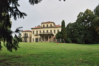
The province of Monza and Brianza is a province in the Lombardy region of Italy.

<span class="mw-page-title-main">Borgomanero</span> Comune in Piedmont, Italy

Borgomanero is a comune (municipality) in the Province of Novara in the Italian region Piedmont, located about 110 kilometres (68 mi) northeast of Turin, about 30 kilometres (19 mi) northwest of Novara and about 60 km northwest of Milan.

<span class="mw-page-title-main">Vimercate</span> Comune in Lombardy, Italy

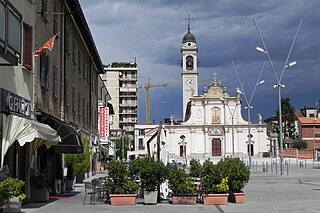
Vimercate is a comune (municipality) in the province of Monza and Brianza, in the Italian region of Lombardy. It is 25 kilometres (16 mi) from Milan and 10 kilometres (6 mi) from Monza.

<span class="mw-page-title-main">Cabiate</span> Comune in Lombardy, Italy

Cabiate is a comune (municipality) in the Province of Como in the Italian region Lombardy, located about 20 kilometres (12 mi) north of Milan and about 20 kilometres (12 mi) southeast of Como.

<span class="mw-page-title-main">Torno, Lombardy</span> Comune in Lombardy, Italy

Torno is a comune (municipality) in the Province of Como in the Italian region Lombardy, located about 45 kilometres (28 mi) north of Milan and about 5 kilometres (3 mi) northeast of Como.

<span class="mw-page-title-main">Arcore</span> Municipality in the province of Monza and Brianza, Lombardy

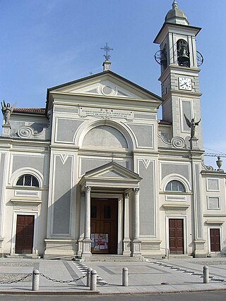
Arcore is a comune (municipality) in the Province of Monza and Brianza in the Italian region of Lombardy, about 20 kilometres (12 mi) northeast of Milan. It's situated on the banks of River Lambro.

<span class="mw-page-title-main">Biassono</span> Comune in Lombardy, Italy

Biassono is a comune (municipality) in the Province of Monza and Brianza in the Italian region Lombardy, located about 20 kilometres (12 mi) northeast of Milan.

<span class="mw-page-title-main">Brugherio</span> Comune in Lombardy, Italy

Brugherio is a comune (municipality) in the Province of Monza and Brianza in the Italian region Lombardy, located about 10 kilometres northeast of Milan. It was established December 9, 1866 unifying the suppressed municipalities of Baraggia, San Damiano and Moncucco, together with the villages of Bindellera, Cesena, Gelosa, San Paolo, Torazza, Occhiate and Increa.

<span class="mw-page-title-main">Cinisello Balsamo</span> Comune in Lombardy, Italy

Cinisello Balsamo is a comune (municipality) of about 75,200 inhabitants in the Metropolitan City of Milan, in the Italian region of Lombardy, about 10 kilometres (6 mi) northeast of Milan city center.

<span class="mw-page-title-main">Usmate Velate</span> Comune in Lombardy, Italy

Usmate Velate is a comune (municipality) in the Province of Monza and Brianza in the Italian region Lombardy, about 25 kilometres (16 mi) northeast of Milan.

<span class="mw-page-title-main">Vertova</span> Comune in Lombardy, Italy

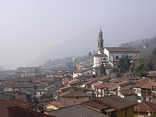
Vertova is a comune (municipality) in the Province of Bergamo in the Italian region of Lombardy, located about 70 kilometres (43 mi) northeast of Milan and about 20 kilometres (12 mi) northeast of Bergamo. As of 31 May 2021, it had a population of 4,449 and an area of 15.69 square kilometres (6.06 sq mi).

<span class="mw-page-title-main">Fiorano Modenese</span> Italian comune

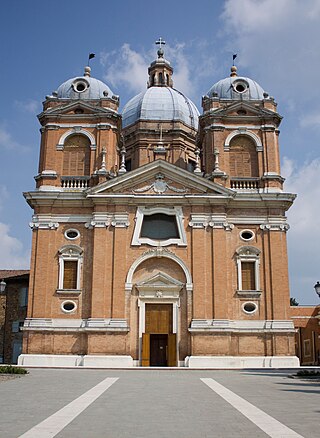
Fiorano Modenese is a comune (municipality) in the province of Modena in the Italian region Emilia-Romagna, located about 45 kilometres (28 mi) west of Bologna and about 15 kilometres (9 mi) southwest of Modena. Neighboring municipalities are Formigine, Sassuolo, Serramazzoni, Maranello.

<span class="mw-page-title-main">San Fiorano</span> Comune in Lombardy, Italy

San Fiorano is a comune (municipality) in the Province of Lodi in the Italian region Lombardy, located about 60 kilometres (37 mi) southeast of Milan and about 25 kilometres (16 mi) southeast of Lodi. As of 31 December 2004, it had a population of 1,724 and an area of 8.9 square kilometres (3.4 sq mi).

<span class="mw-page-title-main">San Damiano, Brugherio</span> Place in Lombardy, Italy

San Damiano is a hamlet in far north Brugherio, Italy. It is located between the Milan-Bergamo highway and the eastern road ring of Monza. It is 1.46 kilometres (0.91 mi) away from the town center.

<span class="mw-page-title-main">Cassina Baraggia</span> Place in Lombardy, Italy

Cassina Baraggia is a hamlet of Brugherio's municipality, which until 1866 was a separate municipality.

<span class="mw-page-title-main">Moncucco</span> Place in Lombardy, Italy

Moncucco was an autonomous Italian municipality until March 30, 1871, when due to a royal decree it became a hamlet of the town of Brugherio, established in 1866. The actual village is located south of Brugherio, along the road that leads from Milan to Vimercate.

The old farmhouses of Brugherio were agricultural structures typical of the Po-Valley in Lombardy, which derived its name from the surrounding areas, roughly corresponding to fractional towns in which Brugherio was divided. The union of the various small rural municipalities in 1866 gave birth to the municipality of Brugherio. Some fragmented towns are still visible, namely: Bindellera, Casecca, Cattoni, Comolli, Dorderio, Guzzina, Increa, Modesta, Moia, Occhiate, Pareana, San Cristoforo, Sant'Ambrogio, San Paolo and Torazza.

<span class="mw-page-title-main">Villasanta Parco railway station</span> Railway station in Italy

Villasanta Parco railway station is a railway station in Italy. Located on the Monza–Molteno railway, it serves the municipality of Villasanta in Lombardy. The train services are operated by Trenord. The original name was La Santa-Villa San Fiorano.

References

  1. "Superficie di Comuni Province e Regioni italiane al 9 ottobre 2011". Italian National Institute of Statistics. Retrieved 16 March 2019.
  2. All demographics and other statistics: Italian statistical institute Istat.
  3. "Popolazione Residente al 1° Gennaio 2018". Italian National Institute of Statistics. Retrieved 16 March 2019.
  4. "Comune di Villa San Fiorano sec. XIV - 1757".
  5. Oleg Zastrow, La chiesa di Santa Anastasia a Villasanta: dalle origini remote ai tempi odierni, Parrocchia Santa Anastasia, 2004.
  6. "Comune di Villa San Fiorano sec. XIV - 1757".
  7. "Villasanta".
  8. Coat of arms of the Taverna family of Milan: quartered: 1st and 4th, bendy of silver and black; 2nd and 3rd, azure, a dog argent, collared gold, seated on a silver cushion, on a silver base, gazing at a star (8) or, in the upper left corner.
  9. "Lo stemma comunale". Comune di Villasanta. 26 May 2008.