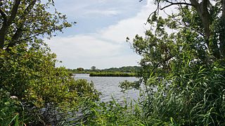
Loosdrecht is a town in the municipality of Wijdemeren, North Holland, Netherlands with a population of about 8,600 inhabitants.

Kiełczynek is a village in the administrative district of Gmina Książ Wielkopolski, within Śrem County, Greater Poland Voivodeship, in west-central Poland. It lies approximately 2 kilometres (1 mi) west of Książ Wielkopolski, 14 km (9 mi) east of Śrem, and 43 km (27 mi) south-east of the regional capital Poznań.
Nutu is a village in Kose Parish, Harju County in northern Estonia.
Gornja Dobrinja is a village in the municipality of Požega, western Serbia. According to the 2002 census, the village has a population of 505 people.

Gorobilje is a village in the municipality of Požega, western Serbia. According to the 2002 census, the village has a population of 1506 people.There is a Serbian Orthodox Church of Saint John the Baptist in the village square.
Prijanovići is a village in the municipality of Požega, western Serbia. According to the 2002 census, the village has a population of 446 people.
Srednja Dobrinja is a village in the municipality of Požega, western Serbia. According to the 2002 census, the village has a population of 481 people.
Tabanovići is a village in the municipality of Požega, western Serbia. According to the 2002 census, the village has a population of 137 people.
Bagačiće is a village in the municipality of Sjenica, Serbia. According to the 2002 census, the village has a population of 85 people.
Boguti is a village in the municipality of Sjenica, Serbia. According to the 2002 census, the village has a population of 72 people.
Dragojloviće is a village in the municipality of Sjenica, Serbia. According to the 2002 census, the village has a population of 114 people.
Goluban is a village in the municipality of Sjenica, Serbia. According to the 2002 census, the village has a population of 42 people.
Krće is a village in the municipality of Sjenica, Serbia. According to the 2002 census, the village has a population of 337 people.
Zaječiće is a village in the municipality of Sjenica, Serbia. According to the 2002 census, the village has a population of 185 people.
Biočin is a village in the municipality of Raška, Serbia. According to the 2002 census, the village has a population of 50 people.
Lukovo is a village in the municipality of Raška, Serbia. According to the 2002 census, the village has a population of 38 people.
Kukurovići is a village in the municipality of Priboj, Serbia. According to the 2002 census, the village has a population of 66 people.
Brodarevo is a village in the municipality of Prijepolje, Serbia. According to the 2002 census, the village has a population of 6,500.
Mrčkovina is a village in the municipality of Prijepolje, Serbia. According to the 2002 census, the village has a population of 33 people.
Bher Ahir is a village situated in the Gujar Khan Tehsil of Rawalpindi District, of Punjab, Pakistan. Its geographical coordinates are 33° 13' 0 North and 73° 4' 0 East.
