Bankovac is a village in Serbia situated in the municipality of Aleksinac, in the Nišava District. The population of the village is 178 people with Serbs as supermajority according to the 2002 census. According to the 1991 census it had 205 inhabitants.
Dobrotin is a village in the municipality of Bajina Bašta, Serbia. According to the 2002 census, the village has a population of 251 people.
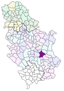
Babin Potok is a village in the municipality of Prokuplje, Serbia. According to the 2002 census, the village has a population of 674 people.
Žitni Potok is a village in the municipality of Prokuplje, Serbia. According to the 2002 census, the village has a population of 592 people.
Beli Potok is a village in the municipality of Sokobanja, Serbia. According to the 2002 census, the village has a population of 238 people.
Brusnica is a village in the municipality of Gornji Milanovac, Serbia. According to the 2002 census, the village has a population of 650 people.
Alin Potok is a village in the municipality of Čajetina, western Serbia. According to the 2011 census, the village has a population of 190 people.
Rakovica is a village in the municipality of Čajetina, western Serbia. According to the 2011 census, the village has a population of 60 people.
Bistrica is a village in the municipality of Nova Varoš, western Serbia. According to the 2002 census, the village has a population of 791 people.
Čelice is a village in the municipality of Nova Varoš, western Serbia. According to the 2002 census, the village has a population of 78 people.
Komarani is a village in the municipality of Nova Varoš, western Serbia. According to the 2002 census, the village has a population of 346 people.
Božov Potok is a village in the municipality of Sjenica, Serbia. According to the 2002 census, the village has a population of 195 people.
Strmac is a village in the municipality of Priboj, Serbia. According to the 2002 census, the village has a population of 181 people.
Drenova is a village in the municipality of Prijepolje, Serbia. According to the 2002 census, the village has a population of 208 people. Following the defeat of the Republic of Užice in 1941, during the World War II in Yugoslavia, leader of the Yugoslav Partisans Josip Broz Tito moved to Drenova on 3 December 1941 where he stayed for 10 days. The Communist Party of Yugoslavia Politburo met in the village on December 7.
Izbičanj is a village in the municipality of Prijepolje, Serbia. According to the 2002 census, the village has a population of 46 people.
Karaula is a village in the municipality of Prijepolje, Serbia. According to the 2002 census, the village has a population of 63 people.
Orašac is a village in the municipality of Prijepolje, Serbia. According to the 2002 census, the village has a population of 204 people.
Pranjci is a village in the municipality of Prijepolje, Serbia. According to the 2002 census, the village has a population of 360 people.
Rasno is a village in the municipality of Prijepolje in the Serbian district of Zlatibor. According to the 2002 census, the village has a population of 410 people.
Vrbovo is a village in the municipality of Prijepolje, Serbia. According to the 2002 census, the village has a population of 99 people.
